


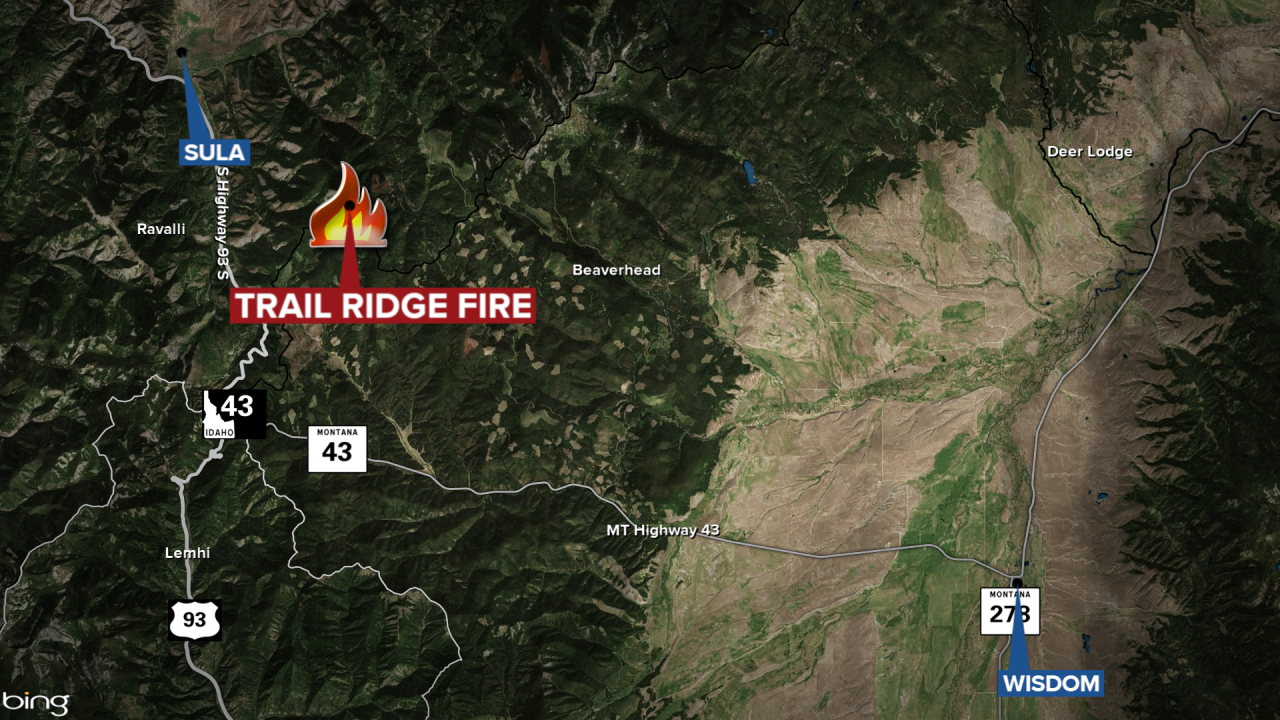
The lightning-sparked Trail Ridge Fire southeast of Sula has burned 15,008 acres and is now 14% contained, according to the Monday update.
The blaze is burning approximately five miles southeast of Sula and approximately 11 miles northwest of the Big Hole National Battlefield.
Fire managers report most of the fire's growth on Sunday was on the north flank of the fire with a large portion of that growth in Tolan Creek Drainage.
The update states that if the fire moves past the Tolan Creek Drainage and begins to threaten a breach along an indirect line paralleling the East Fork Road to the south officials would implement the ‘Warning’ stage of the Evacuation Plan.
Additional information on the Ravalli County Evacuation Plan can be found at the Ravalli County Sheriff’s website https://ravalli.us/622/Evacuation-Guidelines or the Sheriff’s app.
There are closures in effect in the Bitterroot National Forest and the Beaverhead-Deerlodge National Forest.
