


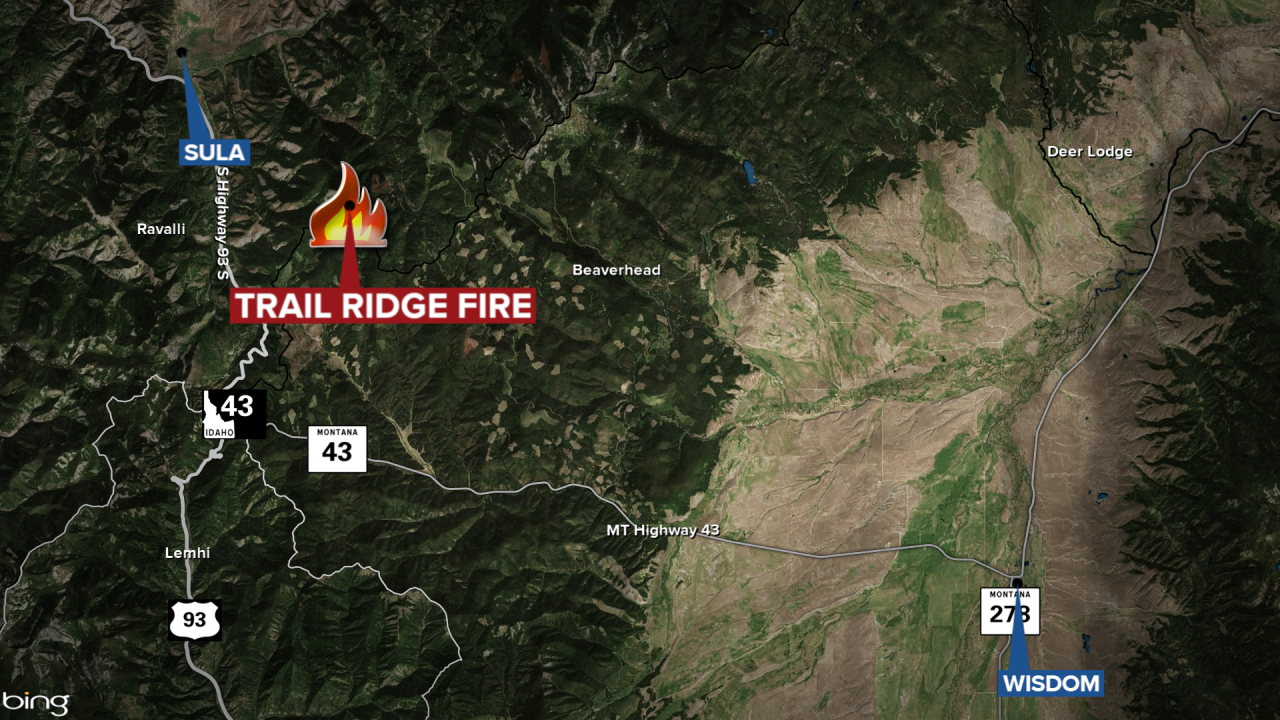
The Trail Ridge Fire southeast of Sula has grown to 10,874 acres to 12,504 acres and is 0% contained, according to the Thursday update.
The Trail Ridge Fire is burning approximately five miles southeast of Sula and approximately 11 miles northwest of the Big Hole National Battlefield.
MTN News
A public meeting to discuss the fire has been scheduled for 7 p.m. on Thursday at the Springer Community Clubhouse in Sula.
There are closures in effect in the Bitterroot National Forest and the Beaverhead-Deerlodge National Forest.
