


MISSOULA — The West Lolo Complex fires burning in Mineral and Sanders counties have now burned 1,018 acres since being sparked by lightning on Wednesday.
The complex of 10 fires is located near St. Regis, Thompson Falls, Superior, and Plains. A total of 220 people are assigned to battle the blazes.
A community meeting to discuss the West Lolo Complex fires is set for the Mineral County Fairgrounds in Superior at 6 p.m. on Sunday.
The meeting will also be streamed live on the West Lolo Complex Facebook page.
The Northern Rockies Incident Management Team 1 took command of wildfire incidents located on the Superior and Plains-Thompson Falls Ranger Districts on Friday.
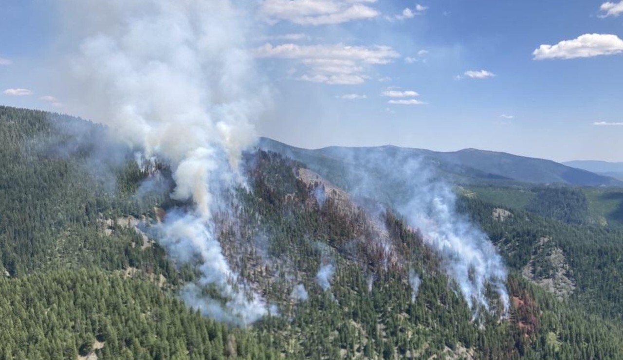
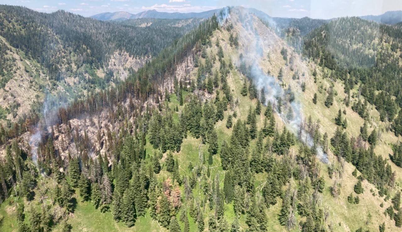
The fires in the West Lolo Complex include Deep Lookout Mountain, Thorne, Sunset, Siegel, Cataract, Sheep Creek and Winniemuck. The Deep Lookout Mountain and Thorne are the largest fires in the Complex.

The Deep Lookout Mountain Fire is approximately 12 miles southeast of Superior while the Thorne Fire is burning approximately six miles north-northeast of Thompson Falls.
There are numerous road and trail closures in place on the Lolo National Forest.
Superior Ranger District:
- Sunset Fire: 17 acres, located up on the Dry Creek Divide, eight miles south of St. Regis
- Deep Lookout Mountain Fire: 159 acres, located on the upper reaches of the Deep Creek Drainage, north of I-90, 12 miles east of Superior, and five miles west of Stark Mountain Lookout
Plains/Thompson Falls Ranger District:
- Siegel Fire: 19 acres, located 3-4 miles up the Siegel drainage northeast of Quinn’s Hot Springs
- Sheep Fire: 3 acres, located on the west of the Clark Fork River across from Quinn’s Hot Springs, ½ mile of the ridgeline, and visible from Highway 135 and Highway 200.
- Cataract Fire: 1 acre, located east of Cataract Ridge
- Winniemuck and Thorne Creek: 819 acres, located North East of Thompson Falls
