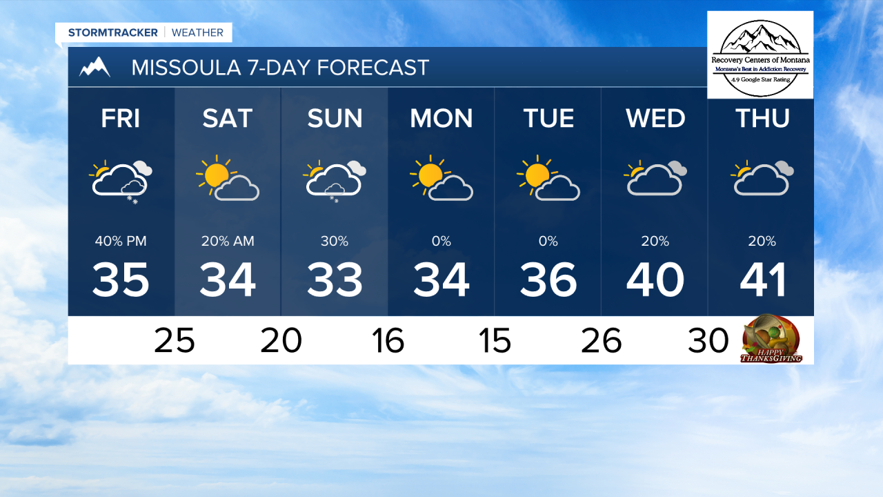
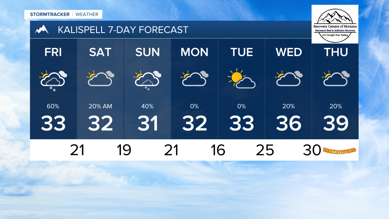
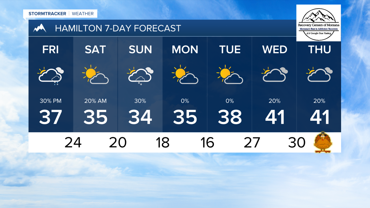
MISSOULA — It was another day of wintry mix and snow flurries across our lower elevations. A cold front moving in from the north tomorrow will give us another shot at more widespread light snow for areas along the US along and east of US-93 and north of I-90.
Some lower elevations could see snow accumulations reaching up to 3 inches. I am most confident in areas near the Mission Mountains, with upslope flow enhancing snow coverage near the base of the mountains.
Snow showers will last into Saturday morning before this system pulls away.
Another round of light snow will come in from the west on Sunday. At this time, this does not look like it will produce significant snow in most areas.
Next week is looking generally drier and slightly warmer, with high temperatures warming slightly back up into the low 40s by Thanksgiving.
——————————————————————————————————————————
MONTANA WEATHER ALERTS:
NONE
——————————————————————————————————————————