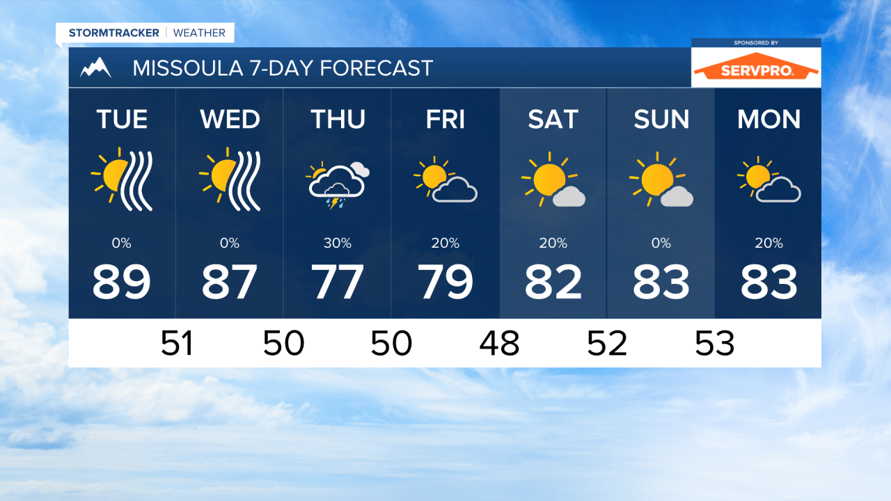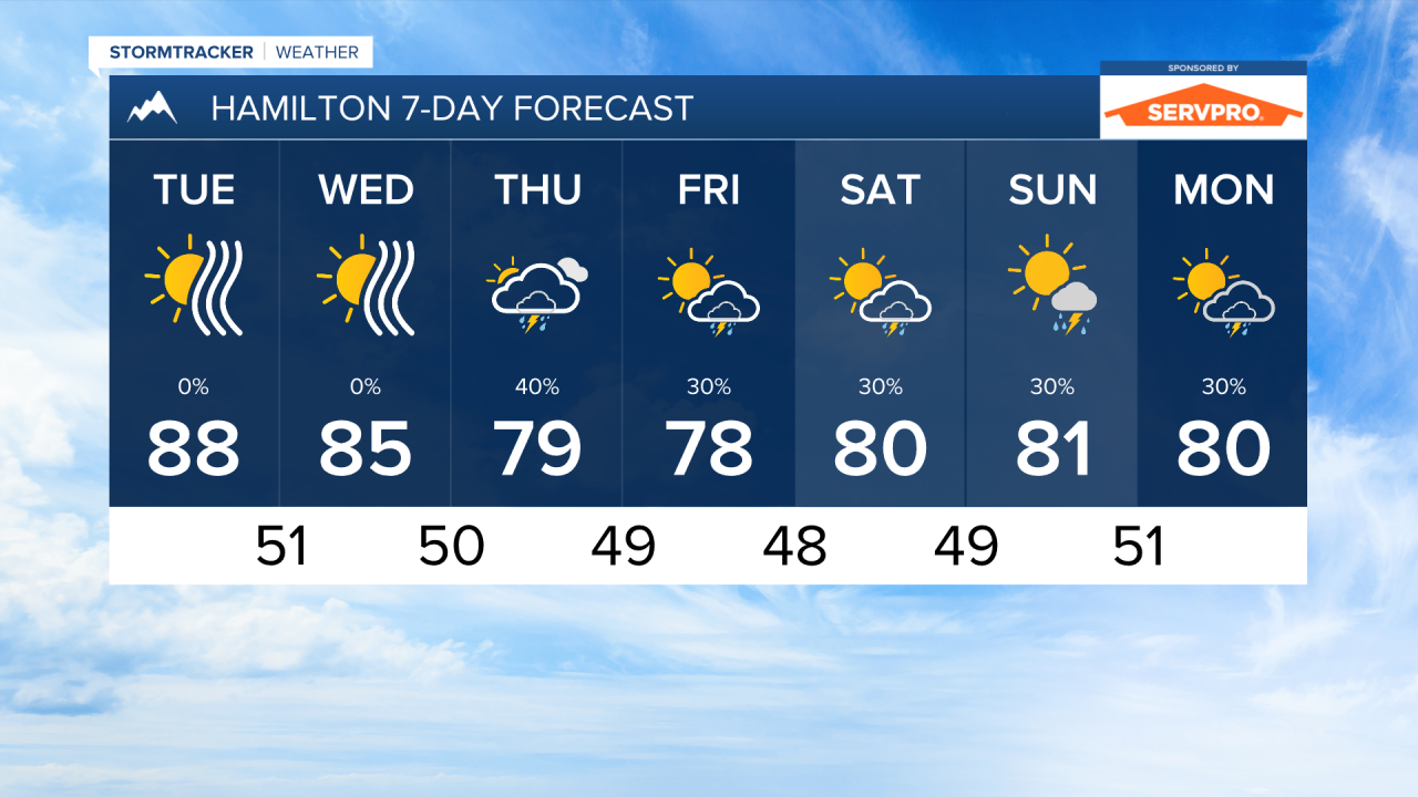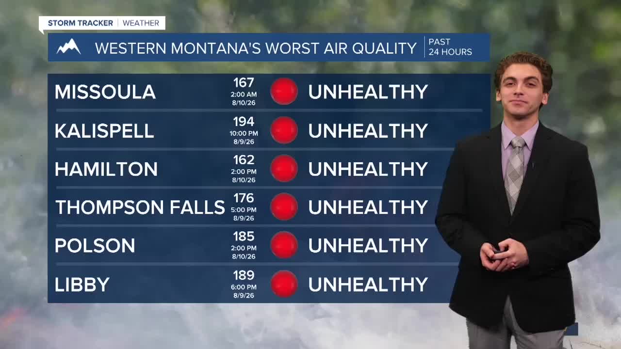


MISSOULA — Some of the worst air quality fore the month so far has impacted western Montana Sunday and Monday. Maximum Air Quality Index Values have been on the high end of unhealthy through most of the area. The smoke will continue to be a concern this week, but we may see slight improvements on Wednesday and Thursday with a cold front moving in from the north.
This cold front will also bring cooler weather, with high temperatures cooling into the 70s on Thursday and Friday.
There is also an increasing potential for scattered thunderstorms to return to the forecast. The cold front coming in from the north, mixed with a wave of monsoonal moisture from the south, will cause daily thunderstorm chances to return on Thursday. We will not be talking about widespread rain, however, which is what we would need to help with wildfires burning across the state.
The stormier pattern looks to last into the weekend and into next week.
——————————————————————————————————————————
MONTANA WEATHER ALERTS:

——————————————————————————————————————————