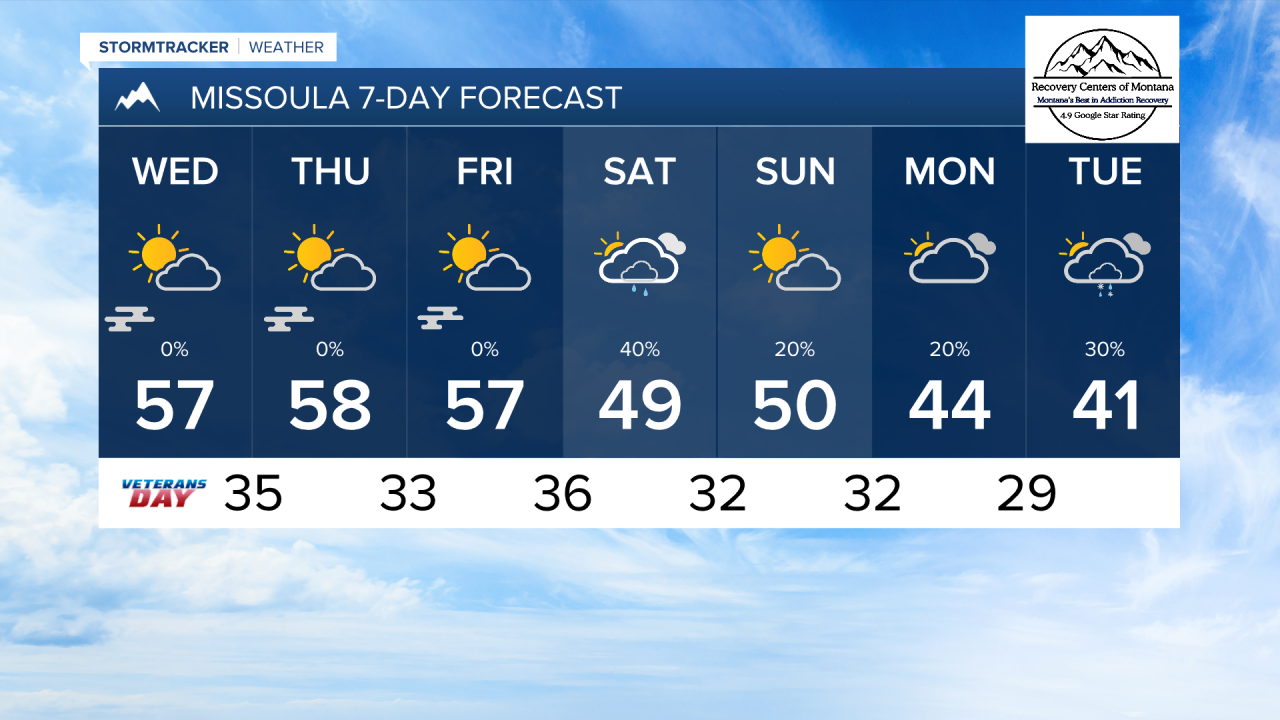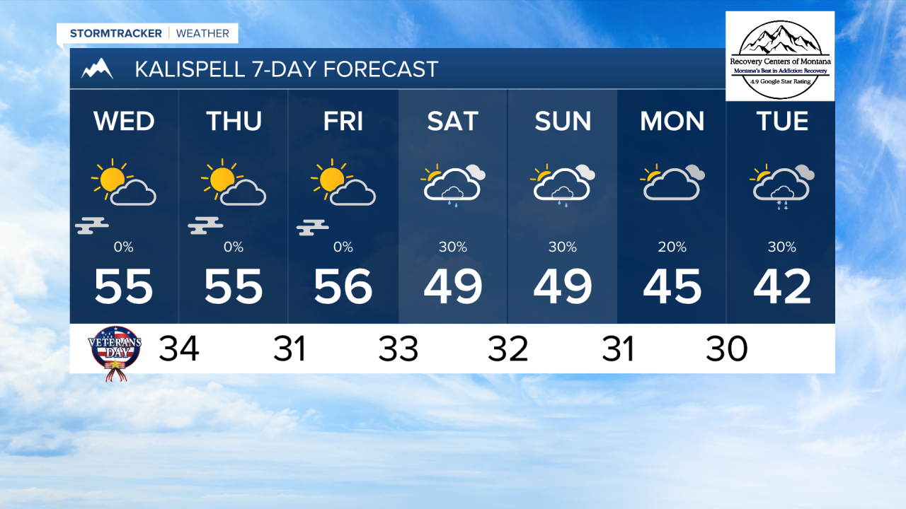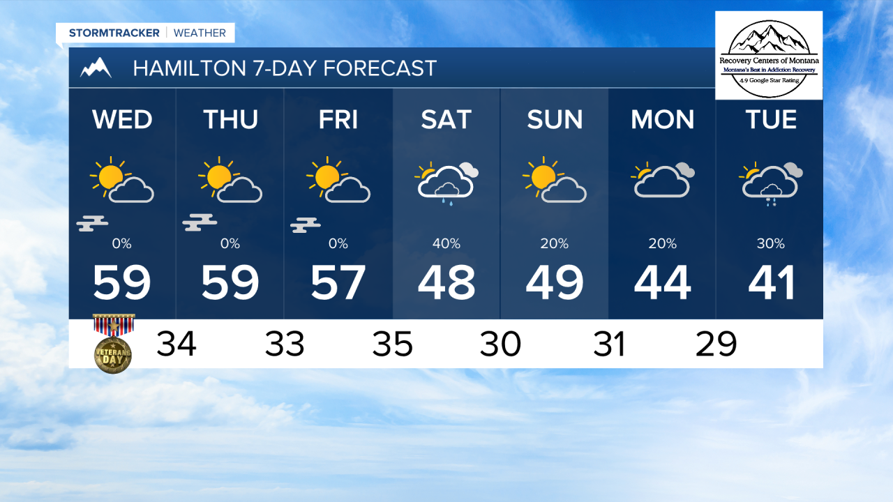


MISSOULA — The remaining light rain showers are pushing out of northwest Montana this evening. By tomorrow, expect drier weather with strong valley inversions developing.
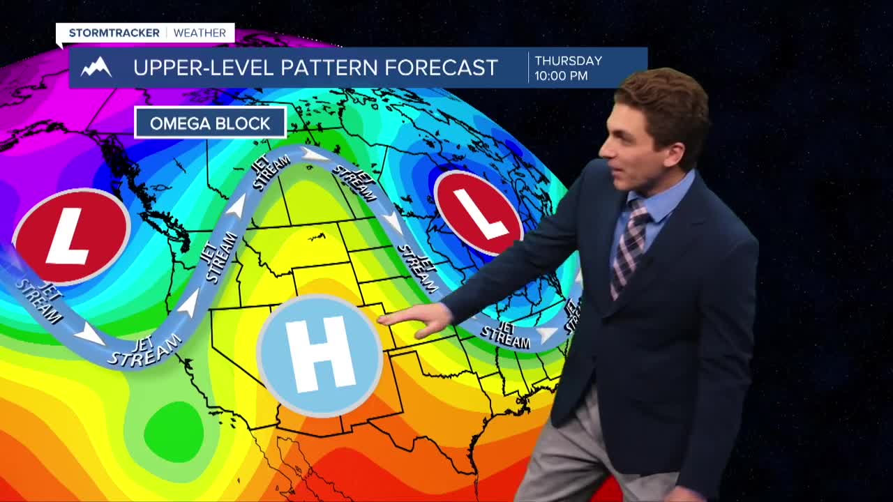
An atmospheric blocking pattern, known as an Omega Block, will set up over the United States. This occurs when two cut-off lows are on either side of a ridge of high pressure. This causes our upper levels of our atmosphere to "slow down" keeping the same weather features in place for days at a time. Montana is under the ridge of this feature, so expect warmer afternoon temperatures, morning fog, and dry weather through Friday.
We will have a weak cold front enter our area on Saturday, bringing scattered showers back to the forecast. A more unsettled and stormy pattern is trending more likely for Montana next week.
——————————————————————————————————————————
MONTANA WEATHER ALERTS:
NONE
——————————————————————————————————————————