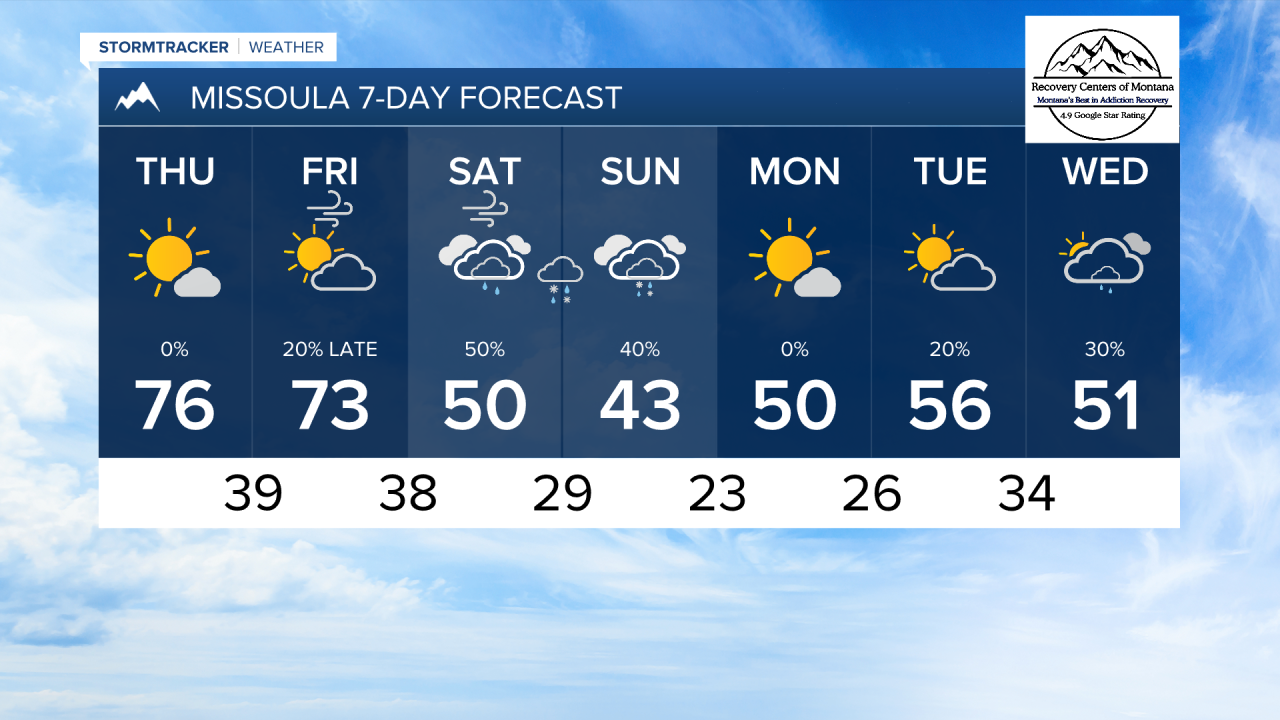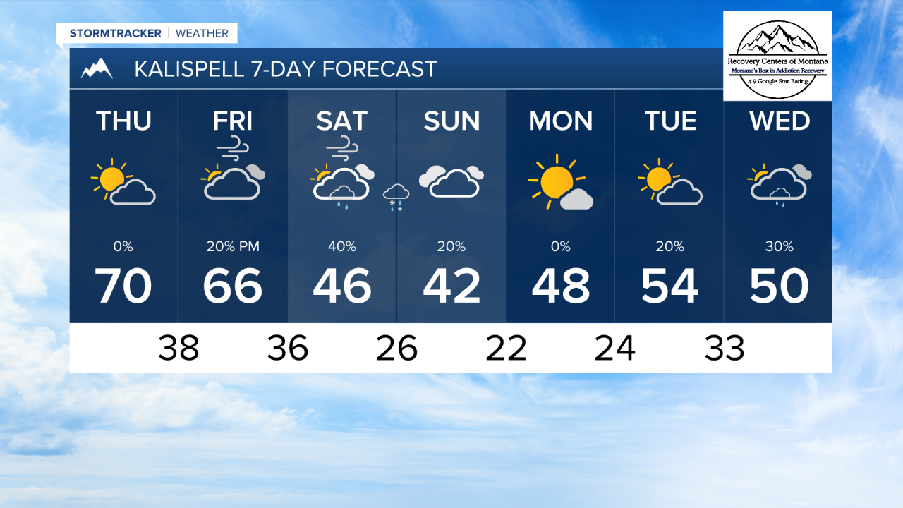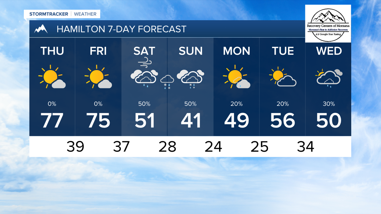


MISSOULA — Another day with highs in the 70s and sunny skies is in the books! We expect another similar day tomorrow, but changes begin to occur on Friday.
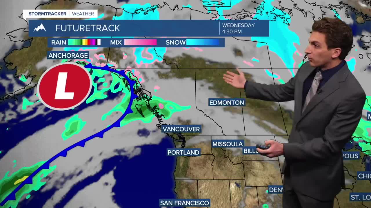
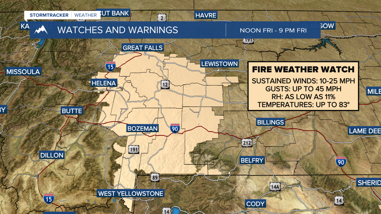
Southwesterly to westerly winds pick up late Friday morning across most of our area, where wind gusts can reach up to 40 MPH. This will increase the fire danger across most of our area. By Friday afternoon, a strong cold front begins to move through northwest Montana bringing scattered rain showers and much colder air.
Snow will begin to fall in the mountains by early Saturday morning. Snow levels will drop through the day. Most lower elevations will begin by seeing rain, then mixing over to snow by Saturday night. Winds will also continue to be gusty Saturday afternoon and evening.
The most likely time-frame for lower elevations snow will be Saturday night into Sunday morning. Valley snow is only expected to reach about an inch of accumulation in the Missoula and Bitterroot Valleys, but isolated areas may see more. Most of northwest Montana will receive less than an inch.
This will bring significant snow to the mountains. several inches to near a foot is possible in some higher elevations. Travel over mountain passes will be difficult.
This system is out of here by Monday, but another cold storm looks to come in towards the middle of next week. More to come on that.
Hard freezes are likely on Monday and Tuesday mornings. Make preparations now to protect pipes, hoses, and outdoor plants.
——————————————————————————————————————————
MONTANA WEATHER ALERTS:
——————————————————————————————————————————