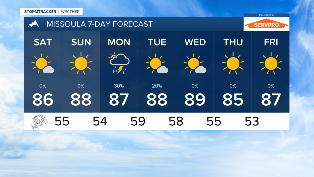
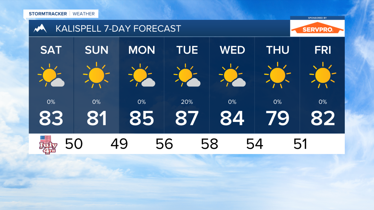
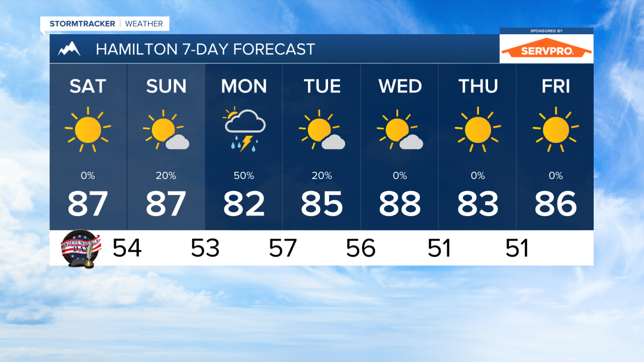
INDEPENDENCE DAY: The Fourth of July will be dry and warm across the area. A weak cold front will clip northwest and north-central Montana bringing a bit of wind. Gusts may be around 20-30 MPH. The area lakes may have choppy water at times in the afternoon. Highs will reach the mid to upper 80s.
SUNDAY, JULY 5TH: Another sunny and warm day is expected. Highs will reach the upper 80s again. A few thunderstorms may form over the mountains of southwest Montana, but they will be spotty and most of us should remain under sunny skies.
MONDAY, JULY 6TH: The day will begin dry and sunny, but scattered thunderstorms will develop by the afternoon over southwest Montana and move northeast throughout the rest of the day. These storms could produce gusty winds, small hail, and heavy downpours. Highs will reach the 80s once again.
TUESDAY, JULY 7TH: Most of western Montana will remain dry, but there will be the chance for isolated to scattered thunderstorms east of the divide. Afternoon temperatures will be in the 80s to low 90s.
LONG-RANGE FORECAST: After the storms move through on Tuesday, most of the rest of the week will be dry and warm.
——————————————————————————————————————————
MONTANA WEATHER ALERTS:
NONE
——————————————————————————————————————————
Missoula Temperature Records Tomorrow:
High: 101 (1934)
Low: 34 (1962)
AVG: 81/50
Kalispell Temperature Records Tomorrow:
High: 99 (2015)
Low: 32 (1962)
AVG: 78/46
Hamilton Temperature Records Tomorrow:
High: 101 (1937)
Low: 36 (2018)
AVG: 80/48