



MISSOULA — TUESDAY, JULY 14TH: Mostly cloudy skies and thunderstorm activity will keep the area cooler than the past few days. Expect high temperatures in the 70s and low 80s across northwest Montana. Highs in southwest Montana will reach the mid 80s. A few thunderstorms could be on the stronger side producing gusty winds and small hail.
WEDNESDAY, JULY 15TH: Cloud cover will decrease throughout the day. Pop up showers and thunderstorms are possible in the afternoon. Highs will warm into the mid to upper 80s.
THURSDAY, JULY 16TH: Thursday will be a drier and warmer day. Expect skies to be mostly sunny to partly cloudy with highs in the upper 80s to low 90s. A stray shower or storm cannot be ruled out.
FRIDAY, JULY 17TH: Another wave of monsoonal moisture enters the state that will develop into showers and thunderstorms in the afternoon. Highs reach the 80s and low 90s.
LONG-RANGE FORECAST: Temperatures will stay much above average next week, but some monsoonal moisture could keep highs just a few degrees cooler than the weekend.
——————————————————————————————————————————
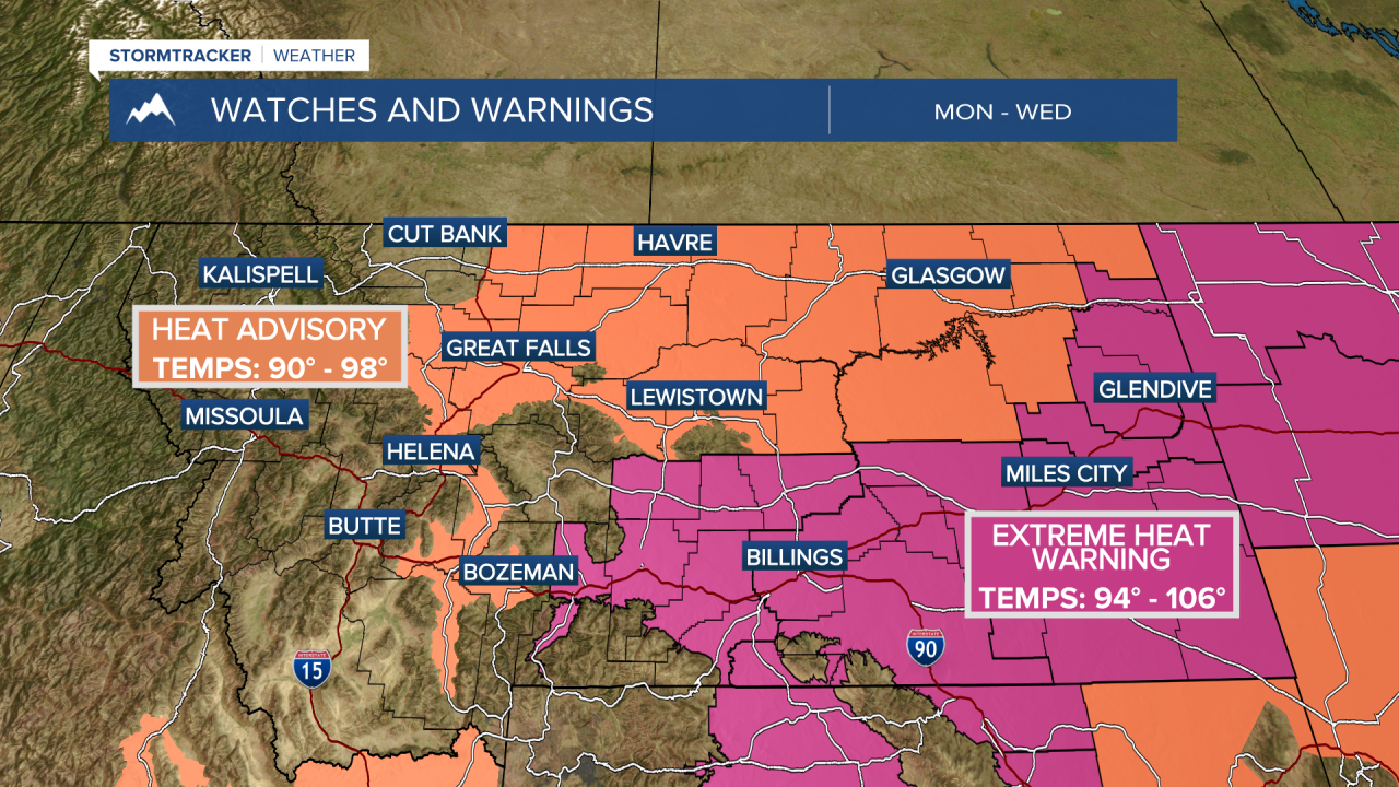
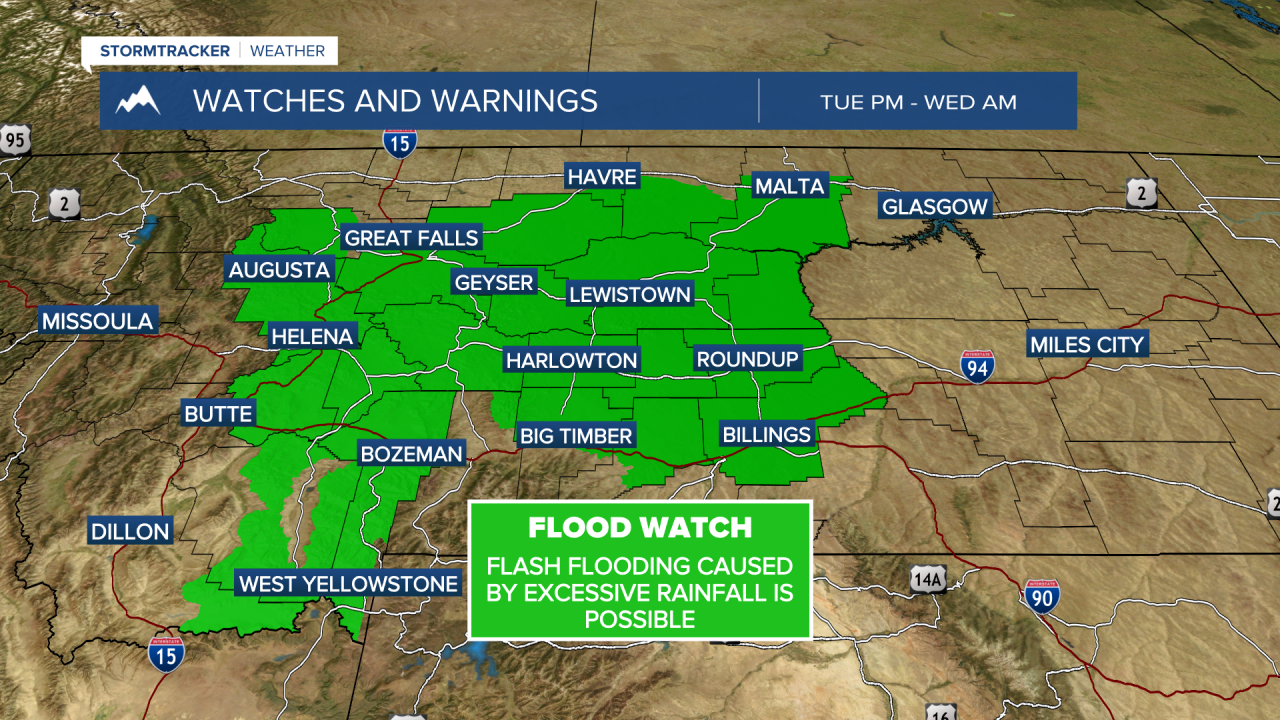
MONTANA WEATHER ALERTS:
——————————————————————————————————————————
Missoula Temperature Records Tomorrow:
High: 103 (2017)
Low: 30 (1901)
AVG: 86/52
Kalispell Temperature Records Tomorrow:
High: 98 (2017)
Low: 37 (2020)
AVG: 82/48
Hamilton Temperature Records Tomorrow:
High: 99 (1953)
Low: 37 (1981)
AVG: 84/50

