

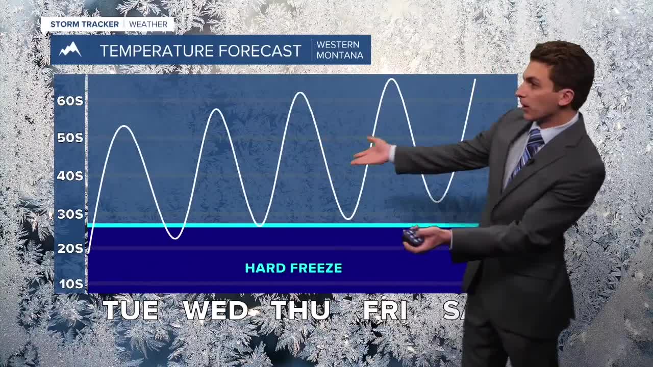


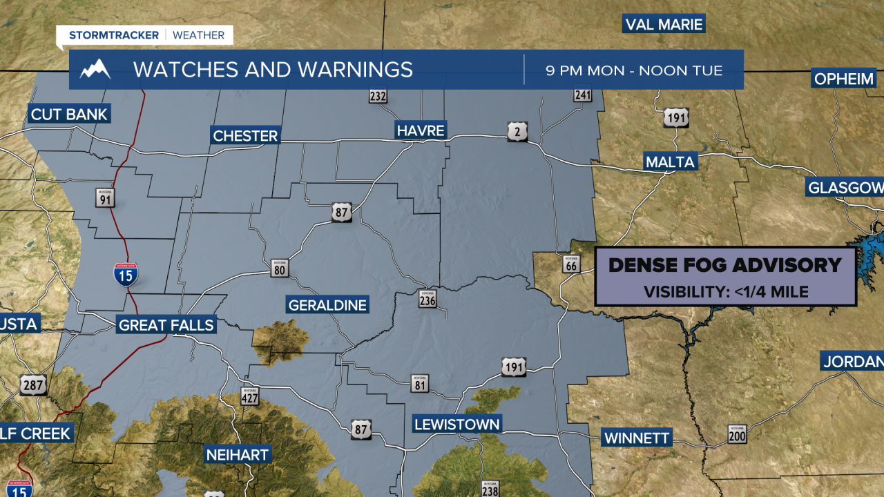
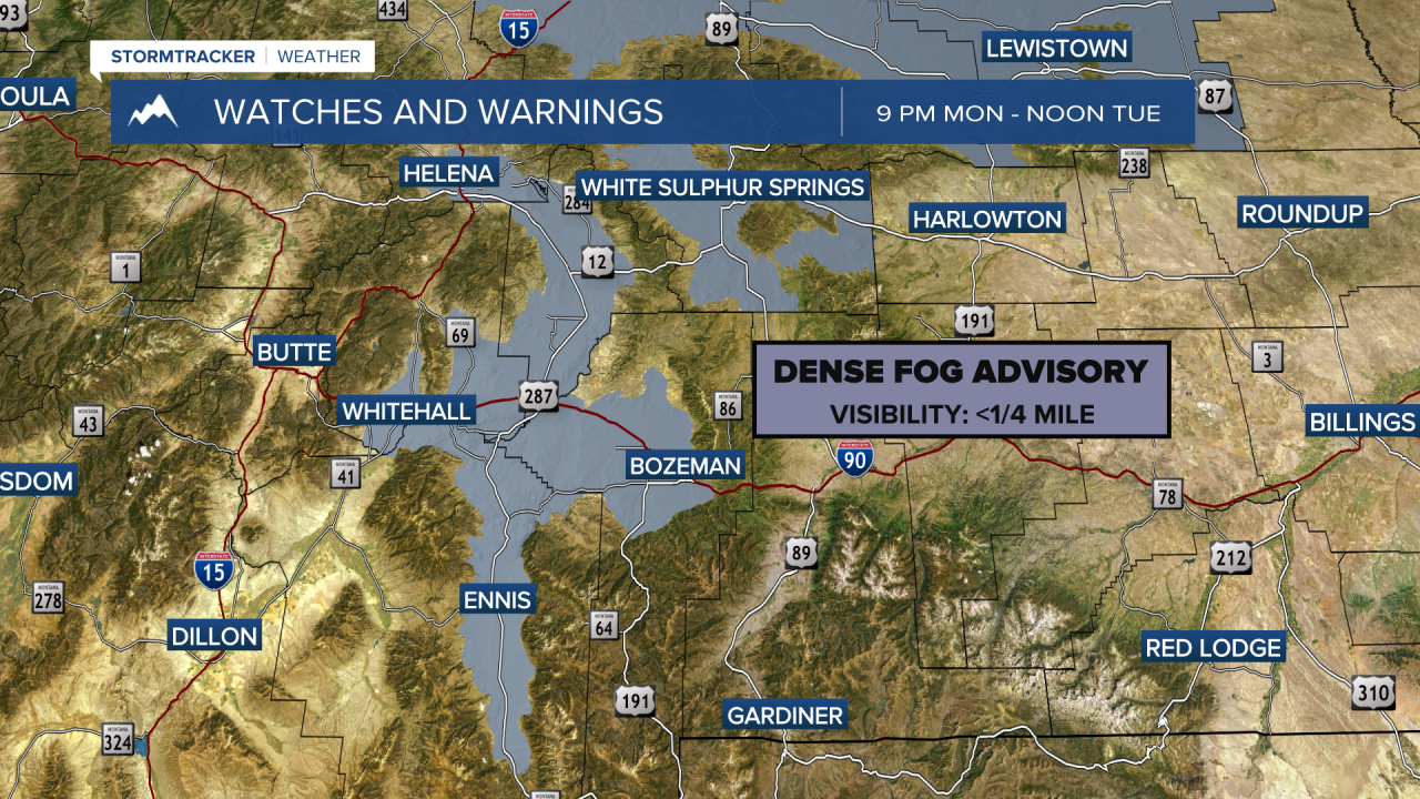
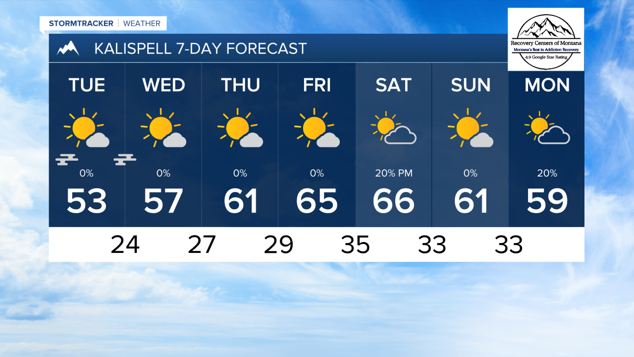
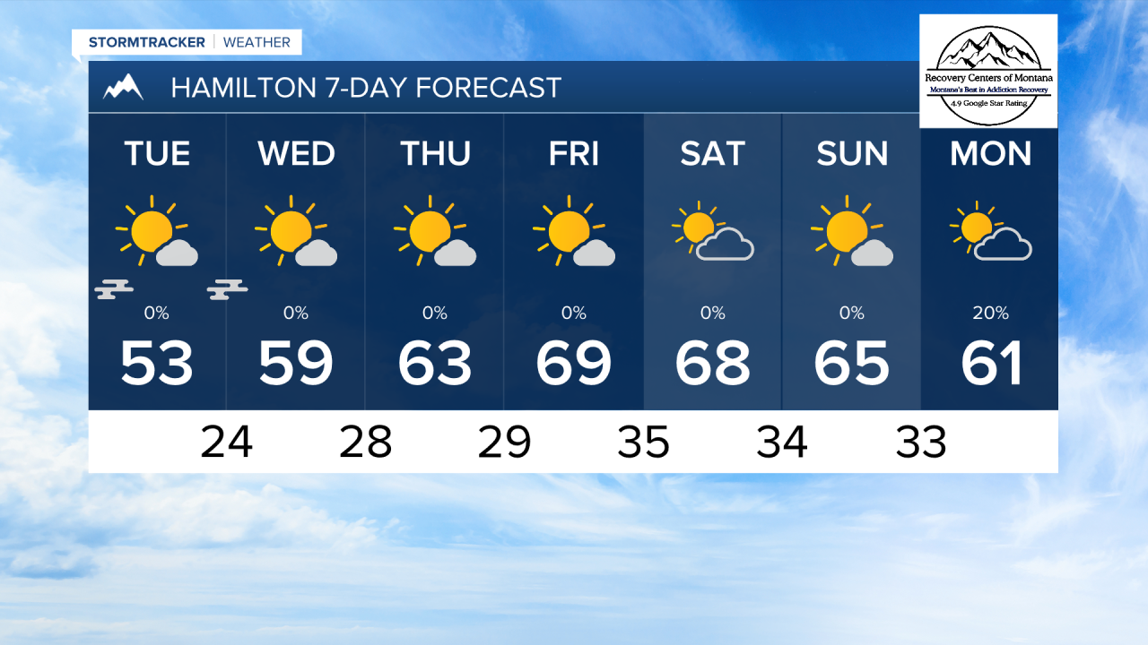
MISSOULA — Our weekend rain and snow maker has moved out of our area. The clearing skies will cause temperatures to plummet this evening. Lows are expected to drop into the 20s for most, with the potential for patchy fog formation tomorrow morning.
High elevation roads may see some ice formation tomorrow morning due to snow melt refreezing overnight.
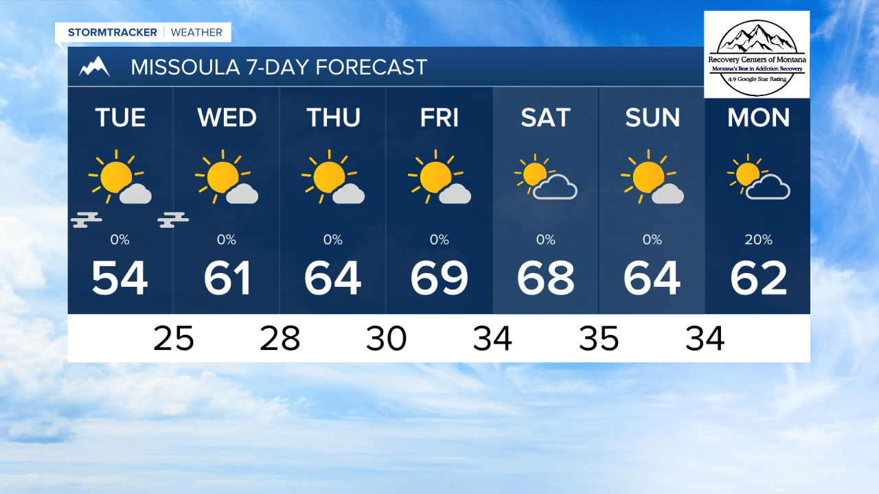
High and low temperatures will warm by a few degrees each day until we reach the upper 60d to low 70s by Friday afternoon.
The weather will stay relatively inactive through the next week, with weak winds, very little precipitation, and mostly sunny skies.
——————————————————————————————————————————
MONTANA WEATHER ALERTS:
MTN
MTN
——————————————————————————————————————————
MTN
MTN
MTN
