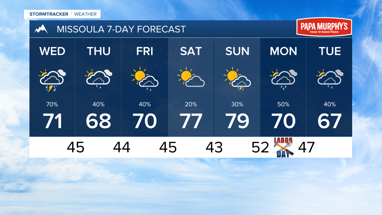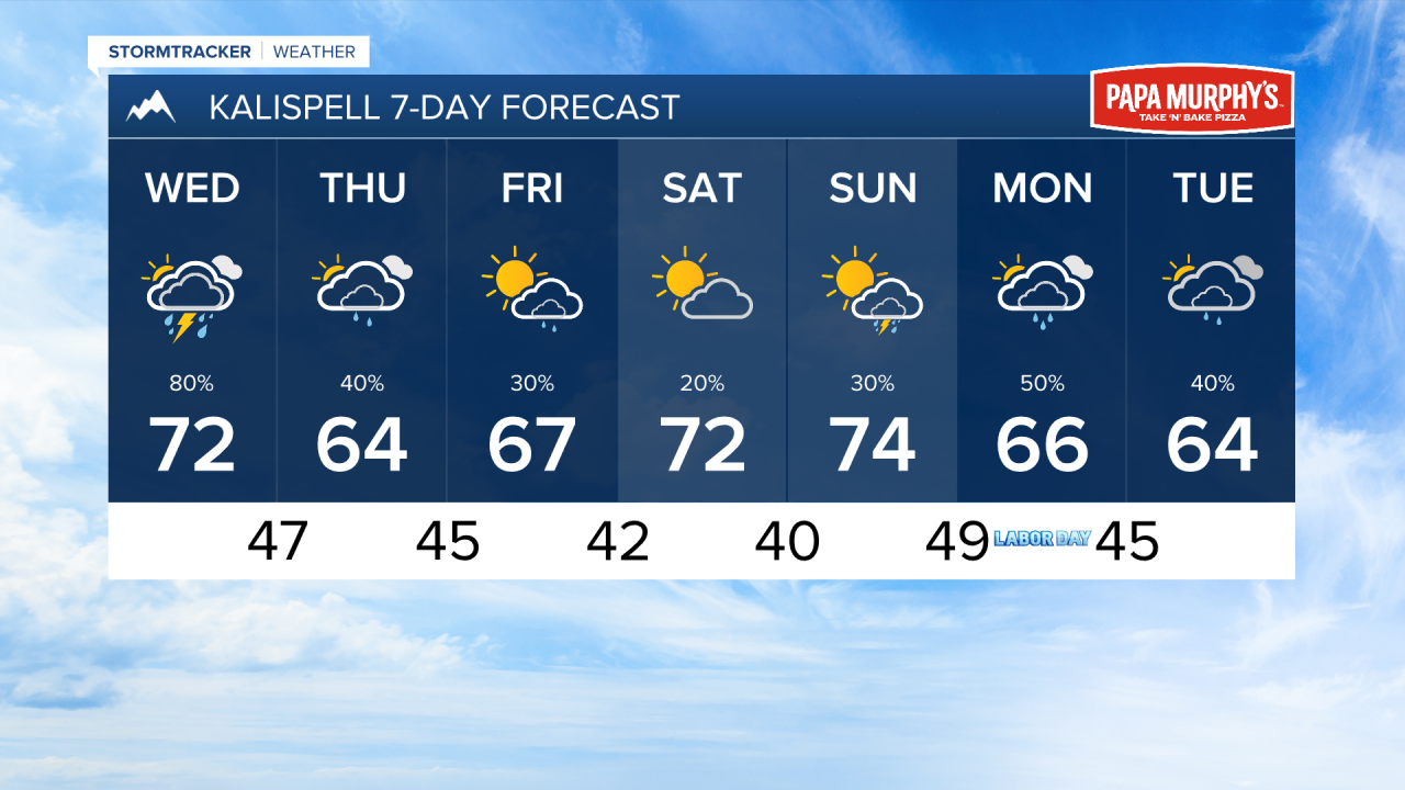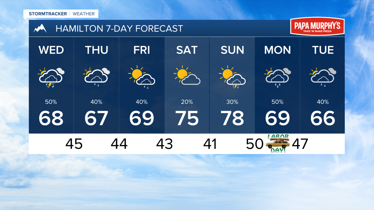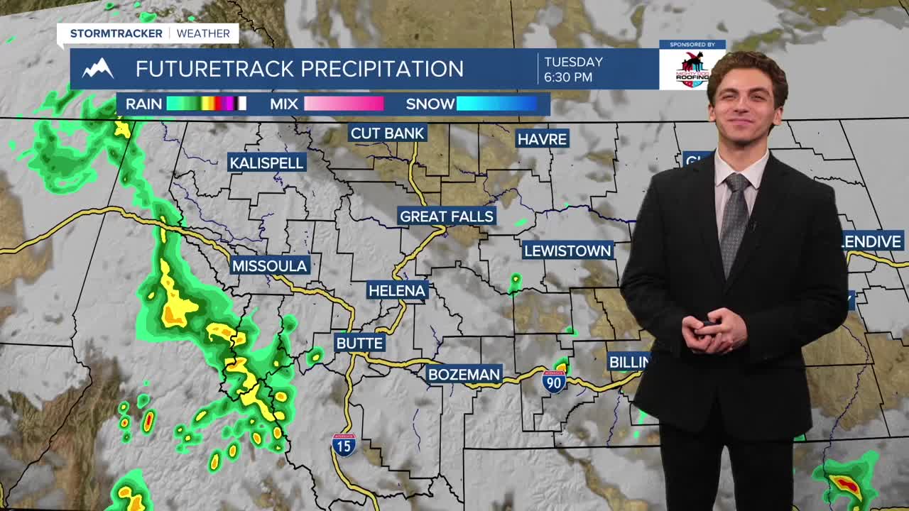


MISSOULA — A storm system moving into the Pacific Northwest will keep our weather in western Montana active over the next few days, with cooler-than-normal temperatures expected.
Showers and thunderstorms have already entered parts of our area this evening. These could produce gusty winds near 30 to 40 MPH and lightning strikes.
Another round of showers and storms moves through beginning around noon tomorrow, lasting through the evening hours. This wave of storms could produce heavy rain with up to half an inch per hour rates. Isolated severe storms are possible in parts of northwest Montana.
Bands of rain showers will continue to propagate into western Montana of Thursday and Friday. Even a bit of snow in the high peaks of the Bitterroot Mountains is possible Thursday morning.
High temperatures will only reach the 60s and 70s over the next week, with overnight lows dropping into the 40s for most locations.
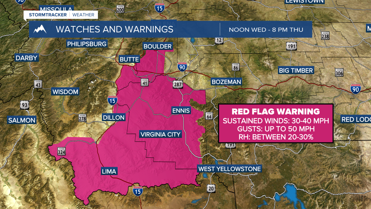
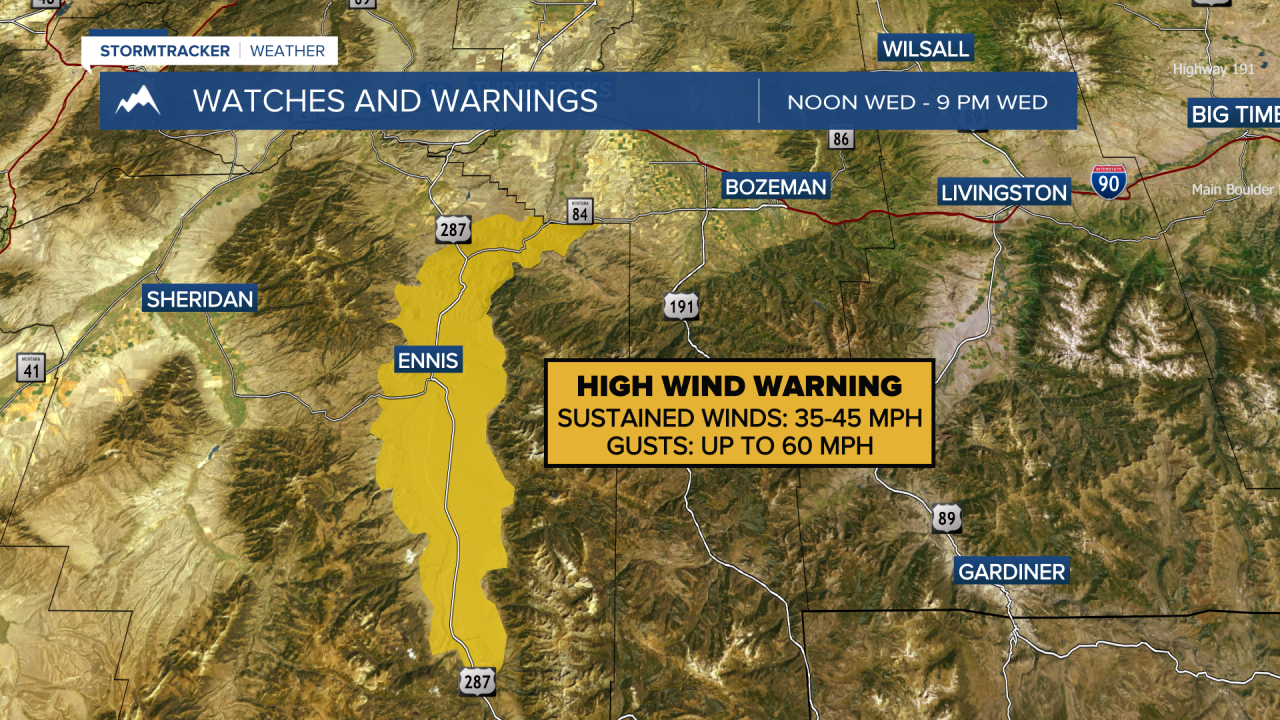
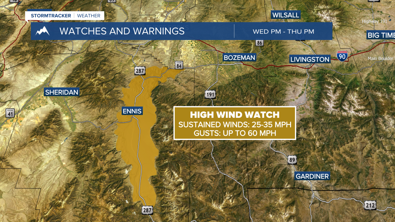
Rain over wildfires in the Pacific northwest and Montana should keep smoke at bay through the rest of the week. But gusty conditions over southwest Montana on Wednesday and Thursday may keep fires like the Nature Grove, Sand Creek, and Bobcat Lakes a little more active.
Another storm system is looking to influence our weather on Monday and Tuesday of next week, which could bring widespread rain to the region. We will continue to monitor this.
——————————————————————————————————————————
MONTANA WEATHER ALERTS:
——————————————————————————————————————————