MISSOULA — Autumn officially begins at 6:05 PM on Tuesday. Our days and nights will be just about equal time. We will be losing daylight at the rate of several minutes per day over the next few months. Say goodbye to those longer days.
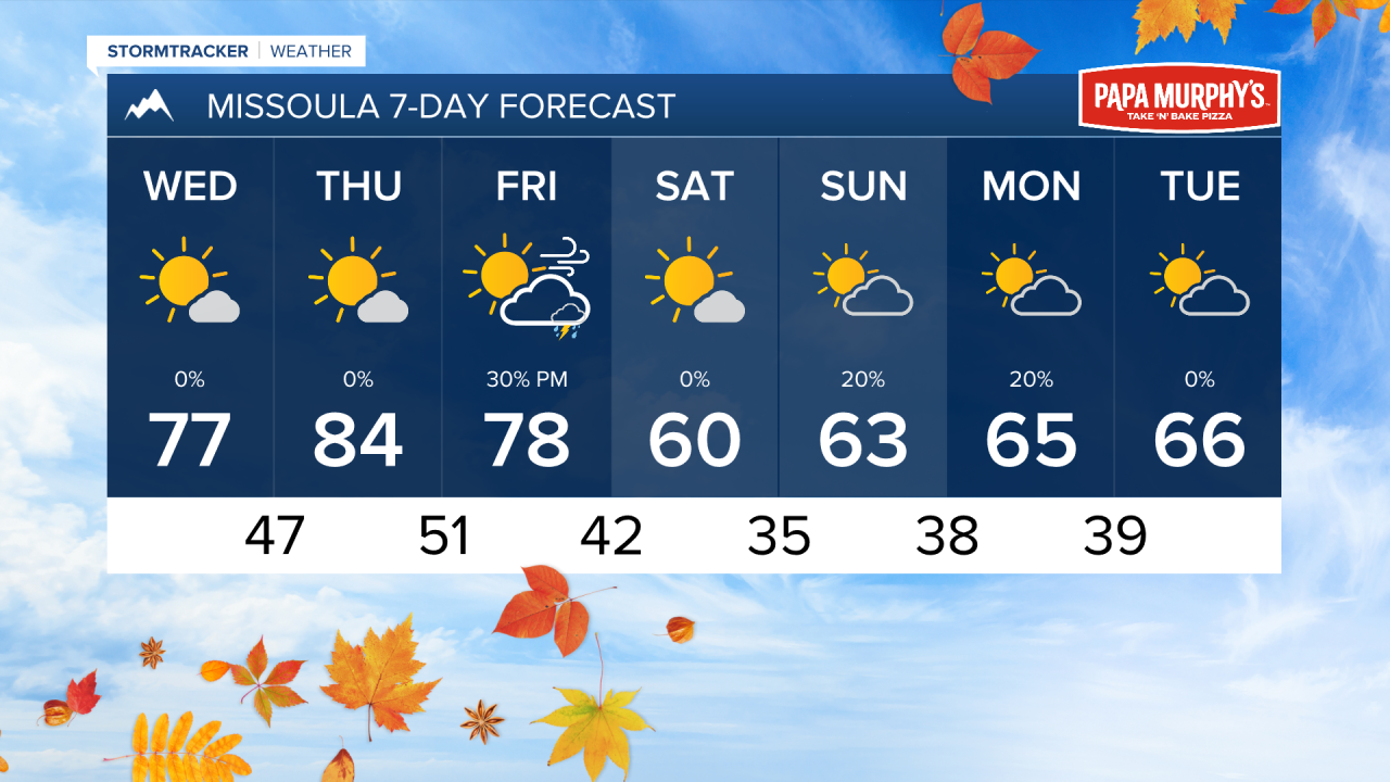
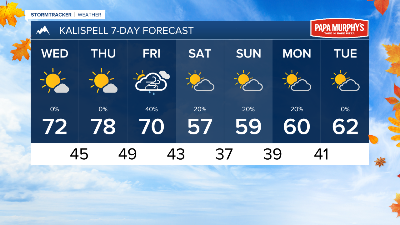
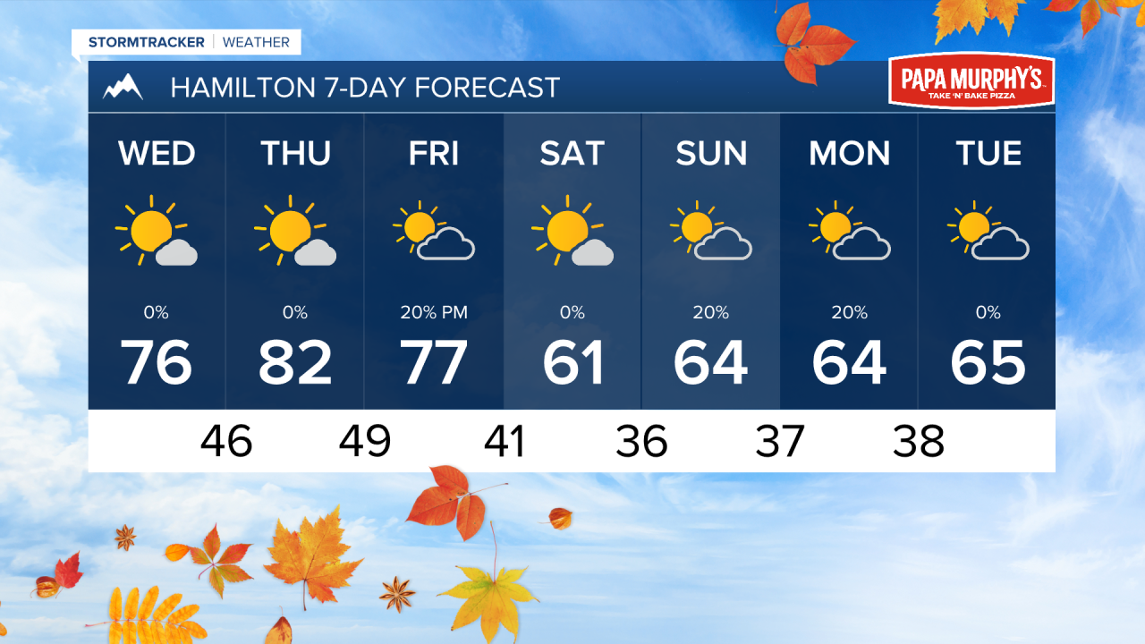
However, summer is not letting go of its grasp just yet. We still have a few more days of highs in the 70s and 80s before a cold front arrives on Friday.
This front will bring increased winds, especially in the afternoon. Maximum wind gusts could reach around 30-40 MPH. Some rain showers and thunderstorms will also accompany the weather system. Although, we really don't expect a whole lot of meaningful rain totals with this. A couple of inches of snow are possible in the alpine areas of Glacier National Park Friday night into Saturday.
Temperatures will significantly cool down for the weekend. Highs are only expected to reach the 50s and 60s, with lows in the 30s. Morning frost is possible across much of western Montana.
——————————————————————————————————————————
MONTANA WEATHER ALERTS:
NONE
——————————————————————————————————————————