


MISSOULA - A low pressure system continues to pump Gulf moisture into western Montana this afternoon and through Tuesday morning, creating significant flooding concerns across several valleys and waterways. The National Weather Service has issued multiple flood alerts as rainfall totals continue to mount.
An Areal Flood Warning remains in effect through Tuesday for the Flathead and Mission valleys, where small streams along the western slopes of the Mission and Swan mountain ranges are experiencing flooding and water ponding in low-lying areas. Additional rainfall of 0.25 to 1 inch is expected by Tuesday afternoon, with higher terrain along the Continental Divide potentially seeing up to 2 inches more. Snow levels are holding steady around 7,000 feet during this period.
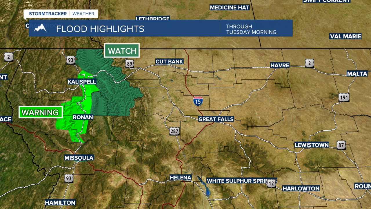
The Glacier National Park region is under an Areal Flood Watch due to the potential for small stream flooding, rock slides, and mudslides in the steep terrain.
A Flood Watch continues for the Clark Fork River above Missoula through Wednesday afternoon. The river is forecast to peak at just over 7 feet Monday afternoon before gradually receding through the week. While this remains below the minor flood stage of 7.5 feet, residents in low-lying areas should remain cautious as water levels stay elevated through midweek.

Tonight brings a 90% chance of rain with patchy fog developing after midnight mostly north of I-90. Temperatures will drop into the upper 30s to mid 40s across most areas. Tuesday will remain mostly cloudy with about a 50% chance of rain and possible morning fog. Highs will range from the 50s in higher elevations to the 60s in valley locations.
Western Montana will catch a brief break late Tuesday into Wednesday as the weather pattern temporarily shifts. Wednesday looks mostly sunny with pleasant warming, pushing temperatures into the 70s and 80s across the region.
However, the active pattern returns Thursday when a quick-moving disturbance brings widespread showers and the potential for thunderstorms. Another brief dry spell is expected Friday before a more significant low pressure system approaches from the Pacific Northwest over the weekend.
Weather models are showing some uncertainty about this weekend system, with the latest guidance suggesting it may split into two parts - sending the bulk of energy into Canada while a weaker feature moves toward California. Regardless, western Montana appears likely to remain in an active weather pattern through the weekend and into next week.
Residents should continue to avoid flooded roadways and stay weather-aware as conditions remain unsettled. Remember: turn around, don't drown.
