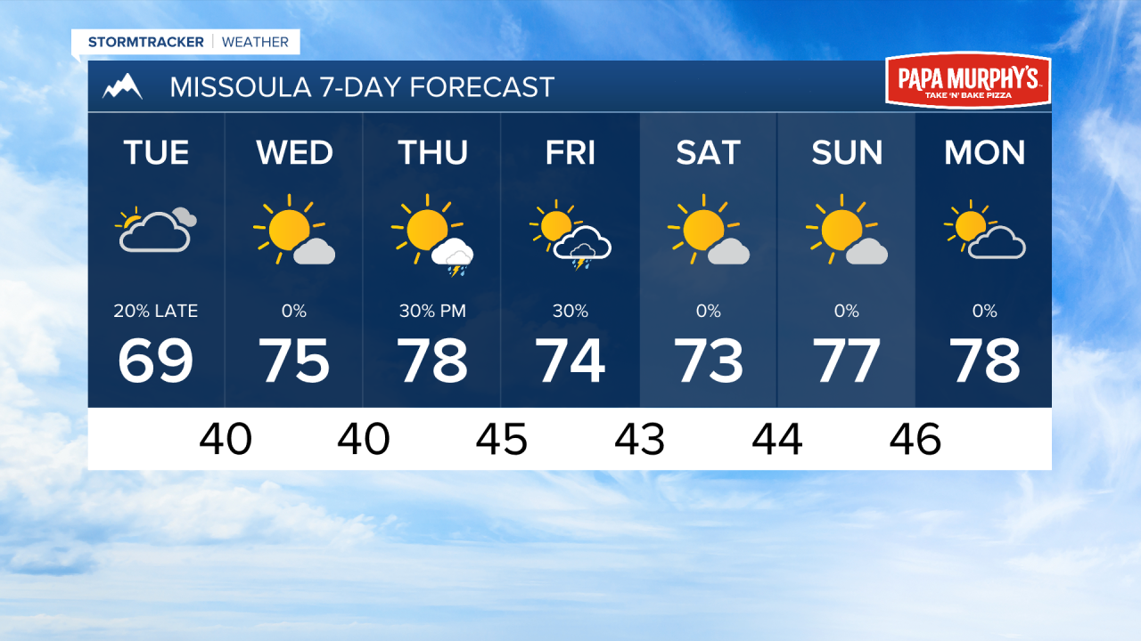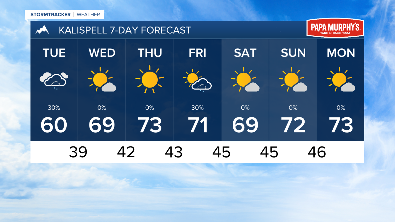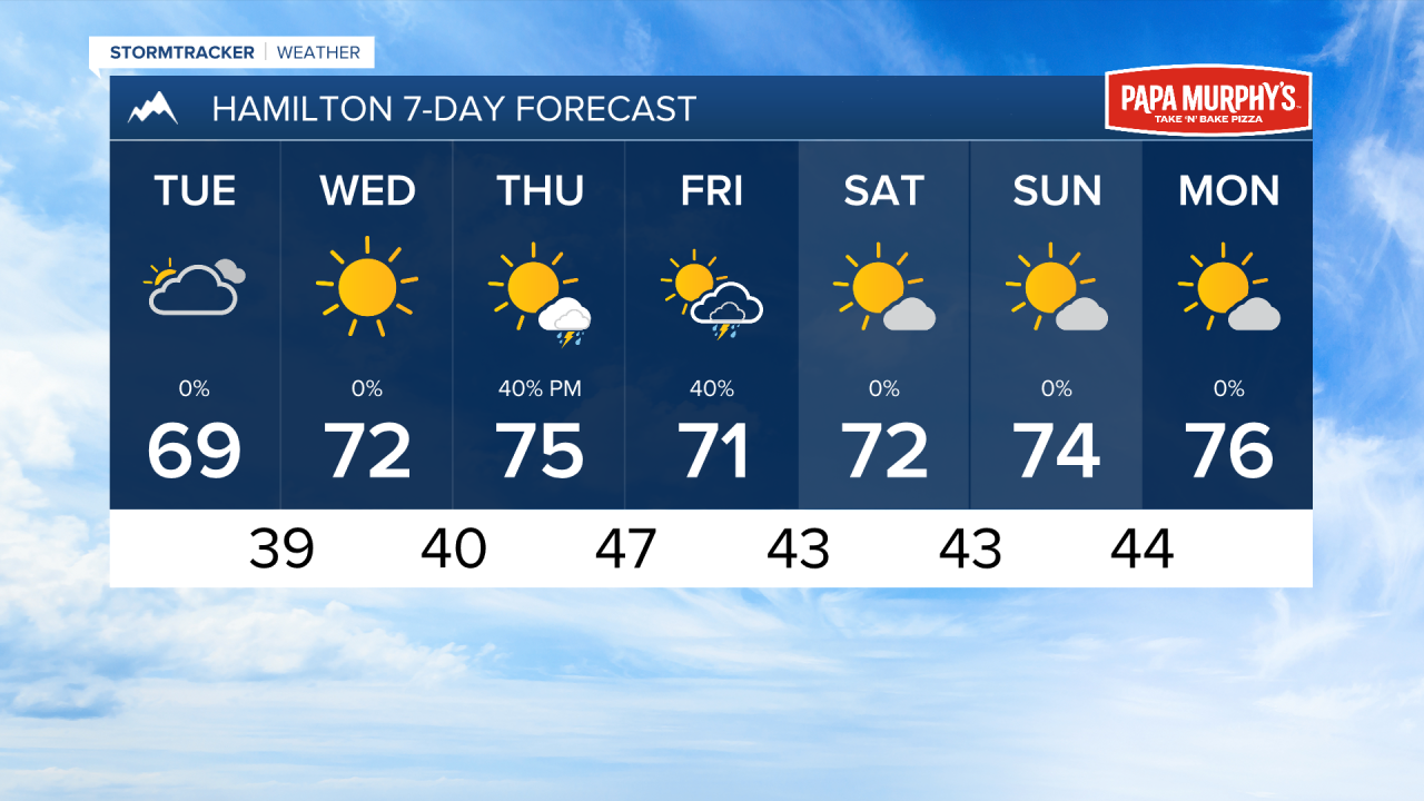


MISSOULA — Afternoon highs only reached the 50s for most in western Montana on Monday. Warmer air will return later this week with temperatures reaching the 70s.
Unfortunately for those is the Bitterroot Valley and the Missoula area. Our storm system tracked a bit further north over the weekend and left us out of any meaningful precipitation. The Kalispell area had about half an inch of rain with this storm.
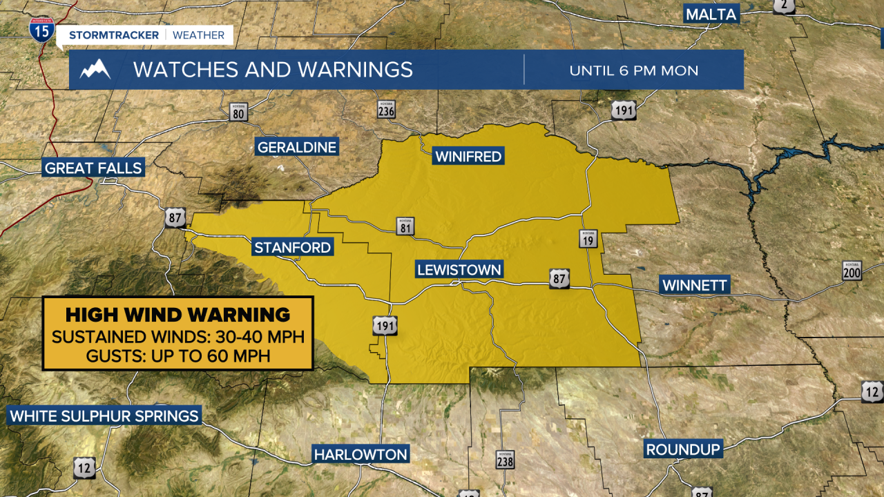
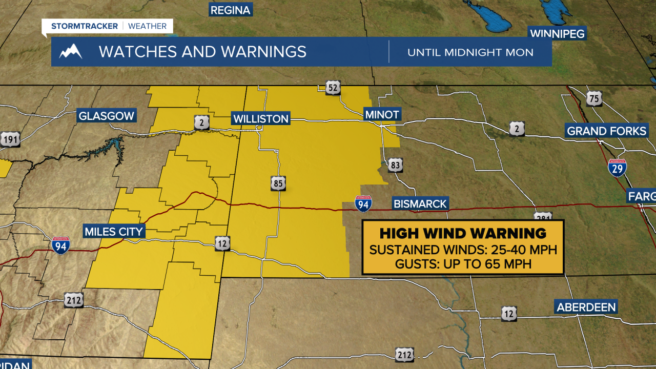
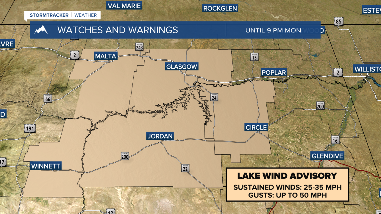
We are on the backside of this system now, with strong winds east of the divide and a few remaining light showers in our area.
Another smaller features comes through northwest Montana tomorrow, introducing yet another chance for scattered light rain showers, mainly staying north of Kalispell. This will also bring another round of light snow to the higher elevations of Glacier.
Temperatures warm into the 70s under mostly sunny skies Wednesday and Thursday.
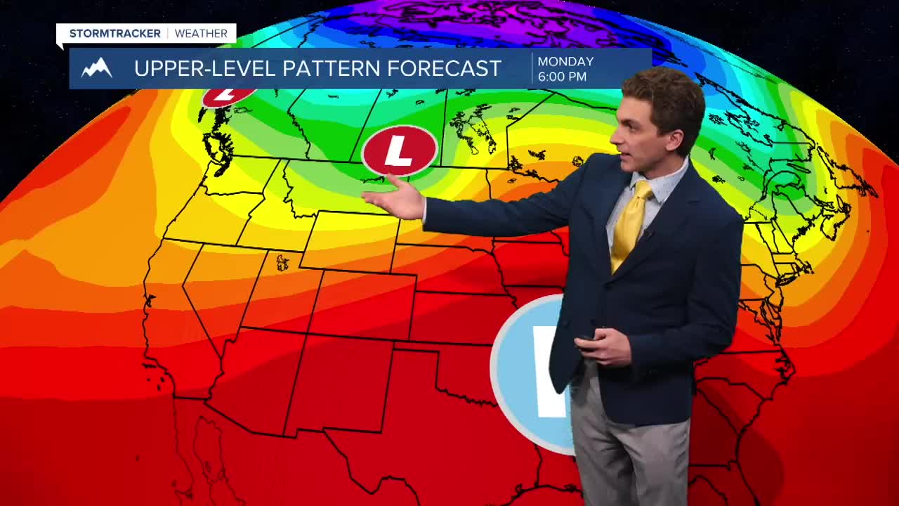
A cut-off low starts to influence our region Thursday evening. This will bring a moist southwest flow aloft. This will reintroduce thunderstorms to southwest and west-central Montana Thursday and Friday.
This low move out on Saturday leaving beautiful conditions for our upcoming weekend.
——————————————————————————————————————————
MONTANA WEATHER ALERTS:
——————————————————————————————————————————