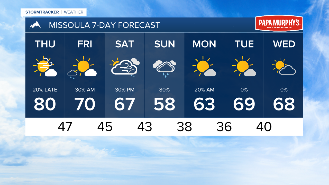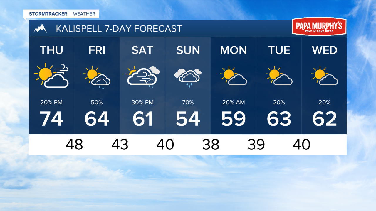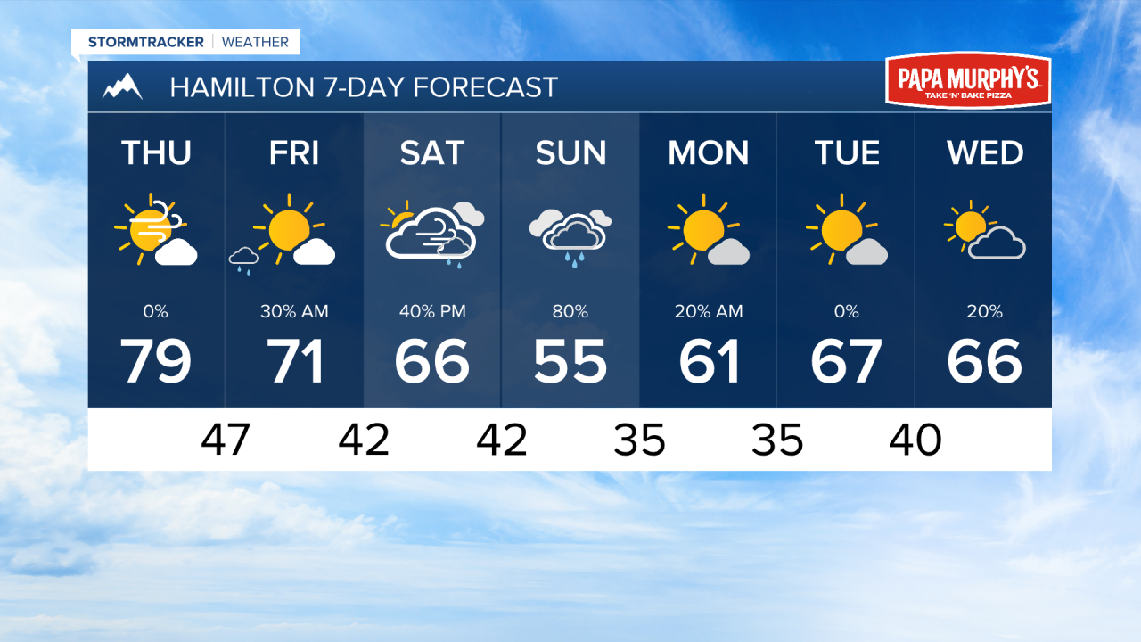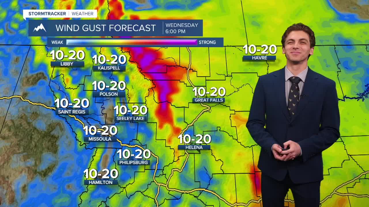


MISSOULA — Winds will increase ahead of a cold front on Thursday afternoon. Maximum gusts could reach around 30 to 40 MPH for most areas around northwest and west-central Montana.
Wednesday was a beautiful day with under mostly sunny conditions with highs in the 70s. Most of the morning and early afternoon will be similar on Thursday, but wind will pick up by the mid afternoon hours with an upper level jet streak moving over the state.
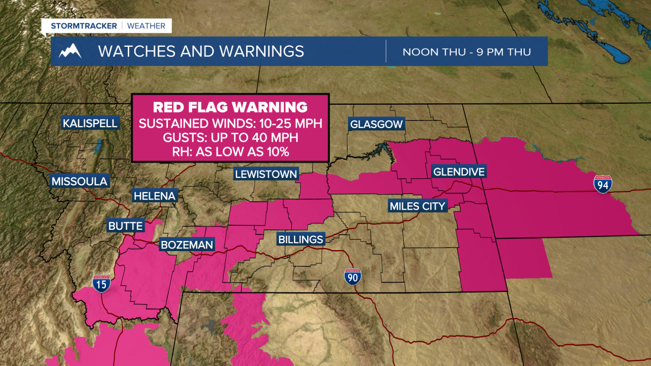
Fire weather conditions become elevated to critical in southern and eastern portions of the state, where overall drier weather has been in place. While our area will have stronger winds as well, I don't expect fire danger to be as bad as the portion of the state under Red Flag Warnings.
A cold front moves into our region Thursday night into Friday morning. This will bring isolated to scattered rain showers and a couple of thunderstorms.
Wind will pick up once again on Saturday afternoon ahead of our next storm.
A larger storm system comes into Montana Saturday night. It will bring widespread rain to lower elevations and snow coming down to about 6,000 feet at times. It will be a soggy and cooler Sunday with highs only reaching the 50s. This system moves out of the area on Monday.
Snow totals could reach several inches in the higher mountain peaks of western Montana, especially near the Glacier area.
Rain totals for lower elevations are looking to be between 0.5" to 1.5" region-wide.
——————————————————————————————————————————
MONTANA WEATHER ALERTS:
——————————————————————————————————————————