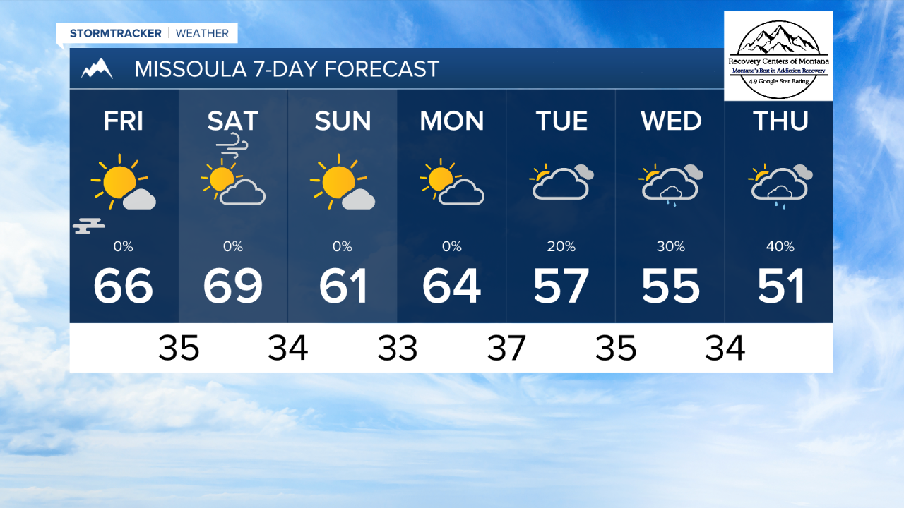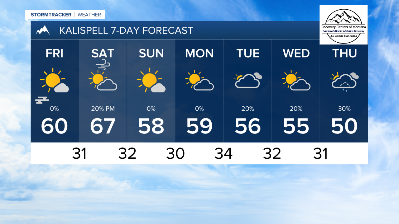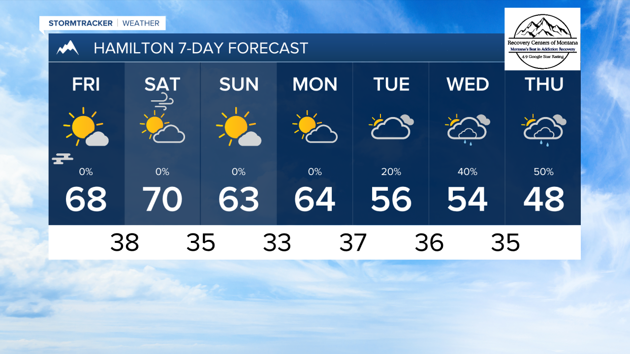


MISSOULA — Very nice fall weather continues today under clear skies and comfortable temperatures. We expect another day of beautiful weather before a cold front arrives om Saturday.
WIth cool temperatures, minimal wind, and clear skies again tomorrow morning, patchy fog is possible in the lower valleys.
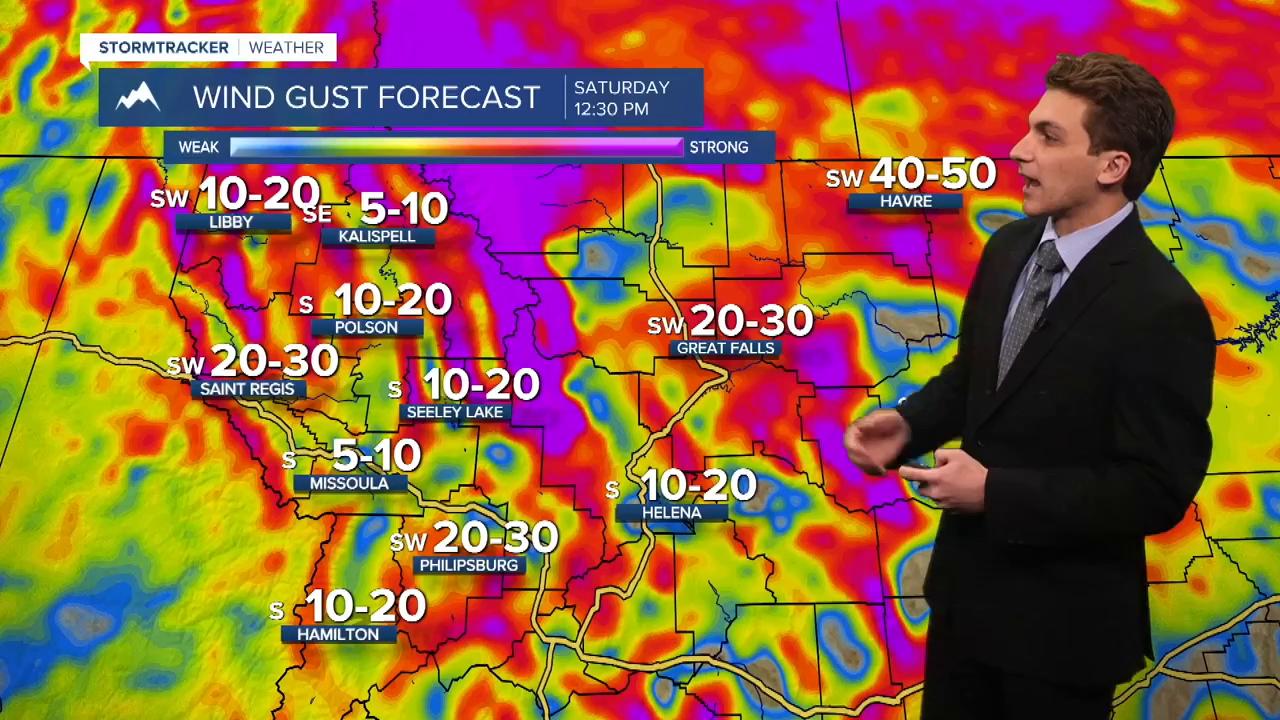
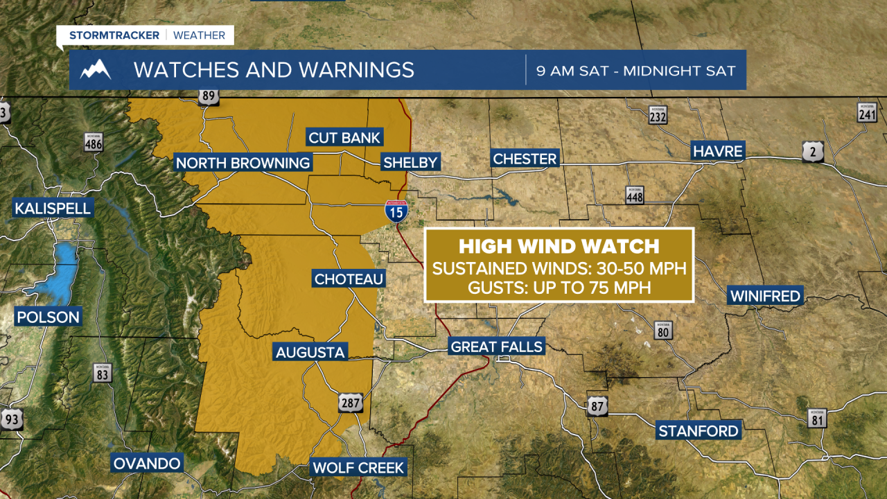
A mid-level jet streak will move over northern Montana on Saturday. This will bring stornger winds back to the area, with 30-40 MPH maximum gusts possible. The wind will calm after a surface cold front passes through Saturday night. We do not expect much preciaption with this front, outside of a few light rain showers in northwest Montana.
Next week will begin dry, but a cut-off low moves into the Great Basin region towards the middle of the week. This will bring scattered rain showers and mountain snow back to southwest Montana.
——————————————————————————————————————————
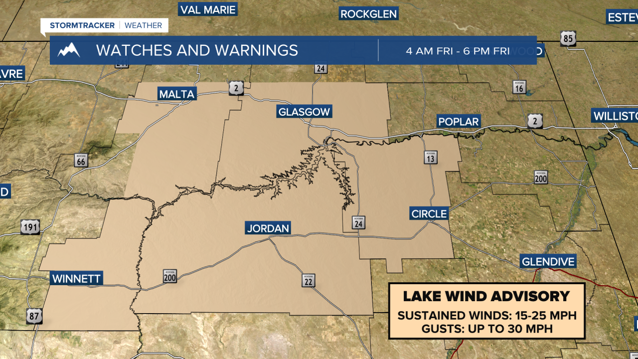
MONTANA WEATHER ALERTS:
——————————————————————————————————————————