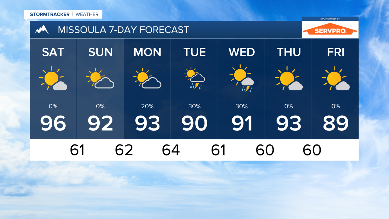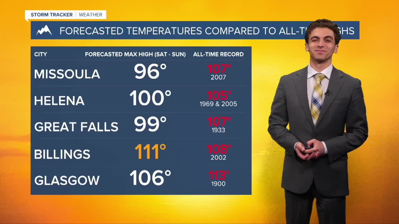


MISSOULA — SATURDAY, JULY 11TH: A pop up shower over northwestern Montana is possible before sunrise. We will be seeing highs reach the low to mid 90s through most of western Montana. Be sure to drink plenty of water if you will be outdoors. We also expect the fire danger to be highest on Saturday with the hot, dry, and breezy conditions. We will be under mostly sunny skies.
SUNDAY, JULY 12TH: Another day of temperatures reaching the low to mid 90s. We will be under partly cloudy skies with dry conditions outside of a stray shower over Lincoln County.
MONDAY, JULY 13TH: Temperatures will reach the upper 80s to low 90s for all locations. Isolated thunderstorms will return to southwest Montana in the afternoon and evening. Most areas will be under partly cloudy skies.
TUESDAY, JULY 14TH: Temperatures continue to run about 10 degrees above normal in the upper 80s and low 90s through western Montana. A bit of monsoonal moisture returns to southwestern Montana in the afternoon.
LONG-RANGE FORECAST: Temperatures will stay much above average next week, but some monsoonal moisture could keep highs just a few degrees cooler than the weekend.
——————————————————————————————————————————
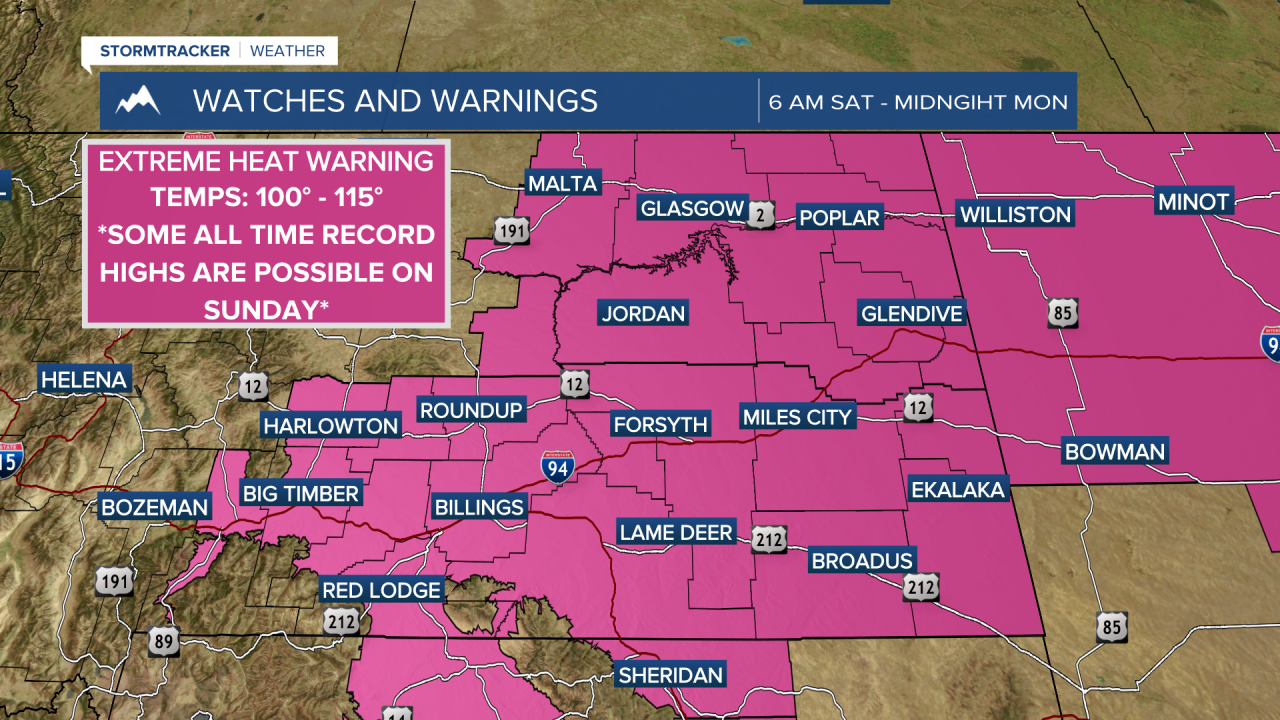
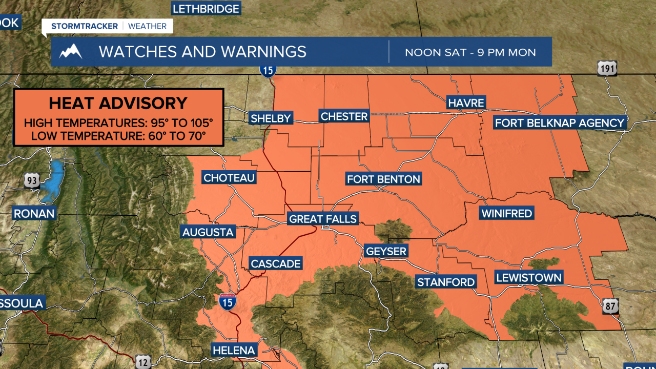
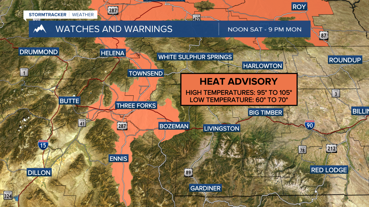
MONTANA WEATHER ALERTS:

——————————————————————————————————————————
Missoula Temperature Records Tomorrow:
High: 103 (2023)
Low: 38 (1911)
AVG: 84/51
Kalispell Temperature Records Tomorrow:
High: 97 (2024)
Low: 38 (1994)
AVG: 81/47
Hamilton Temperature Records Tomorrow:
High: 100 (2013)
Low: 38 (1951)
AVG: 83/49