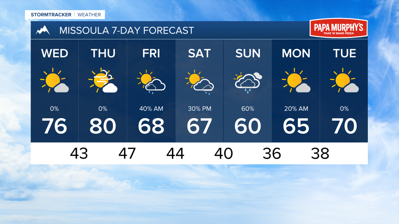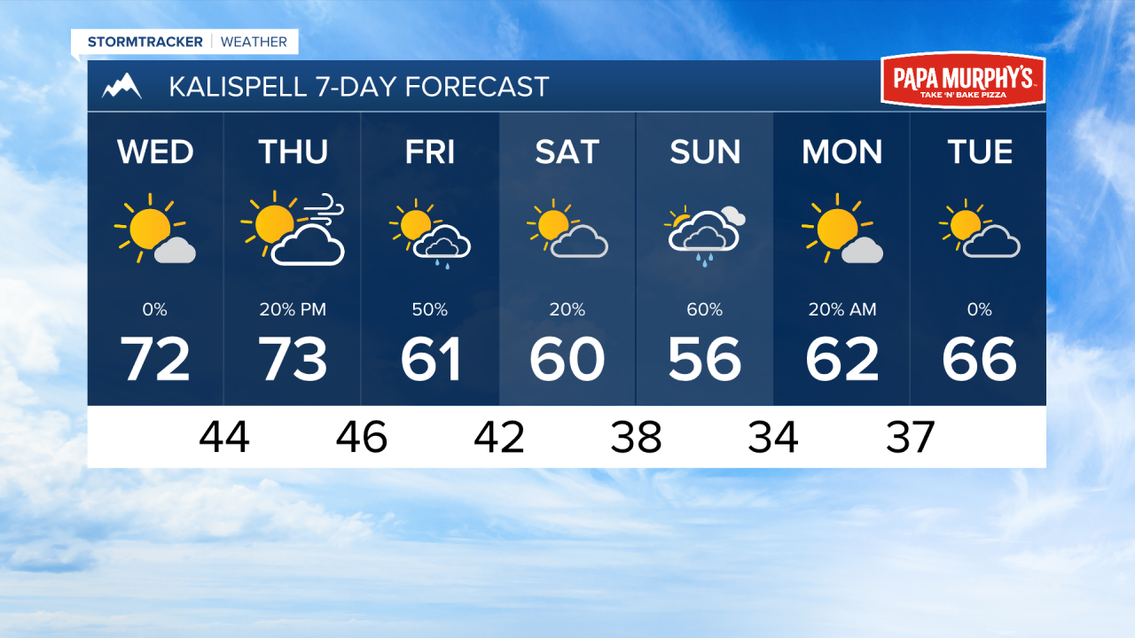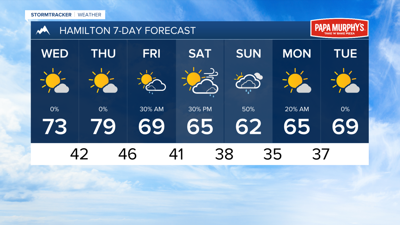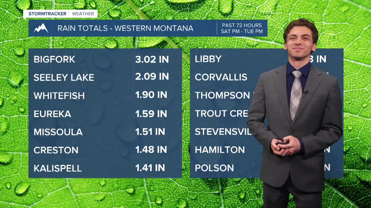


MISSOULA — Most locations in western Montana had about an inch of precipitation over the holiday weekend. This storm is on it's way out and we will have calmer weather on Wednesday.
Expect some patchy fog to develop in valley locations Wednesday morning with all of the moisture we have had and cooler temperatures, Lows will dip into the upper 30s to low 40s across the region.
Wednesday afternoon should be beautiful with highs in the 70s under mostly sunny skies.
A jet streak will move over northwest and west-central Montana on Thursday. This will generate wind gusts for most communities near the surface around 30 to 40 MPH, especially in the afternoon.
Another larger-scale storm system will move into the area this weekend. This will bring more rain to lower elevations and even some mountain snow down to about 7000 to 8000 feet. As this system is still a few days out, some of the finer details still need to be worked out. For now, expect a colder and wetter weekend yet again.
——————————————————————————————————————————
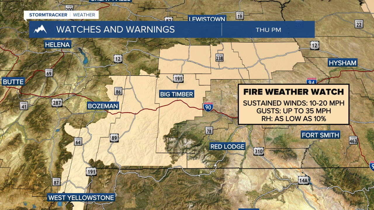
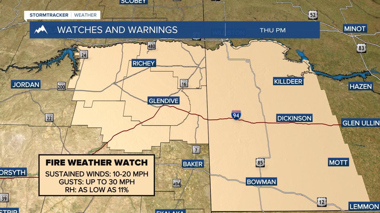
MONTANA WEATHER ALERTS:
——————————————————————————————————————————