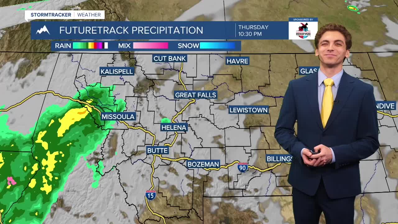


MISSOULA — Our active weather pattern continues over the next few days with a strong center of low pressure over the Pacific Northwest bringing waves of rain to western Montana.
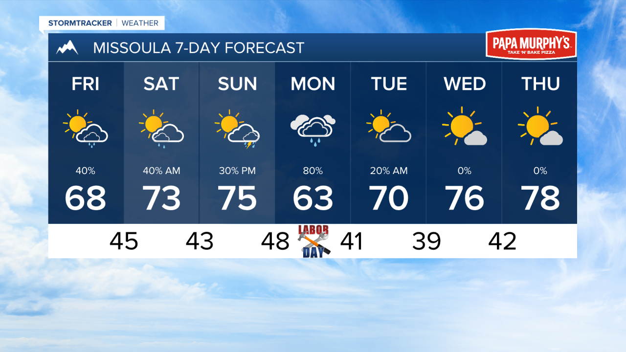
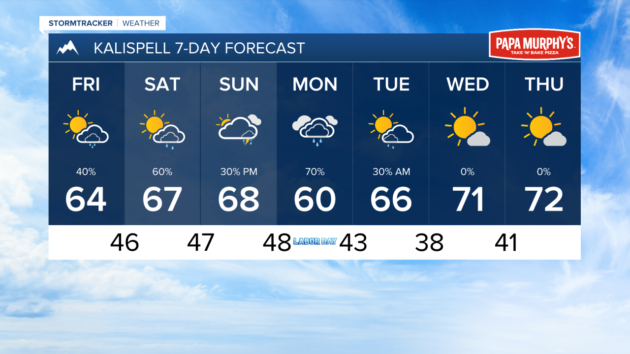
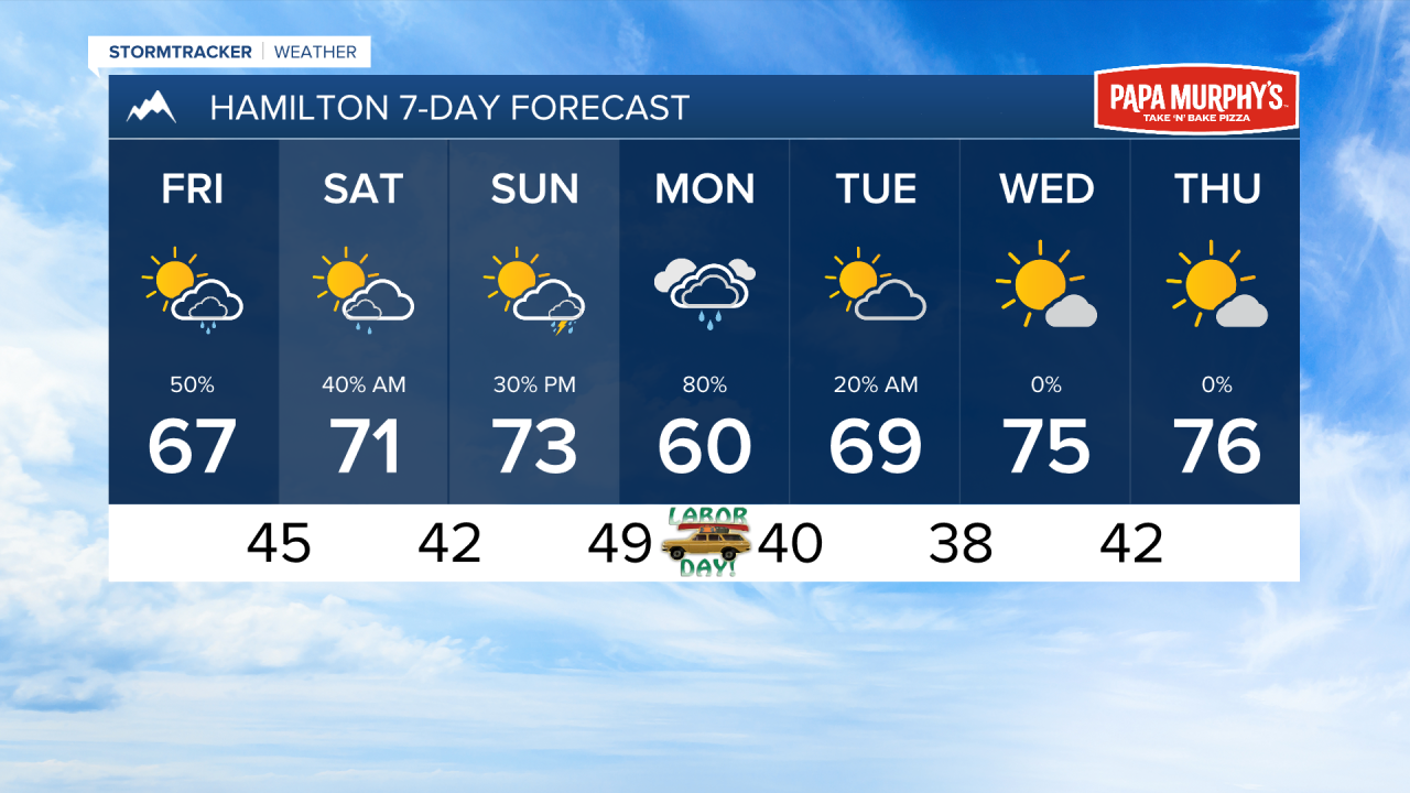
A line of heavier rain showers will move into the area late tonight through early tomorrow morning. This will bring another wetting rain to most locations. An isolated thunderstorm or two are possible Friday afternoon before another more organized line of showers moves in Friday night into Saturday morning.
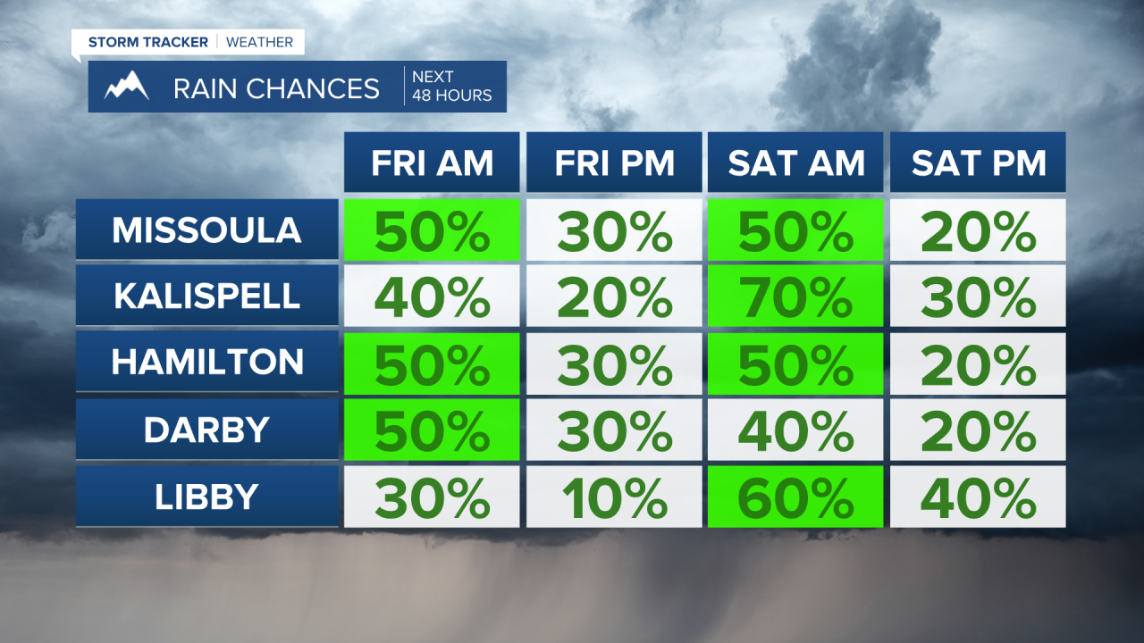
Things will dry out briefly by Saturday afternoon. Some thunderstorms will return by Sunday evening ahead of another larger-scale storm system moving into Montana by Labor Day. This is set to bring widespread rain to much of the state. This syetm will move out by Tuesday morning. Drier and warmer weather will return towards the middle of next week.
Temperatures will stay near to below average over the next week with these storm systems impacting us.
Air quality will not be an issue in the near future as most wildfires have seen sufficient rain over the past few days, drastically reducing smoke output.
——————————————————————————————————————————
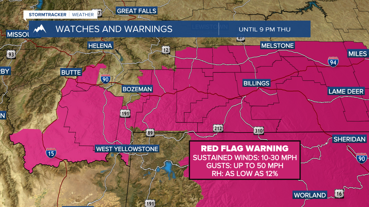
MONTANA WEATHER ALERTS:
——————————————————————————————————————————