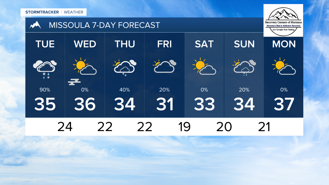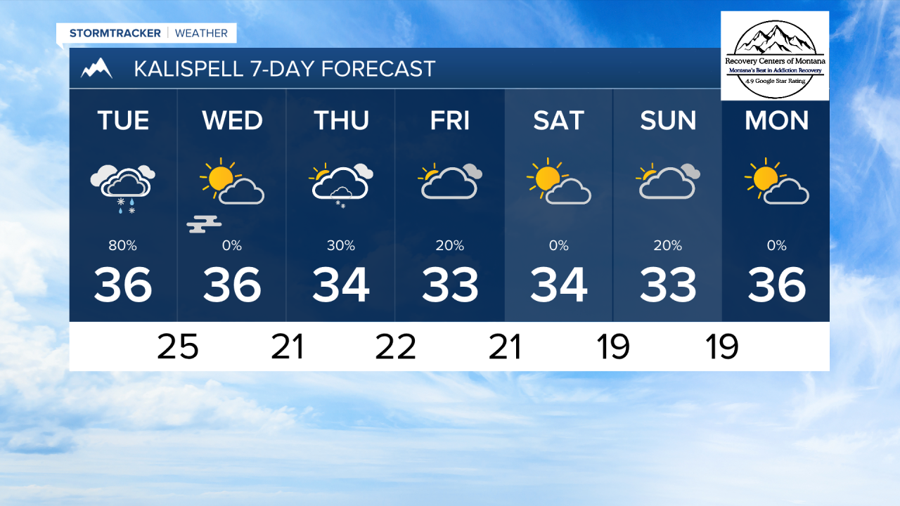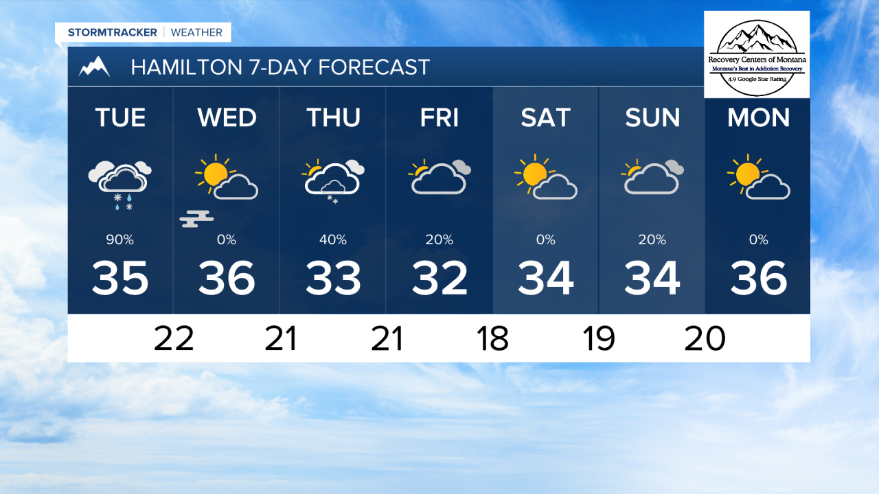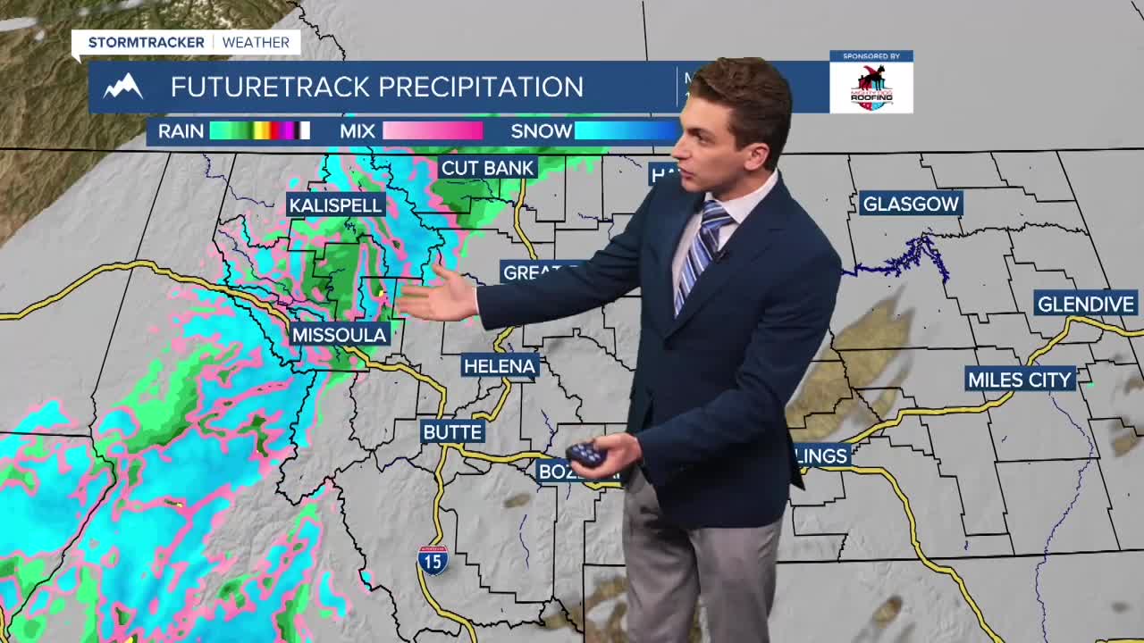


MISSOULA — Widespread rain and snow has begun this afternoon and will last through Tuesday night for most areas. We will likely see a conversion from rain to snow on Tuesday for valleys south of I-90 in western Montana.
A center of low pressure over eastern Idaho and western Wyoming will bring a plume of mosture over Montana Monday night into Tuesday. This will begin as mostly rain for lower elevations west of the divide. The rain/snow conversion will occur Tuesday morning, and we may see this switch a few times throughout the day.
Winter weather will be more of a travel factor over the mountains, where several passes around western Montana will pick up multiple inches of slushy snow.
This system will move out of the area by Wednesday morning, where fog is likely to form in its wake.
Another storm system will bring scattered snow showers back to our area to end the week, but it doesn't appear we will see significant accumulation with this.
Temperatures will be cold this week. Highs will only reach the 30s, while lows dip to the teens and 20s.
——————————————————————————————————————————
MONTANA WEATHER ALERTS:
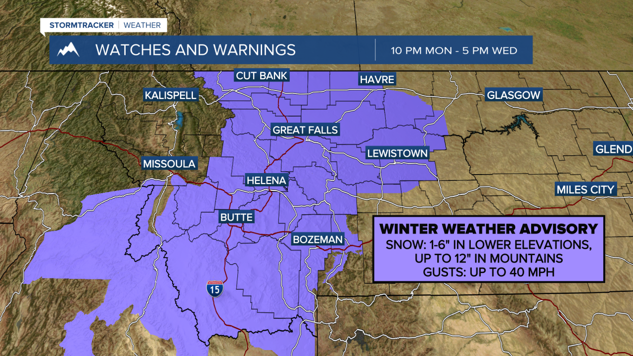
——————————————————————————————————————————