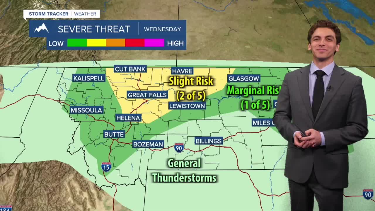


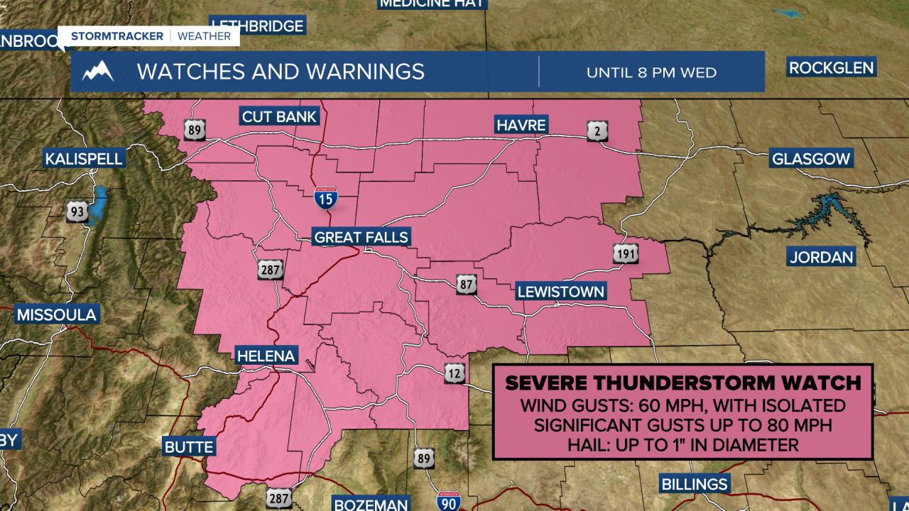
MISSOULA — ferocious thunderstorms producing sever gusts produced 70 to 80 MPH wind gusts in areas like Helena, Great Falls, Chateau, Augusta, and Butte Wednesday afternoon.
These storms were thankfully a lot weaker when the moved through western Montana earlier in the day. They did produce good rain, ranging from about 0.1" to 0.5" for most areas.
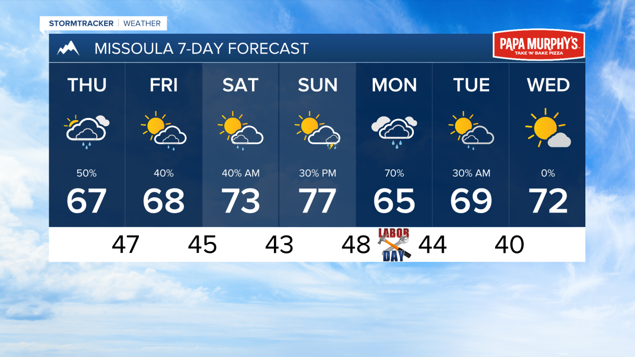
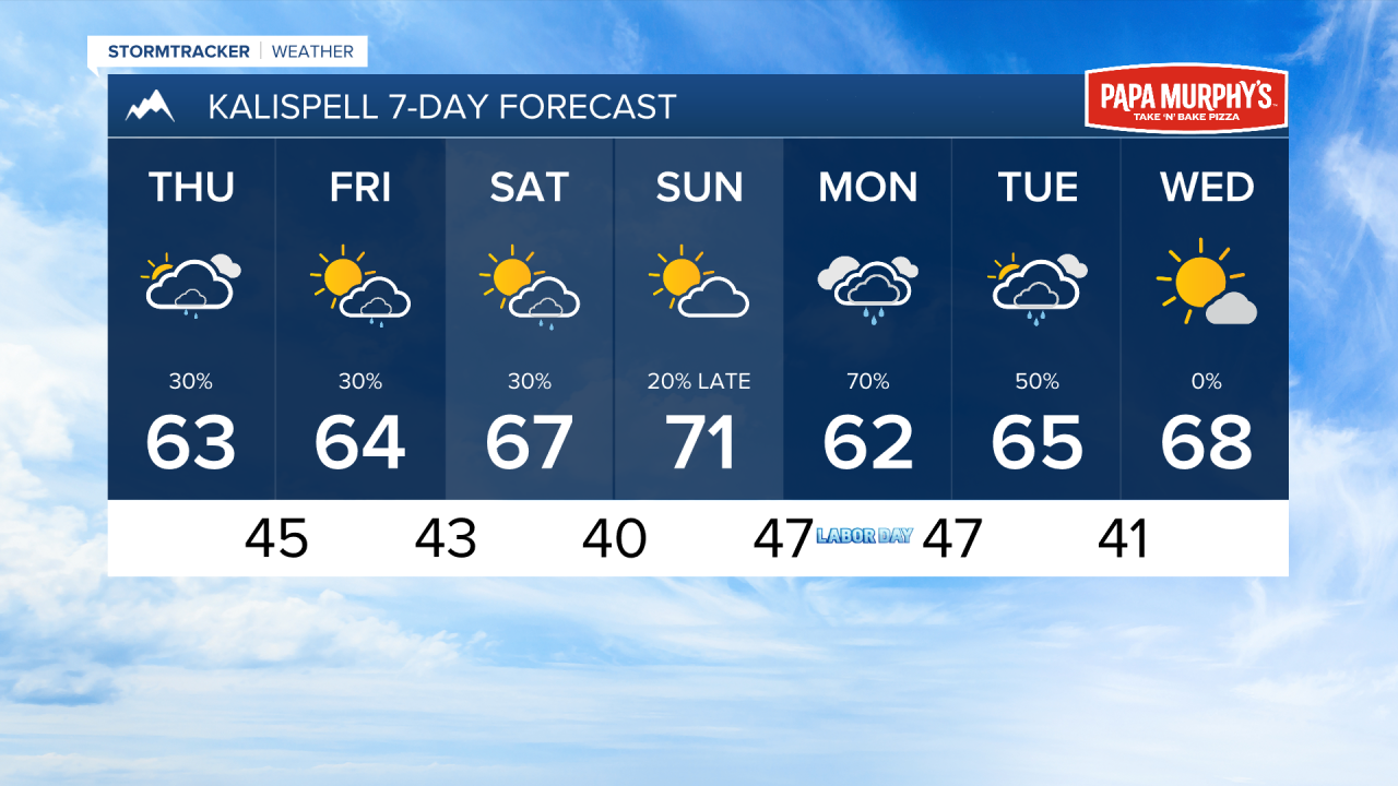
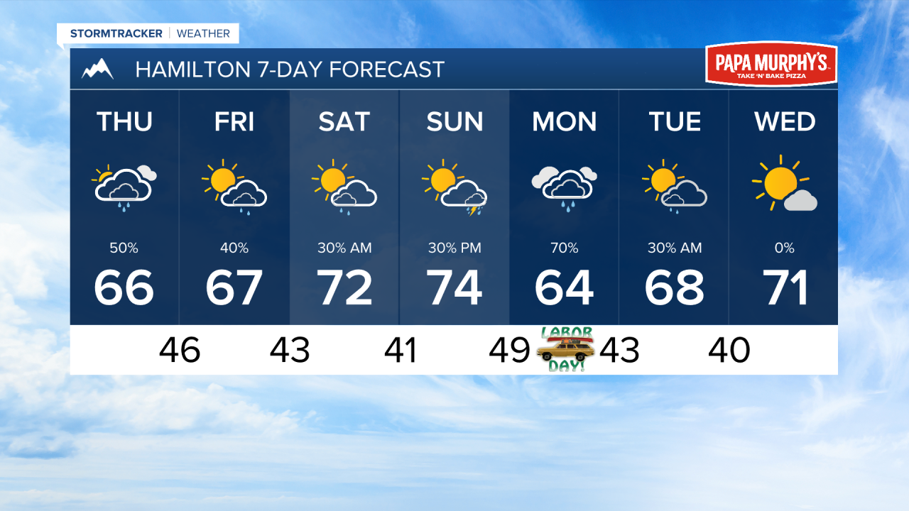
As we are now on the colder side of this system, expect less thunderstorm activity and more light rain showers over the coming days. More waves of moisture on on the way Thursday, Friday, and early Saturday morning.
Another system will begin to influence our area on Sunday evening, bringing isolated thunderstorms back to the forecast. This will turn into a more steady rain heading into Labor Day with the current storm track. The heaviest precipitation seems to be targeted east of the Continental Divide in north-central Montana, where 1-2 inches of rain may fall. Some areas west of the Divide may receive up to an inch. This storm will move out Tuesday afternoon. Drier weather takes its place through he middle of next week.
Temperatures will remain near to below average through next week.
Wildfire smoke will become less of a talking point moving forward with rain falling on most active wildfire in the northwestern United States.
——————————————————————————————————————————
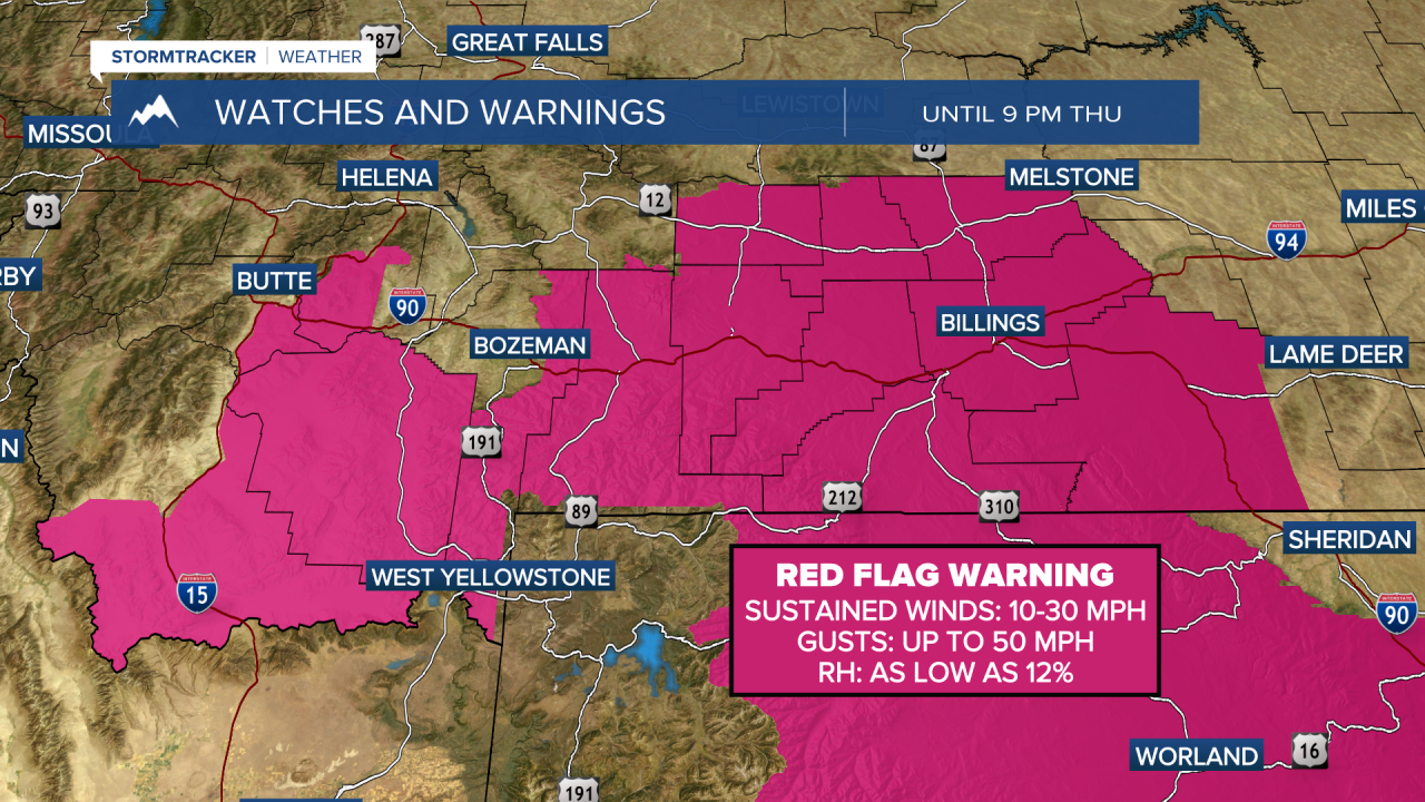
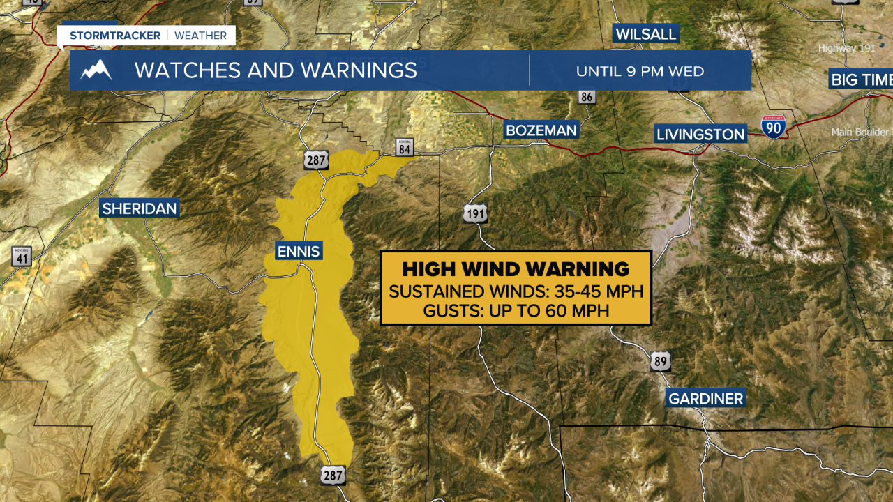
MONTANA WEATHER ALERTS:
——————————————————————————————————————————