

MISSOULA — Rain and snow continue to come down in western Montana on Tuesday evening. This storm systems will slowly move out of our area tonight and tomorrow morning.
After the sun sets, snow levels will drop once again, giving one last opportunity for our lower elevations to see some flakes before the wet weather moves out.
Skies will clear from southwest to northwest through the night, This will allow temperatures to drop into the 20s by tomorrow morning, increasing the chance for icy road conditions with the recent rain. With the clear skies, freezing fog will form in some of our valleys.
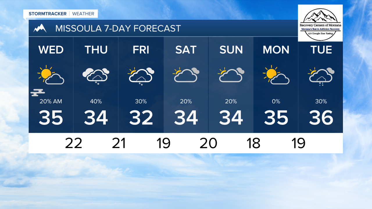
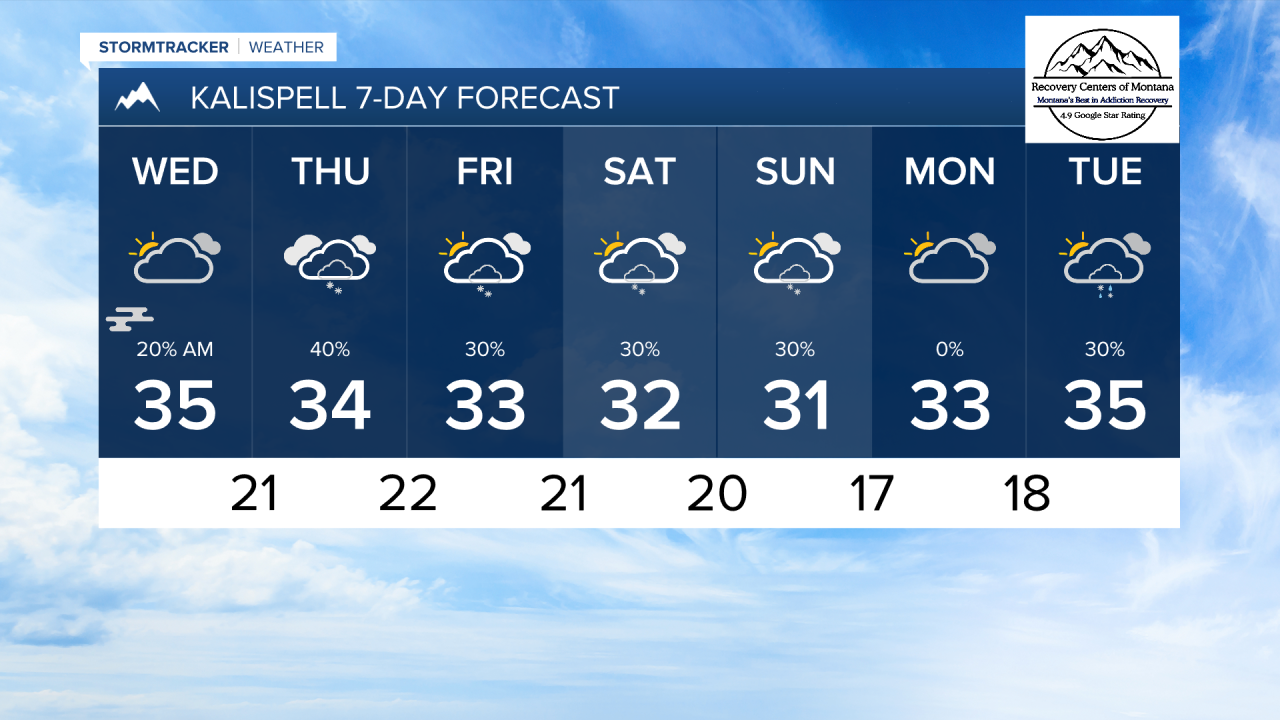
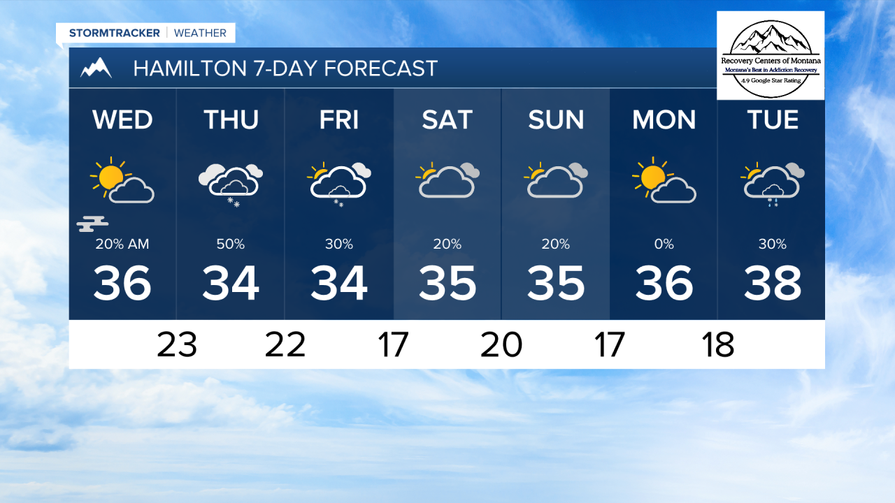
Wednesday afternoon will feature more sunshine but it will be chilly. High temperature won't escape out of the 30s for the rest of the week.
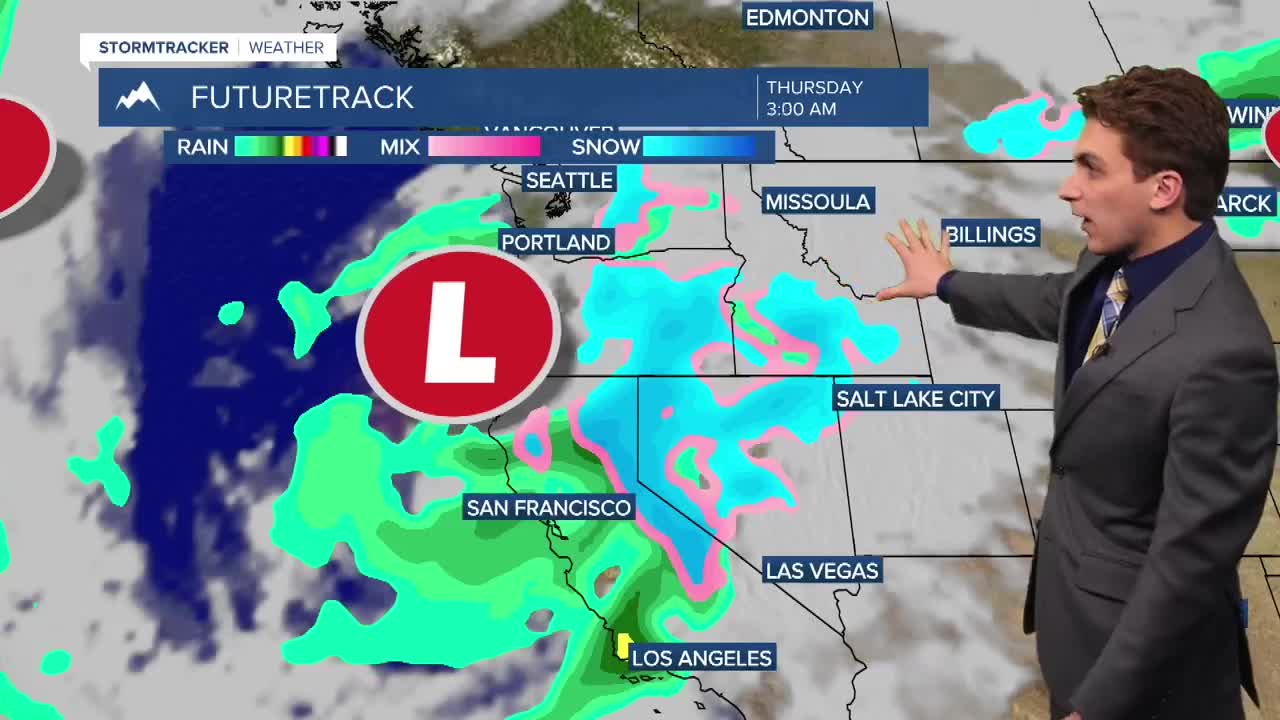
Another storms system will move into our area late Wednesday night into Thursday morning. With cold air already in place, this increases the chances of all elevations seeing snow with this once. However, there seems to be less moisture with this storm, so accumulation is looking minimal at this time. We will continue to watch how this develops in the next couple of days.
——————————————————————————————————————————
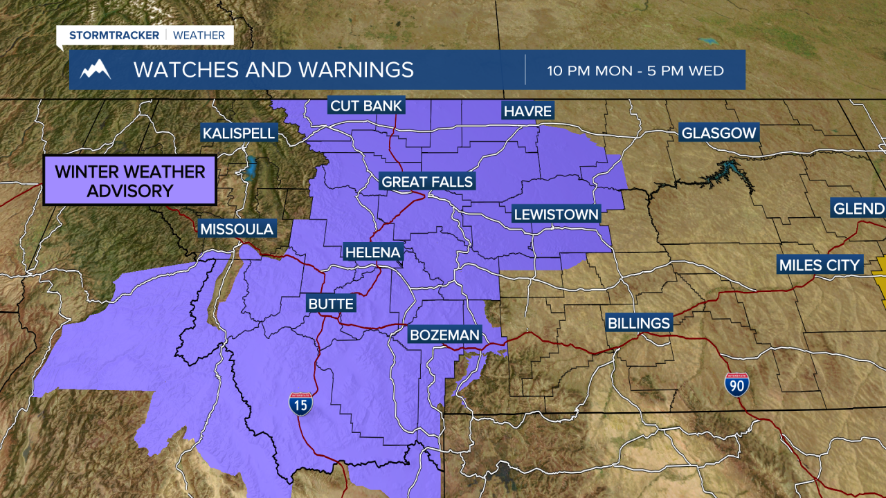
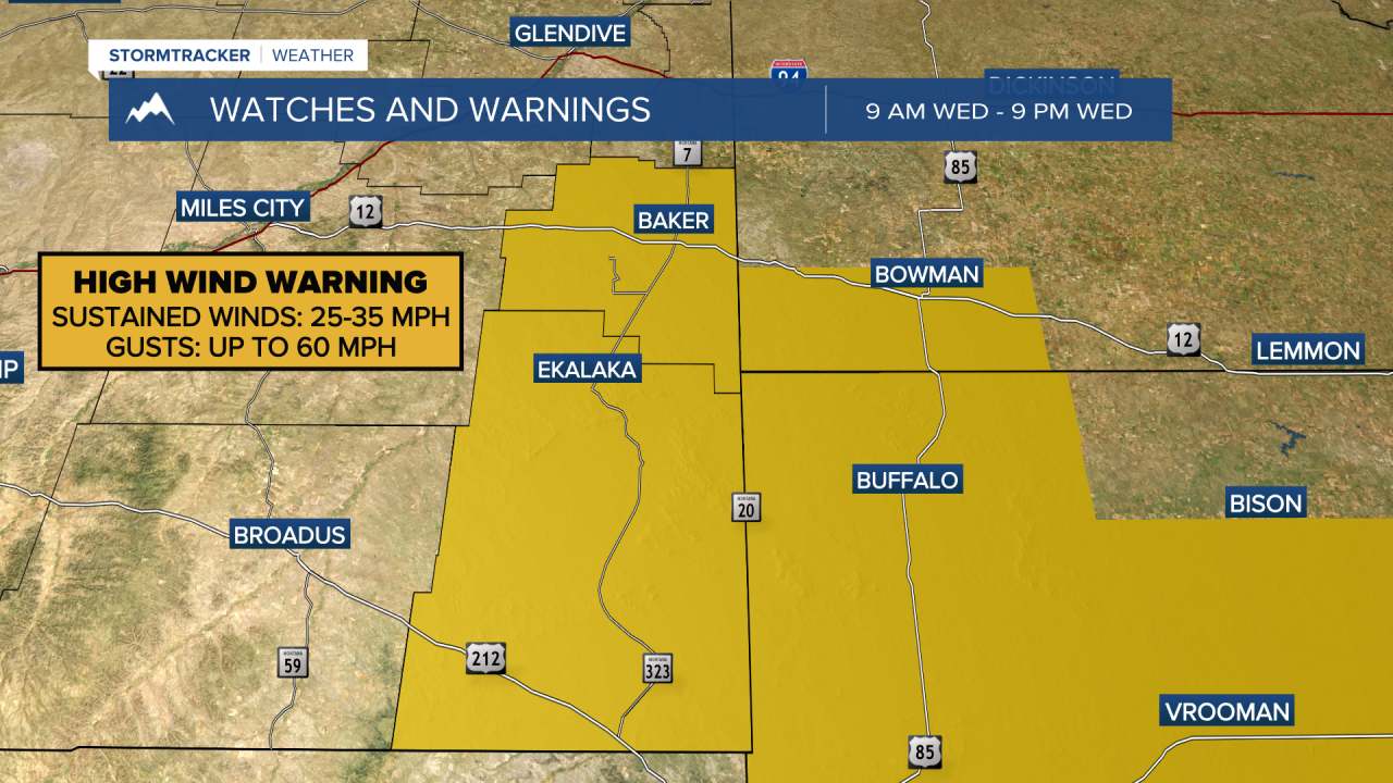
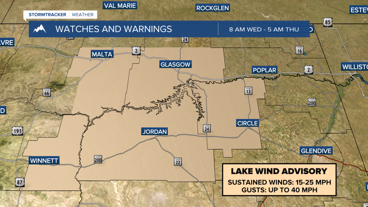
MONTANA WEATHER ALERTS:
——————————————————————————————————————————