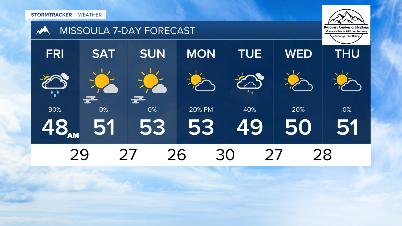
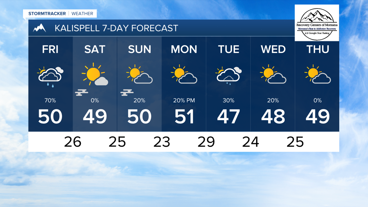
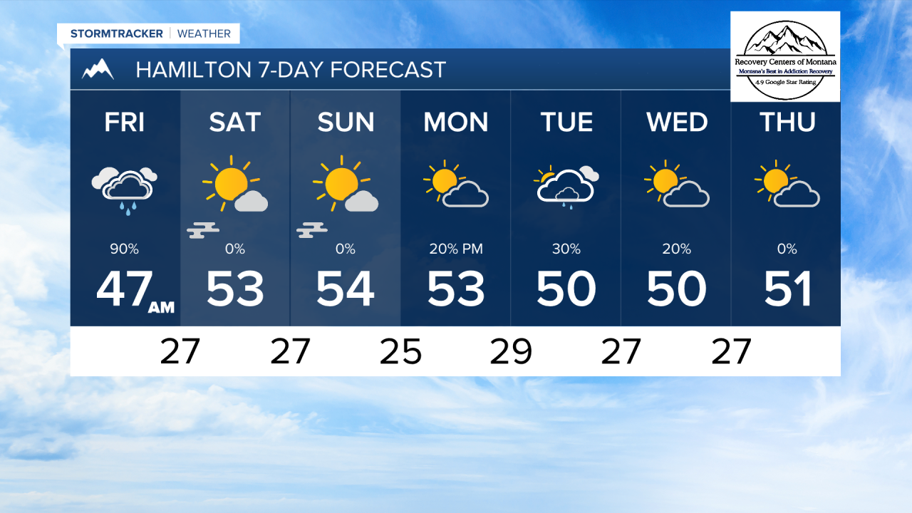
MISSOULA — Rain will begin to move into the Bitterroot late tonight. Showers and cloud cover will move south to north through our area overnight until rain becomes widespread by Friday morning.
A cold front moving in from the northwest will bring light rain over the mountains of northwest Montana, as well as the Fleathead and Mission Valleys. The Missoula and Bitterroot Valleys rain will mostly originate from a center of low pressure to the southeast.
Short range forecast models have backed off on some of the heavier lower elevation rain. Most of northwest Montana should expect around 0.1" t 0.3" of rain. The Missoula and Bitterroot Valleys should revive 0.2" to 0.5" of rain.
This system moves out of our area by Friday evening. Clearing clouds with colder air in the wake of this storm will allow fog to form on Saturday and Sunday mornings.
Temperatures will be much cooler when the cold front passes. Highs will only reach the 40s and 50s, while lows dip into the 20s and low 30s through most of next week.
A few showers are possible near the International border on Sunday.
Models are still struggling with a storm system next week. Some bring more rain and snow over our area, and some keep us bone dry. We will continue to monitor this.
——————————————————————————————————————————
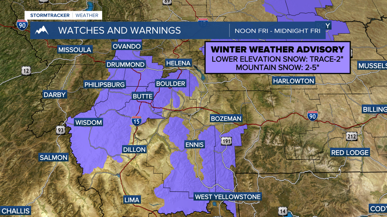
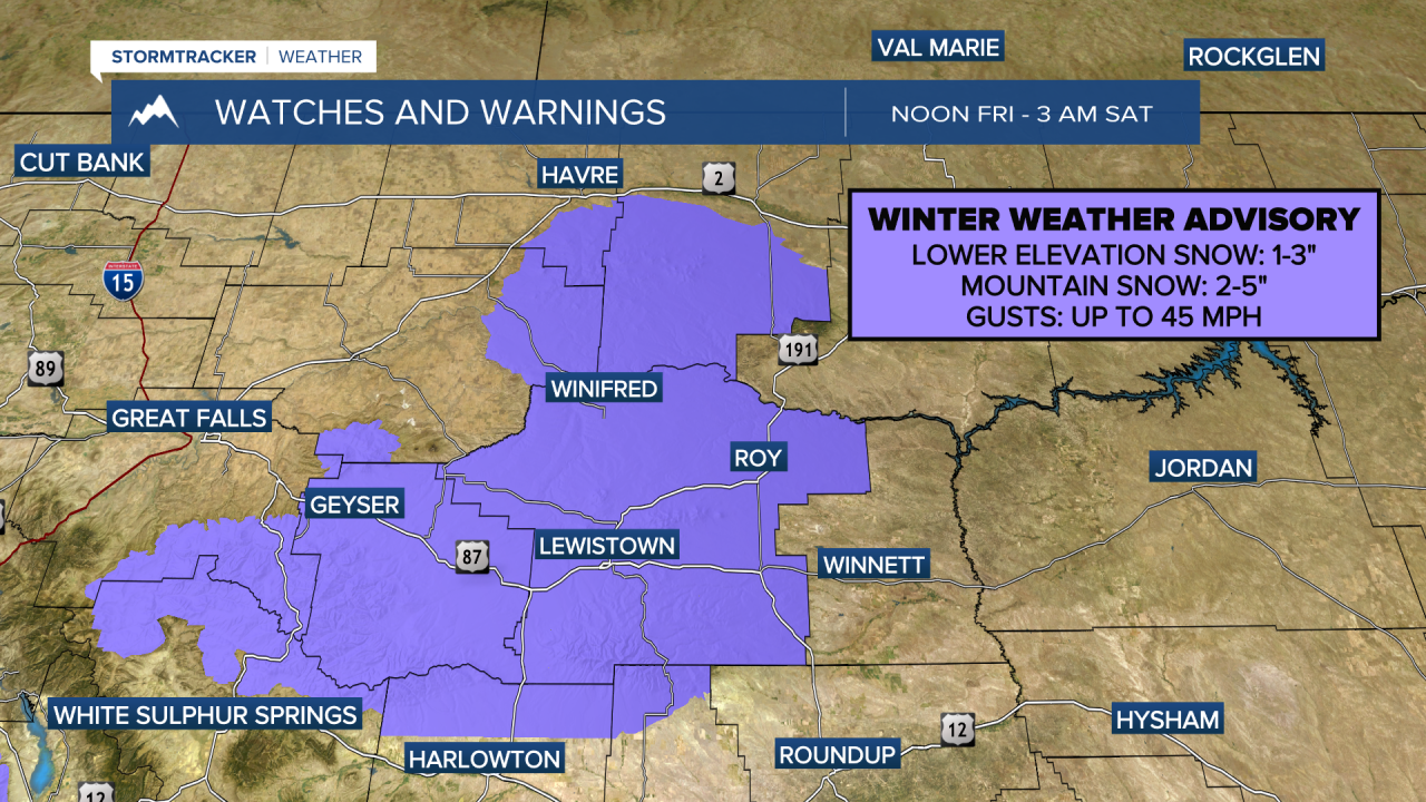
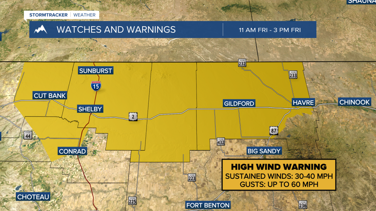
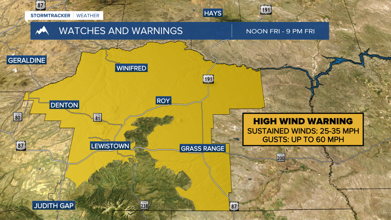
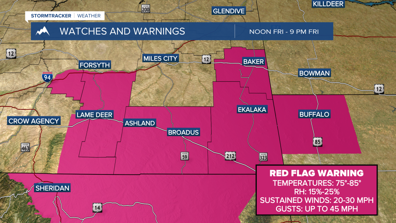
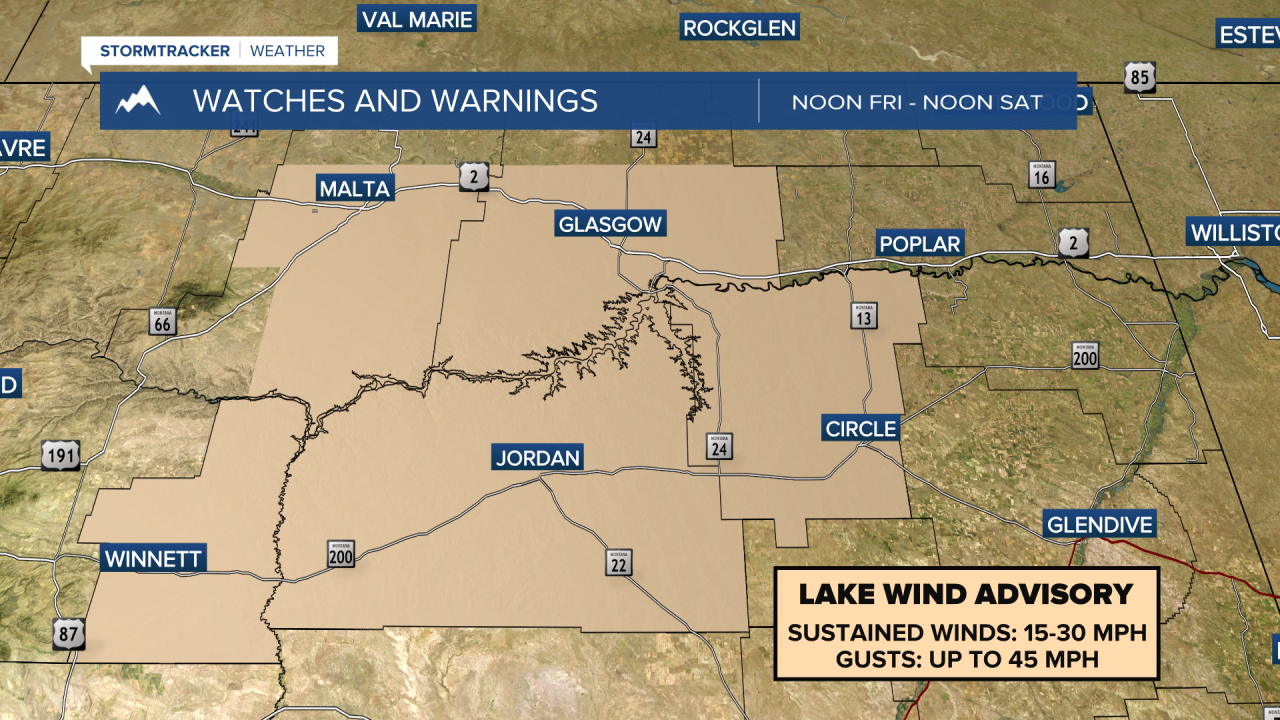
MONTANA WEATHER ALERTS:
——————————————————————————————————————————