


MISSOULA — Light rain has come down in portions of western Montana of Thursday. More storms are in the forecast in the coming days.
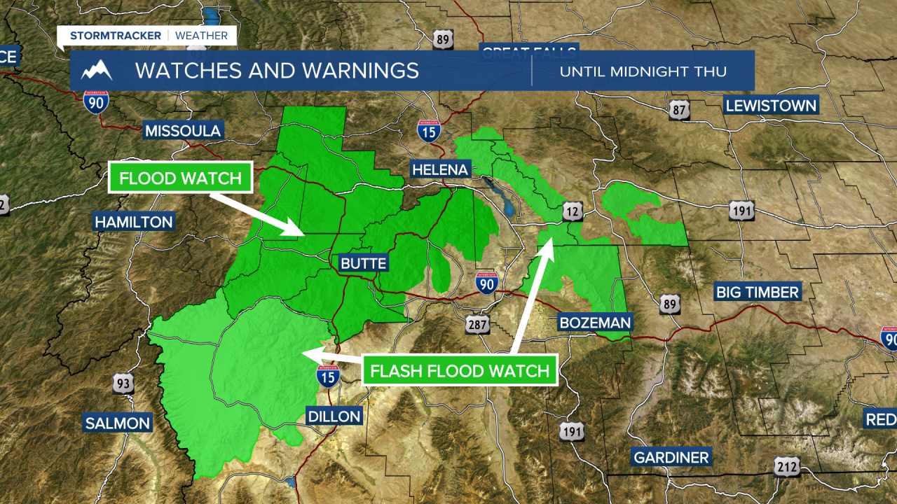
Flood watches have been issued through southwestern Montana as storms today could produce very heavy rain and potentially cause flash flooding. While no counties in our viewing area are included in this, it is important for travelers to know who are headed east of the Missoula and Bitterroot Valleys.
There will be a round of showers and storms moving into southwest and west-central Montana Friday morning, with another wave developing in the afternoon. This is Missoula's best chance to pick up some much-needed precipitation.
Temperatures have been much cooler since yesterday's cold front came through. Highs on Tghursday have only reached the 70s for most areas. We are in store for another cooler day on Friday before temperatures warm back into the low to mid 80s for the weekend.
The air quality has also been much better. Light smoke will stick around for at least the next couple days, but heavier smoke burning from fires in Oregon may come back into out area beginning this weekend.
——————————————————————————————————————————
MONTANA WEATHER ALERTS:
——————————————————————————————————————————


