

Most areas had a break from active thunderstorms today. But the severe threat returns tomorrow, this time a little further west.
Expect mostly clear skies tonight, outside of an isolated storm or two over north-central Montana. Lows drop into the upper 50s and low 60s by tomorrow morning.
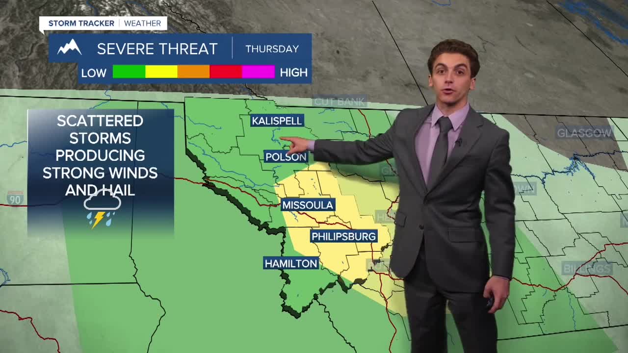
The monsoonal high transports another wave of moisture into the state tomorrow. Instability will be at low to medium levels as there will be plenty of daytime heating under mostly sunny skies. Storms will begin to pop over the mountains of southwest Montana between 2 PM and 3 PM and move northeastward through the evening.
Storms will be capable of producing damaging winds in excess of 60 MPH and hail greater than an inch in diameter. You should make sure to have multiple ways to receive warnings if any are issued for your area.
The severe risk continues into Friday as well in the same areas, with the same hazards.
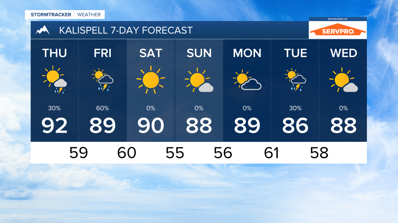
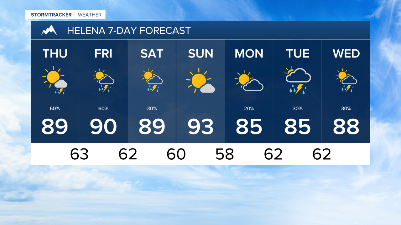
Temperatures will still be running above normal through the rest of the week and into the weekend. Expect high temperatures to reach the upper 80s to low 90s Thursday and Friday. If it weren't for the expected thunderstorms, post locations would be pushing the low 100s!
The weekend will be drier, sunnier, and hot. Highs will run in the 90s across the state.
More waves of monsoonal moisture and cloud cover will come in next week.
——————————————————————————————————————————
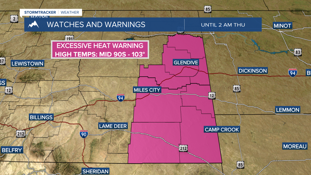
MONTANA WEATHER ALERTS:


——————————————————————————————————————————