

THURSDAY NIGHT- FRIDAY MORNING
Snow remains in the forecast Thursday night into Friday morning.
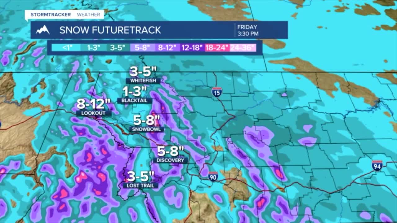
Widespread snow showers will bring accumulation amounts closer to a foot in Lookout Pass with the Flathead, Mission, Missoula, and Bitterroot Valleys seeing closer to 1-3”.
Seeley and Swan Lake and other upper elevation valleys along the Divide could see closer to 6-8” Thursday into Friday morning.
The northwest corner will clear from the snow earlier Thursday night, so accumulation amounts are expected to hover closer to an inch or less.
Snow levels stay in mountains through the afternoon but come crashing down to valley floors after sunset.
Slick roads and reduced visibility under areas of falling snow are likely Thursday night and Friday morning.
Friday we wake up to the fresh coat of snow on the ground and temperatures in the mid to upper 20s.
FRIDAY AFTERNOON-SATURDAY
Friday afternoon we warm up to the mid to upper 30s once again.
We stay mostly snow-free Friday afternoon, with the expectation of isolated pockets of light snow.
Another push of moisture returns Friday night.
Accumulation Friday night through Saturday morning will be limited closer to an inch in valleys.
Our main focus is on the 24-hour periods which include one round at a time, but for future weekend plans, expect slick roads, wet snow accumulation through the evenings in valleys, and wintry mix/wet roads during the afternoon.
EXTENDED FORECAST
Our extended forecast keeps isolated snow around, but arctic air moves in.
Highs Sunday will be in the 20s and 30s in West-Central and Southwest Montana but closer to the mid-teens for the northwest.
This arctic air mass has been very inconsistently produced with each model run, so our focus for the end of the week will be the snow events.
This weekend we will keep a close eye on the arctic air mass moving in.
