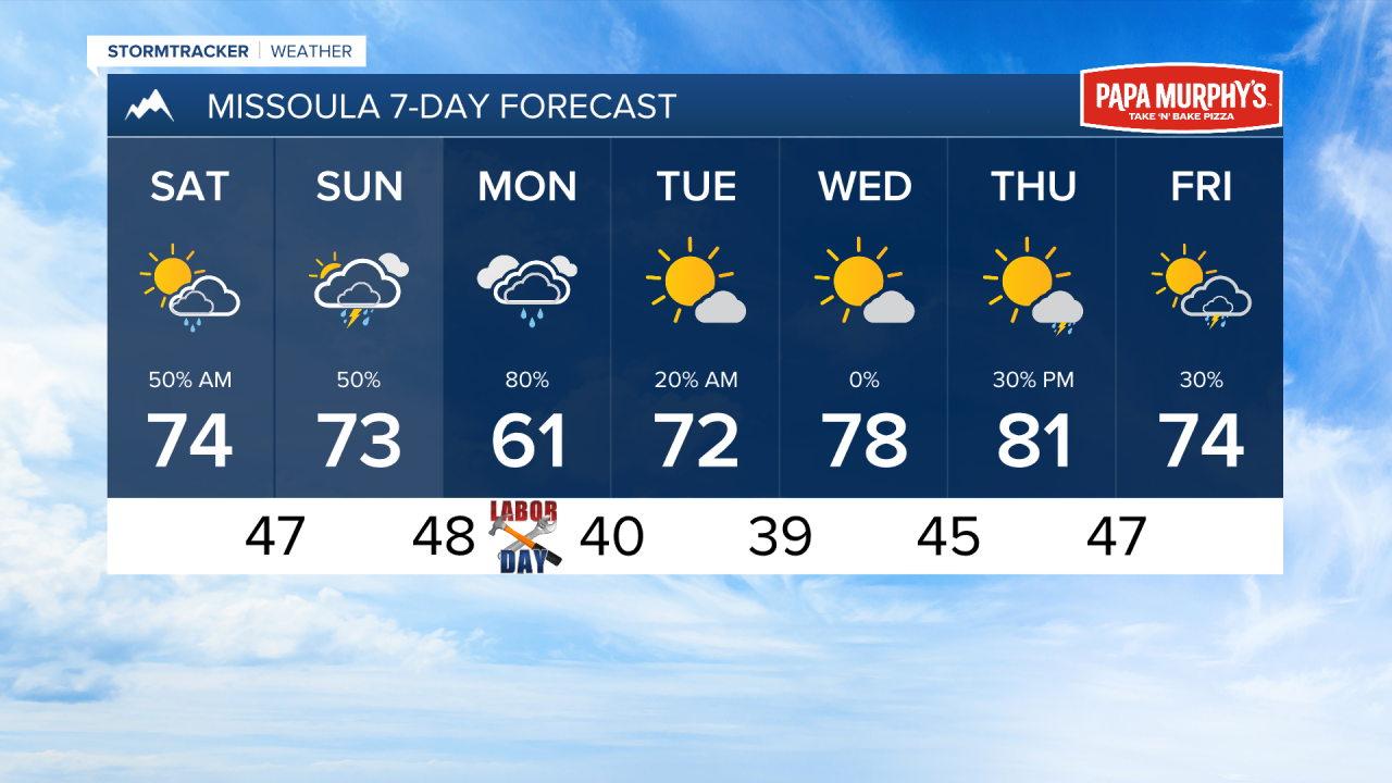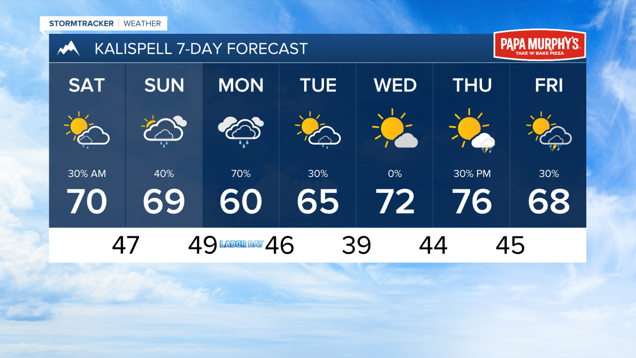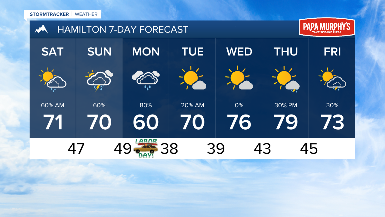


MISSOULA — Most locations in western Montana have recorded over a quarter of an inch of rain over the past few days. There is more wet weather in the forecast through Monday.
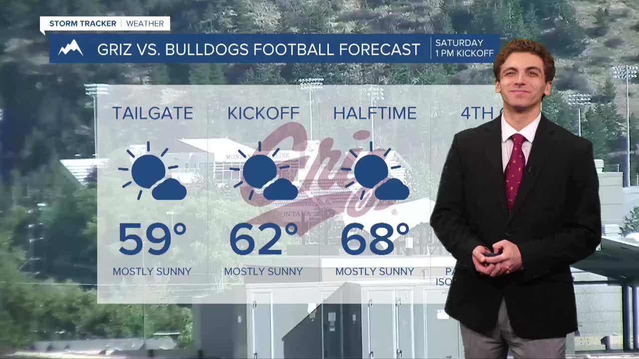
Another round of heavier showers moves into western Montana this evening lasting through early Saturday morning. We will actually have some sunshine through most of the late morning to early afternoon hours, just in time for the Griz to take on the Drake Bulldogs at home. A few thunderstorms may pass to our east Saturday in the mid to late afternoon hours.
Another round of heavier rain and thunderstorms moves in Sunday afternoon. This will convert into a widespread rain event on Labor Day. There is an opportunity for some places to pick up over an inch of precipitation with this event.
The stormy weather will move out Tuesday morning, allowing drier and warmer conditions to come back towards the middle of next week.
High temperatures will remain in the 60s and 70s through early next week. We will warm back into the 70s and low 80s by Wednesday and Thursday.
With rain continuing to fall. I expect very minimal, if any at all, wildfire smoke in our area.
——————————————————————————————————————————
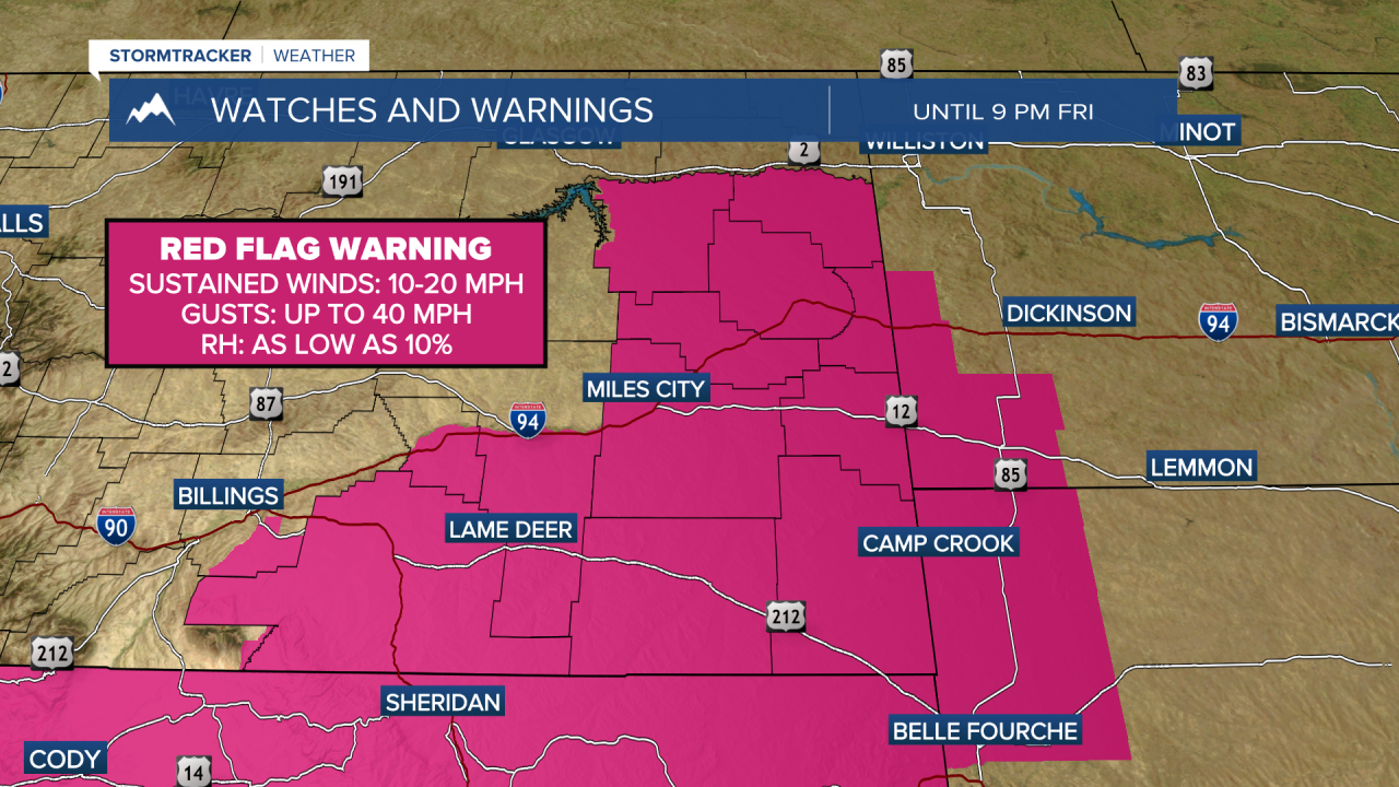
MONTANA WEATHER ALERTS:
——————————————————————————————————————————