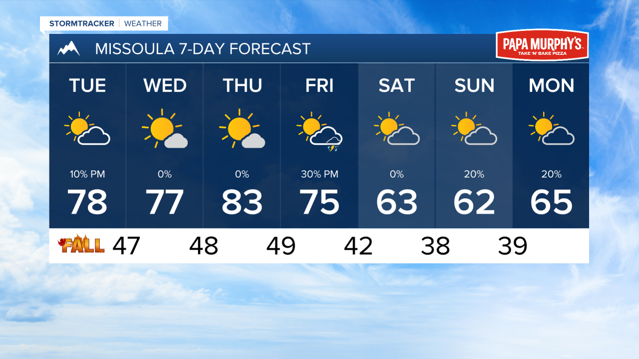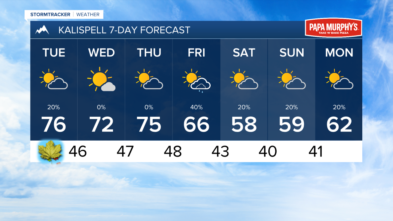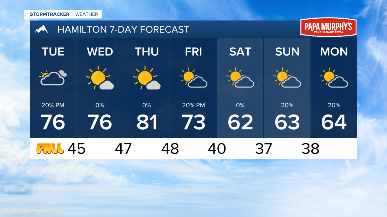


MISSOULA — Monday featured warm temperatures and clear skies. While the warmth will stick around, expected a bit more cloud cover for your Tuesday with the potential for a pop-up shower in the afternoon.
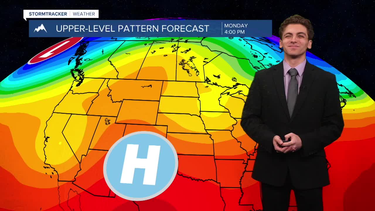
A ridge of high pressure will keep our weather pattern warm and predominately dry through Thursday. Highs will reach the 70s and 80s across the region.
By Friday, a cold front will begin to push through the region. This will not be a widespread rain. The highest chances for precipitation will be in northwest Montana. A little bit of wind will accompany the front's arrival on Friday afternoon.
Weekend weather will be much cooler with high temperatures only in the 50s and 60s. Overnight lows will dip to the 30s, creating favorable conditions for frost to develop.
——————————————————————————————————————————
MONTANA WEATHER ALERTS:
NONE
——————————————————————————————————————————