


MISSOULA — We're moving into a very active weather pattern today, with this lasting through the weekend.
Watch the forecast:
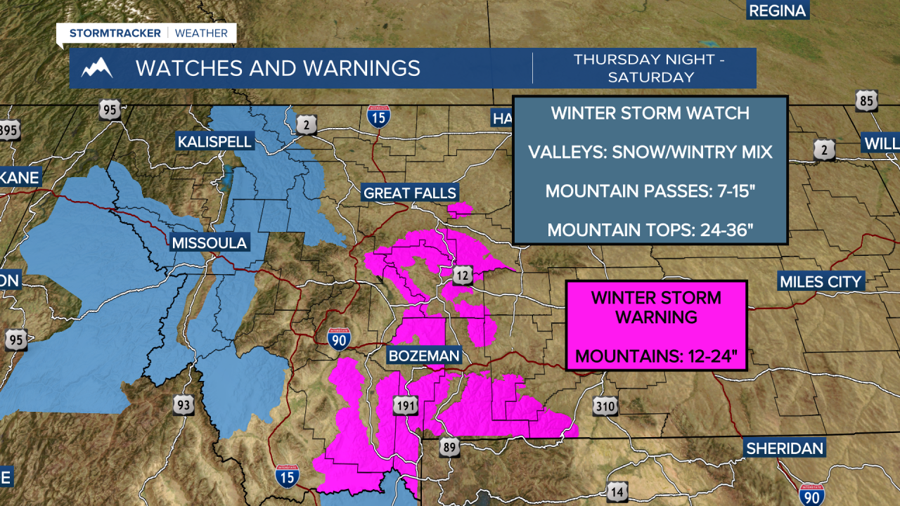
Valleys
Temperatures will be the key to initial precipitation. Snow or a rain and snow mix will start Thursday, with precipitation types going from snow, then rain, then rain/snow, then back to snow.
Thursday night into Friday morning, snow, rain and snow, freezing rain and sleet will be possible, leading to some icy driving conditions. Snow amounts of a trace to 2" will be possible for certain valleys that can remain cold Thursday into Friday morning.
Snow or a wintry mix will continue Friday into the weekend for all valley locations, with icy roads expected during the overnight hours.
Mountains
Precipitation in the mountains is more straight forward with heavy snow expected in the mountains through the weekend. For those with travel plans over mountain passes, be prepared for difficult travel along with slippery and snow covered roads.
Taking a quick look at next week, the mountains will continue to see snow; however, passes may begin to even see a rain/snow mix as warmer air moves in.
The valleys will primarily see precipitation fall as rain Monday and Tuesday with highs in the low to mid 40s.
Watch the 24/7 StormTracker Weather stream below:
