


MISSOULA — Scattered mountain valley rain/snow along with mountain snow continues today, only minor impacts are expected with highs in the low to mid 40s.
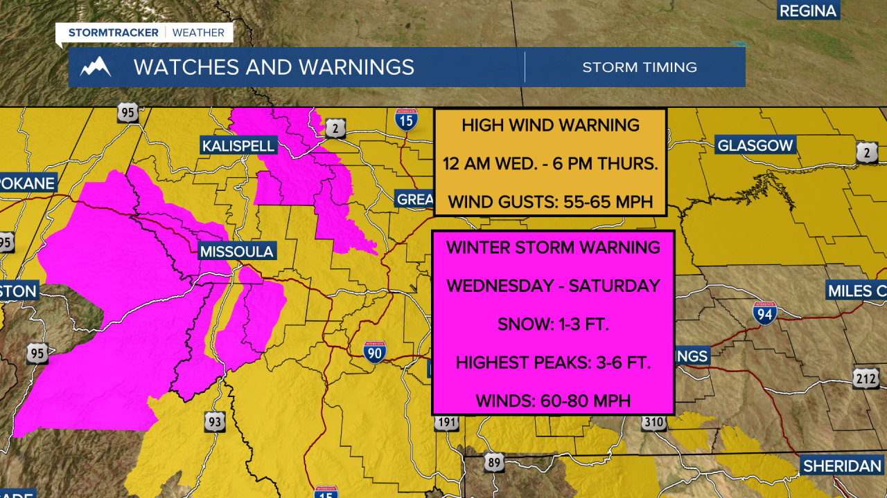
The first of a series of Pacific systems will move through tonight into Thursday morning bringing heavy mountain snow, valley rain/snow and strong winds. Wind gusts in the mountains during this time will be in the 50-70 mph range with 50-65 mph winds in the valleys. Downed trees and power outages will be likely during this time frame.
Watch Here:
After this our attention will shift to the heavy mountain snow. This will be a long duration event with snow not really coming to an end until Saturday. By this time snow amounts will be measured in feet for all mountain ranges. Factor the snow in with the winds, and very difficult back country conditions will set up with Blizzard conditions possible.
Taking a quick look at the long term forecast, by next week models show warmer air quickly returning with highs well into the 60s by Tuesday and Wednesday.
