

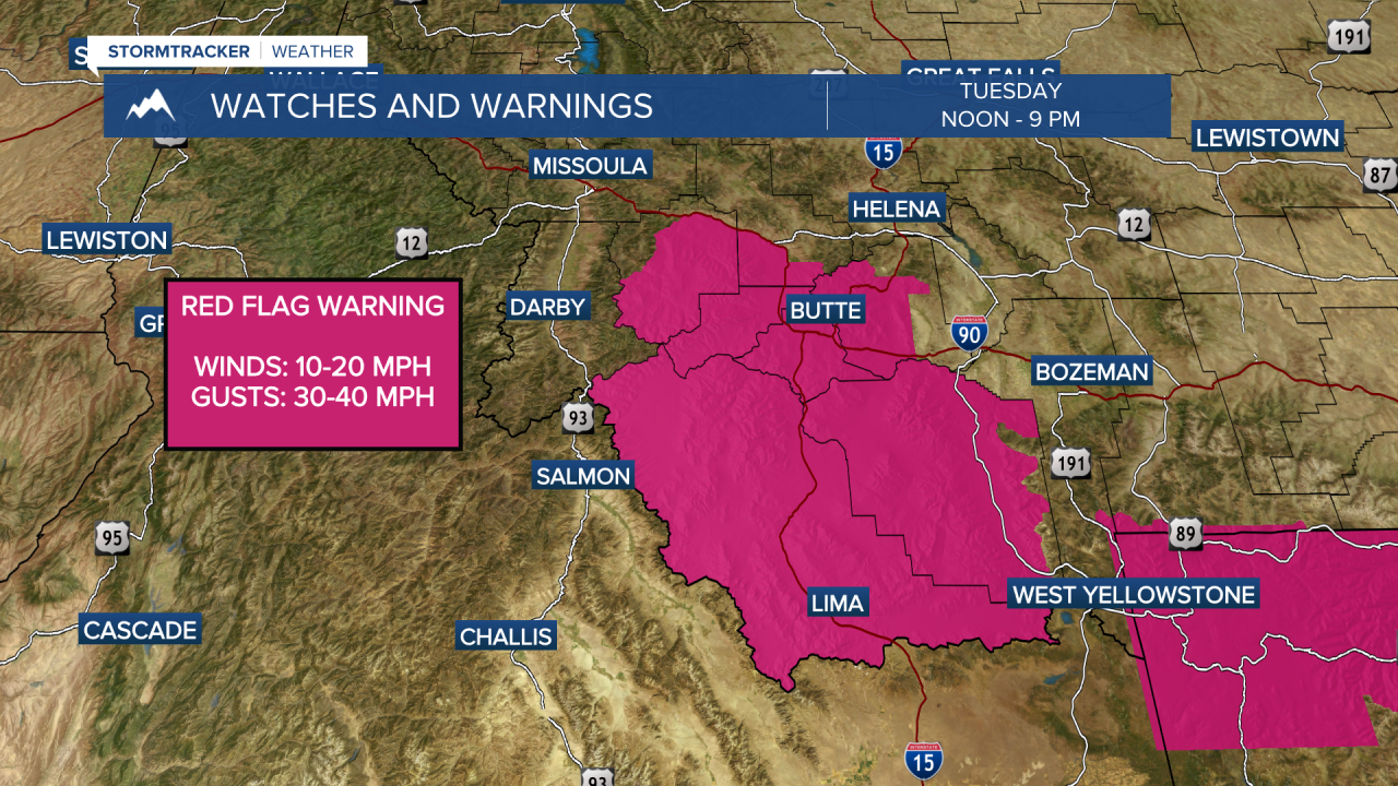


MISSOULA — Elevated fire danger again Tuesday with Red Flag Warnings issued for locations east of the divide in SW Montana. Breezy winds this afternoon with gusts between 30-40 mph in the warned area will allow fires to grow quickly under these conditions. Highs today top out again in the 80 and a few low 90s.
By Wednesday, cooler air will start to move in as a more active weather pattern sets up. Initially showers and storms will remain along the Montana/Canadian border Wednesday afternoon before sliding south by Thursday.
Highs will be in the low to mid 80s Wednesday then 70s to low 80s Thursday and Friday.
Taking a quick look at the weekend, expect some smoky and hazy skies with pleasant temperatures as highs top out in the upper 70s to low 80s. Isolated shower and thunderstorm activity continues this weekend primarily impacting locations south of I-90.
