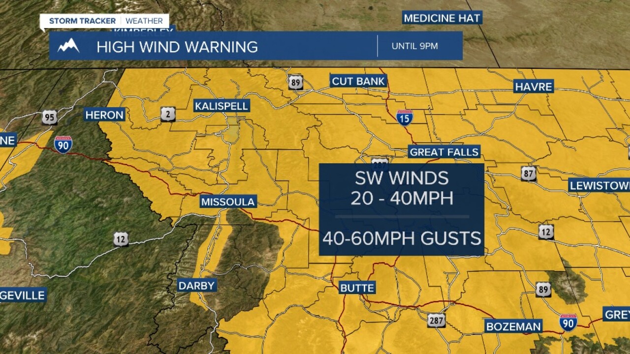


MISSOULA — Today’s big weather story was the remarkably strong wind as an intense Pacific system and cold front that blew through the Northern Rockies.
Widespread wind gusts of over 50 mph created several power outages and downed large trees that have fallen on numerous roadways impacting travel.
Snow showers have also developed behind the cold front which further impacted travel and visibility. The strong winds will persist through the mid-evening hours then gradually diminish through Thursday morning.
High Wind Warnings will continue for the Missoula and Bitterroot valleys and the West Glacier, Butte/Blackfoot, and Potomac/Seeley Lake regions until 9 p.m. Wednesday -- and until 6 p.m. for the Flathead and Mission valleys and the Lower Clark Fork Region.
Thursday is shaping up to be a gorgeous day with ample sunshine and highs in the mid-30s.
A weak disturbance looks to pop a few rain/snow showers on Friday with a mix of clouds and sun otherwise. Highs will be in the mid-30s to low 40s.
Right now, Saturday looks to be the nicer of the two weekend days as another system is expected Sunday into Monday.
