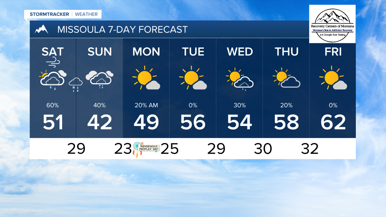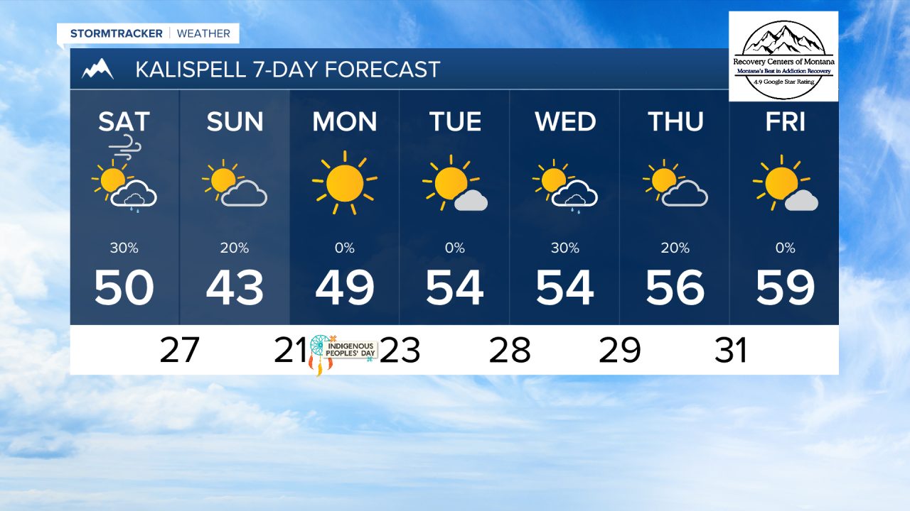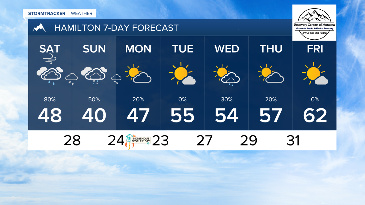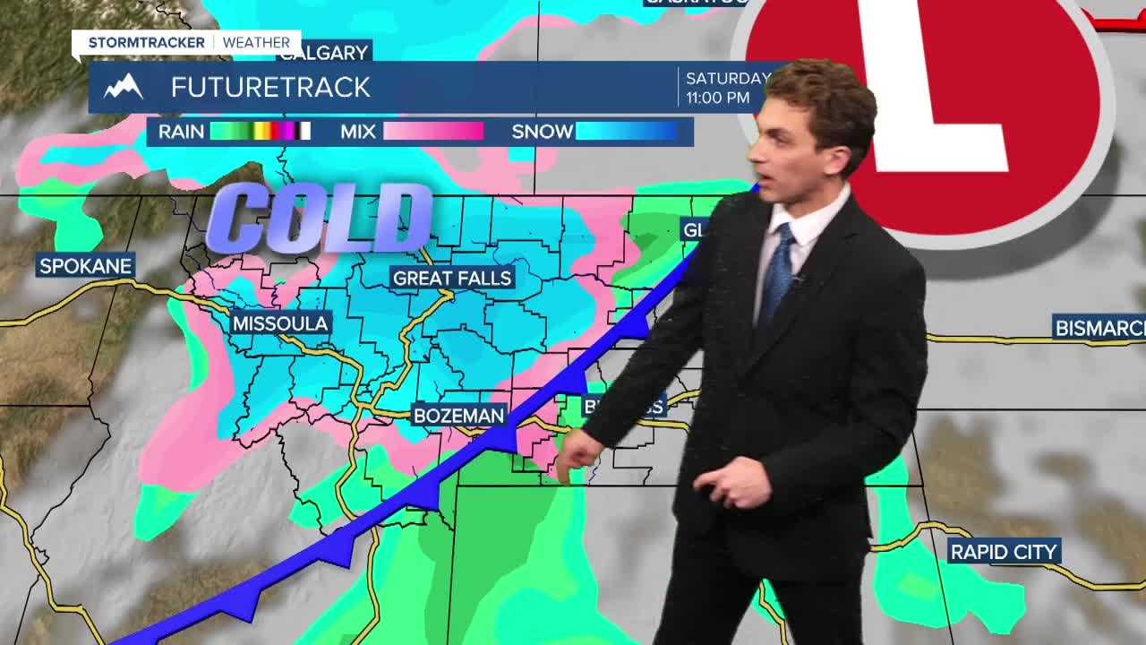


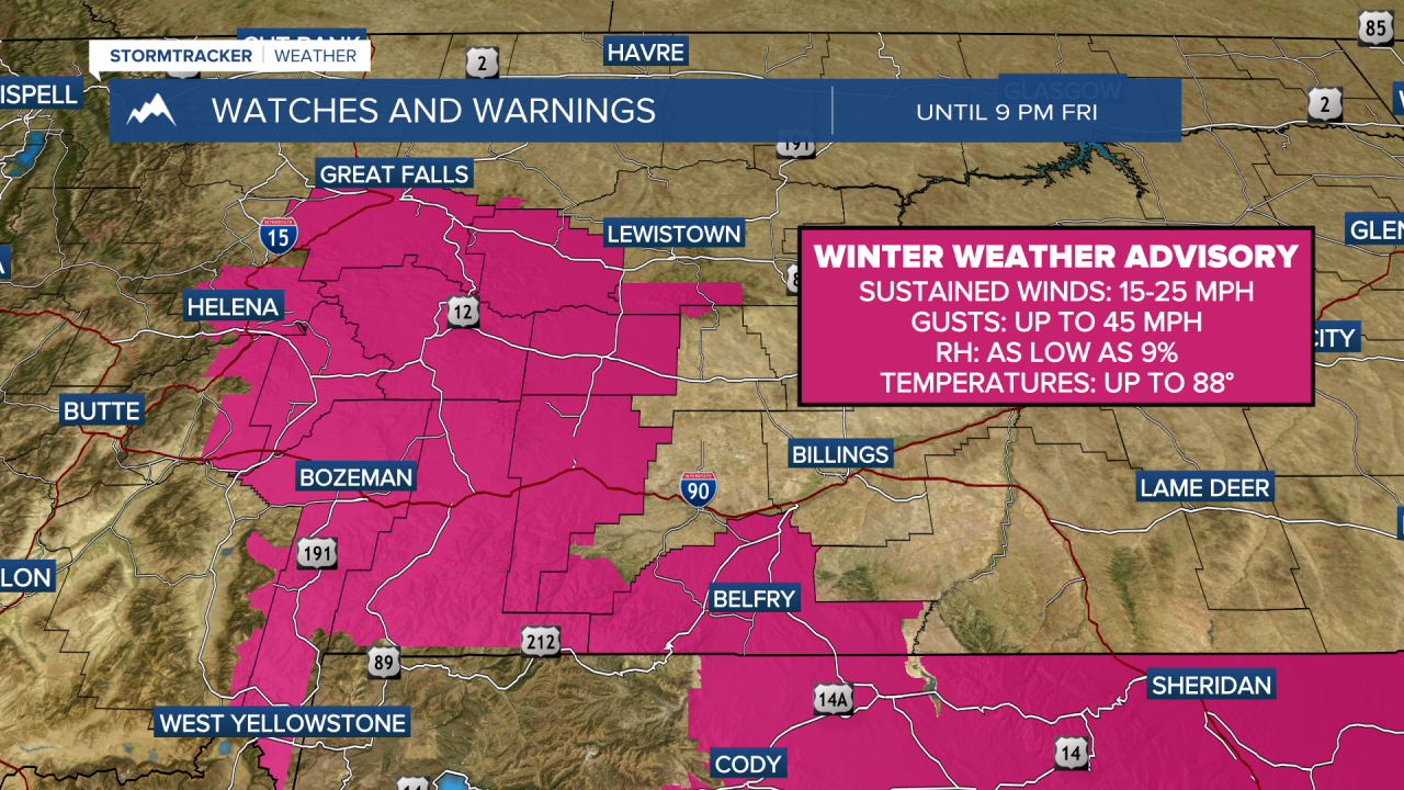
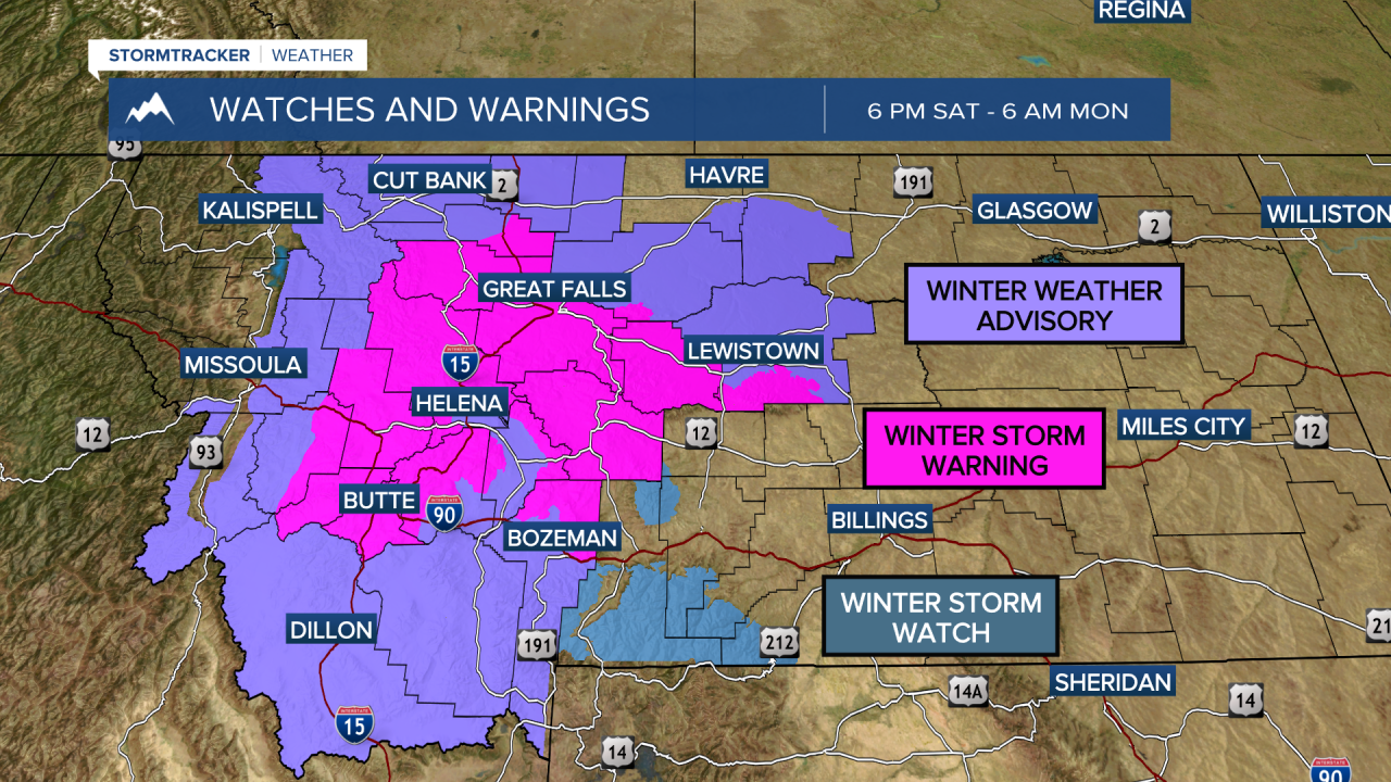
MISSOULA — Warm temperatures and gusty winds highlight our weather on Friday, but drastic changes are coming on Saturday after a cold front moves through the state. This will bring about a 30 to 40 degree temperature swing and some wet weather, including snow.
Overall, there are too many factors working against us in the lower elevations of western Montana to see any meaningful snow totals. Warm ground temps, high sun angle, and overall lack of precipitation coverage really limit what we can see here. I do think a transition over to some snow in areas south of Missoula is possible Saturday night into Sunday, it just will have trouble sticking.
We will, however, see some good early season totals for our mountains, with up to 9 inches possible in the high peaks of the Bitterroot and Sapphires.
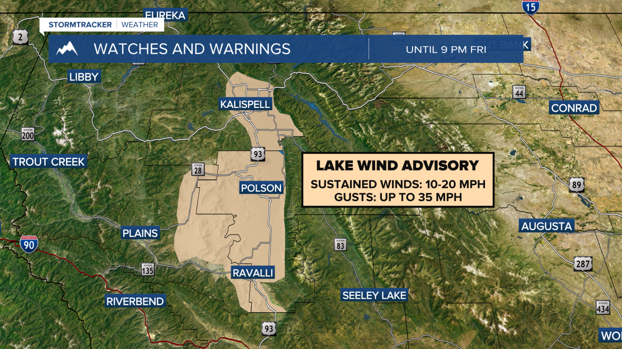
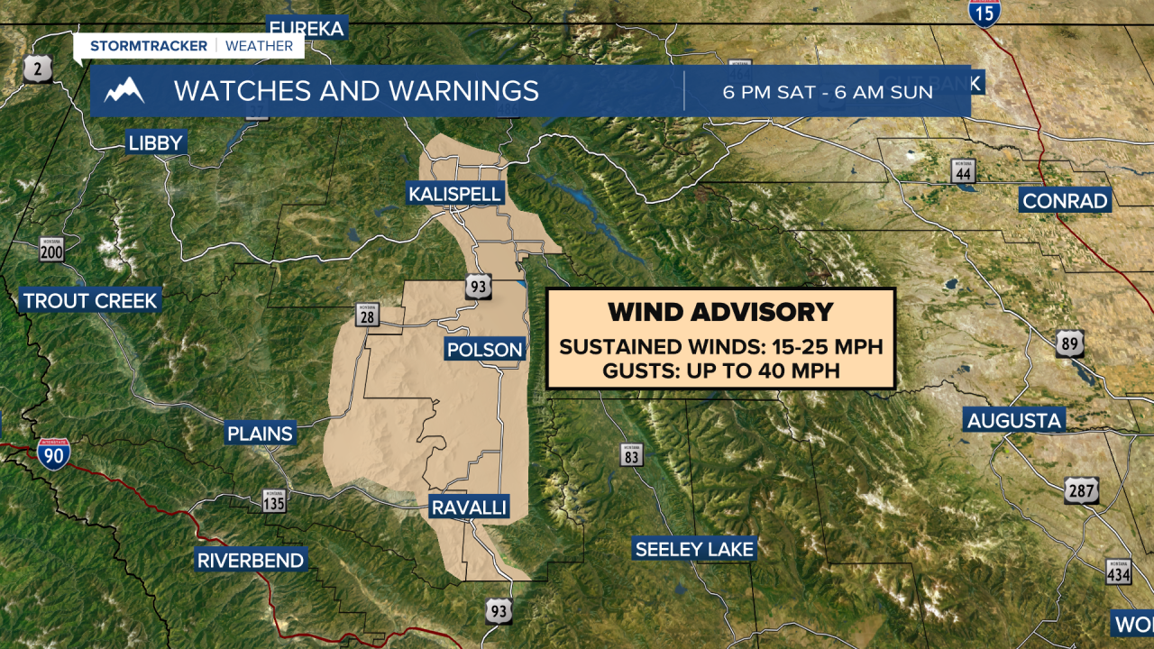
Gusty winds our of the north will develop in the Flathead and Mission Valleys on Saturday night, with maximum gust reaching 40 MPH. This will bring chopping conditions to Flathead Lake. This wind could reach the Missoula area late in the night as well.
Expects most mountains passes to be slick and slushy through the weekend.
This system moves out of our area on Sunday night. A hard freeze is likely by Monday morning with lows dipping well into the 20s, so be sure to prepare your pipes and care for the plants as soon as possible.
——————————————————————————————————————————
MONTANA WEATHER ALERTS:
——————————————————————————————————————————