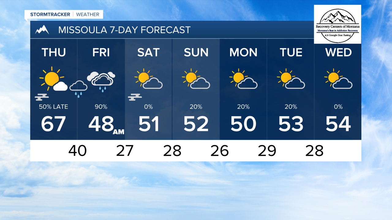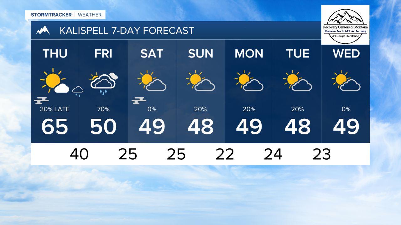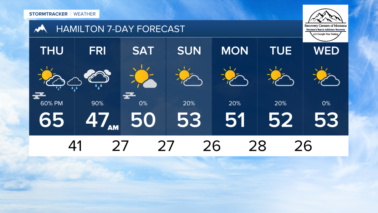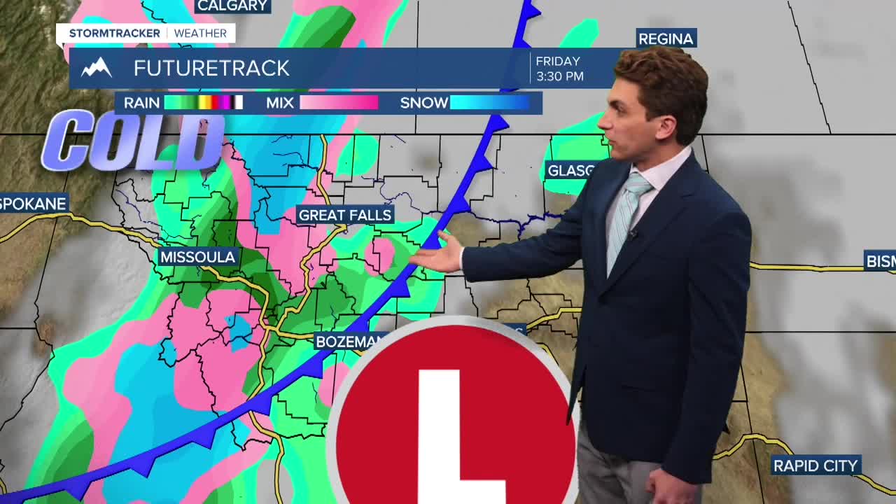


MISSOULA — Most of Thursday should be nice and sunny, with high temperatures in the 60s once again. A low pressure system to from the southwest and a cold front from the northwest will move into Montana Thursday night into Friday. This will produce widespread rain and high mountain snow.
Forecast models seem to be running a bit bullish on precipitation totals in western Montana at this time. I'd say a realistic expectation for rain totals should be around 0.1" to 0.5" through northwest Montana, and 0.25" to 0.75" in the Missoula and Bitterroot Valleys.
Our mountains here in western Montana could see up to 4 inches of wet snow. Snow levels are only expected to drop to about 5000 feet, so noticeable accumulation will only be in the higher peaks.
Winter weather impacts should be minimal with this storm, except for over the higher elevation mountain passes.
This system will be out by Saturday afternoon, leaving us with much cooler and drier weather for the weekend.
Forecast models are still varying greatly after this storm moves out. Some are trying to bring in more rain and snow shower early next week, while others are completely dry. We will continue to watch this and see what solution is favored in the days ahead.
——————————————————————————————————————————
MONTANA WEATHER ALERTS:
NONE
——————————————————————————————————————————