HAMILTON – The Bitterroot National Forest is planning to implement several prescribed burning projects.
Fire crews will conduct the prescribed burns to reduce forest fuels, improve conditions within the Wildland Urban Interface, and restore characteristics of a fire-adapted ecosystem.
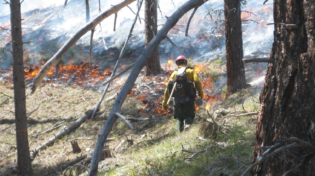
All total, fire managers plan to burn approximately 3,400 acres this spring. Smoke from the burns will likely be visible from West Fork Highway, East Fork Road, or Highway 93.
Darby/Sula Ranger District – 2,050 acres are planned:
- Waddell Units, south of Lake Como
- Como/Horse Lick, south of Lost Horse and north of Lake Como
- Trapper Bunkhouse, SW of Darby between Little Tin Cup & McCoy Creeks
- Cameron Blue and Middle East Fork, along East Fork road between Guide Creek and Tolan Ridge
West Fork Ranger District – 900 acres are planned:
- Lower West Fork Units, south of Trapper Creek and north of Lloyd Creek
- School Point Ecoburn Units, west of Ward Creek and east of Halford Creek
- Soda Springs Ecoburn, east of Little West Fork and west of Halford Creek along Forest Road 5633B
- West Fork Horse Pasture, north of the confluence of the Nez Perce Fork and West Fork Rivers at Lone Pine Helibase
Stevensville Ranger District – 450 acres are planned:
- Larry Bass Units, within the Bass Creek Recreation Area north of Stevensville.
- Sweeney Creek Units, west of Florence
The burns will only be ignited if operational safety, fuel moisture, weather conditions, and air quality parameters can be attained.
Fire crews will monitor all burns after ignition to ensure that they stay within prescribed boundaries until declared out.
Major roads in the area will be signed and local residents who have requested prior notification will be contacted in advance of burning.
Spring prescribed fire activities normally take place in April and May and burning is highly weather dependent. A mosaic pattern of burned and unburned areas will remain after treatments.
The public is also asked to avoid traveling in prescribed burn units while crews are present, as well as trails and roads directly adjacent to the units.
For more information about specific burns or to be placed on a pre-burning notification list, please contact your local ranger district. Click here for burn updates, maps, and photos of project areas.
