

For the last couple of days, our main weather story has been the cold... now we're going to throw in a little snow to go along with it.

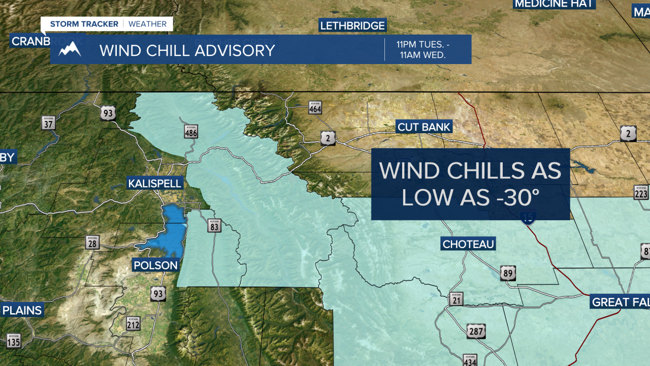
A quick moving disturbance will move from NW to SE overnight into Wednesday morning with anywhere from 1"-5" for valley locations (the higher amounts most likely for west central Montana) and 3"-8" at pass level. Breezy conditions will also accompany the snow, so blowing snow with reduced visibilities is very likely... that and dangerously low wind chill values. A Wind Chill Advisory has been issued for the West Glacier Region where values could approach -30.
Expect some sunshine here and there for northwest Montana as Wednesday progresses; maybe a couple peeks for southwest Montana before sunset. Highs will range from the mid teens to mid 20s Wednesday with lows in the single digits above and below zero for Thursday morning.
After a brief lull Wednesday night into early Thursday morning, it looks like another disturbance will continue our chance for light to even moderate snowfall on Thursday with similar highs.
We should see a break in the active weather arriving Friday into the weekend with a mix of clouds and sun, highs generally in the 20s and lows in the single digits and teens.
