


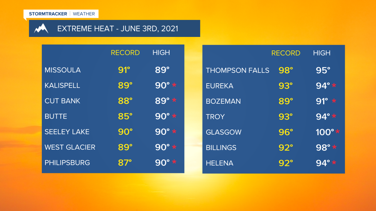
After a scorching day (for early June standards) with numerous record highs tied or broken across the state, we’ll see our recent dominating ridge of high pressure begin to shift east.
With that, a few thunderstorms will continue to develop overnight Thursday. The main threats will be brief, heavy rain, small hail and perhaps strong winds.
Friday will feature a pretty dry cold front moving through western Montana with breezy conditions at times. We’ll see isolated showers/thunderstorms, but that threat will really remain east of the Divide. Highs will be a little cooler with readings in the upper 70s to mid 80s and mostly sunny skies.

The weekend is looking dry and breezy with mainly sunny and seasonal temps in the upper 60s to mid 70s. Saturday will be a windy day with west wind gusts up to 20-30mph at times.
