

Our system will slowly wind down as we head into the overnight hours from NW to SE.
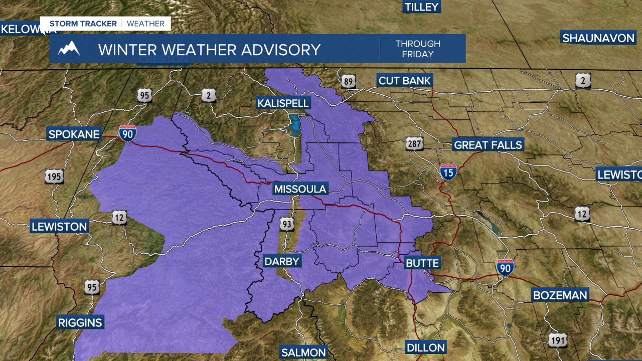
Winter Weather Advisories are still in place through 8pm for the Lower Clark Fork Region and the Bitterroot/Sapphire Mountains, through 11pm for the West Glacier & Potomac/Seeley Lake Region and through 5am Saturday for the Butte/Blackfoot Region.
Patchy fog is likely Saturday morning - especially where clouds begin to clear out sooner. Visibility may be reduced to 1/4 mile or less locally. Pockets of freezing drizzle could also accompany the fog which looks most likely across NW Montana and along the Divide. If you have travel plans, consider leaving some extra time & be prepared for changeable road conditions.
Otherwise, expect some clouds to start and partly cloudy skies by late Saturday. We’ll see breezy conditions during the afternoon with highs in the upper 30s to low 40s.

High pressure takes over for Sunday and Monday with more sun than clouds and highs in the 40s to even low 50s (for Monday).
Active weather looks to return by midweek however the associated disturbances look to be on the weaker side… still, we’ll keep you posted here in the StormTracker Weather Center.
