
A strong ridge of high pressure over the northern Rockies remains the dominate weather feature allowing for sunny, dry and hot conditions!
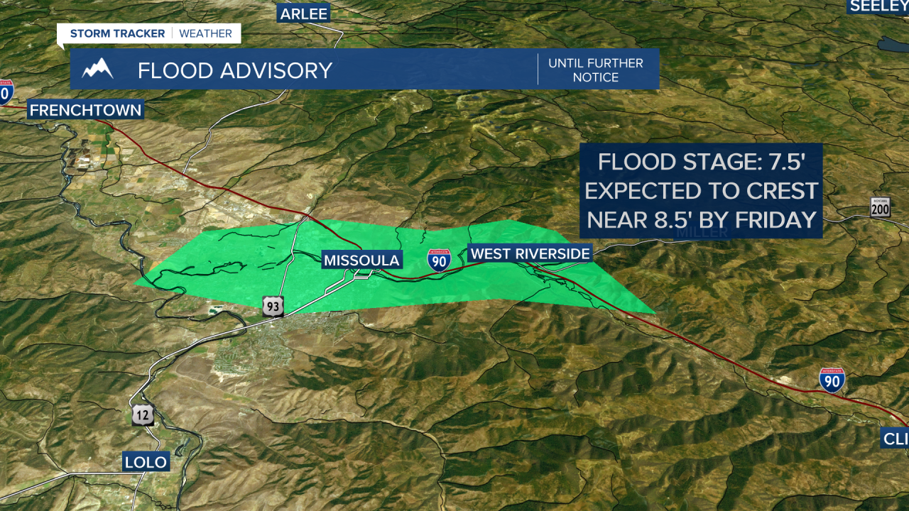
Of course, our rivers, creeks & streams continue to run high, fast & cold. Please use caution if recreating around waterways.
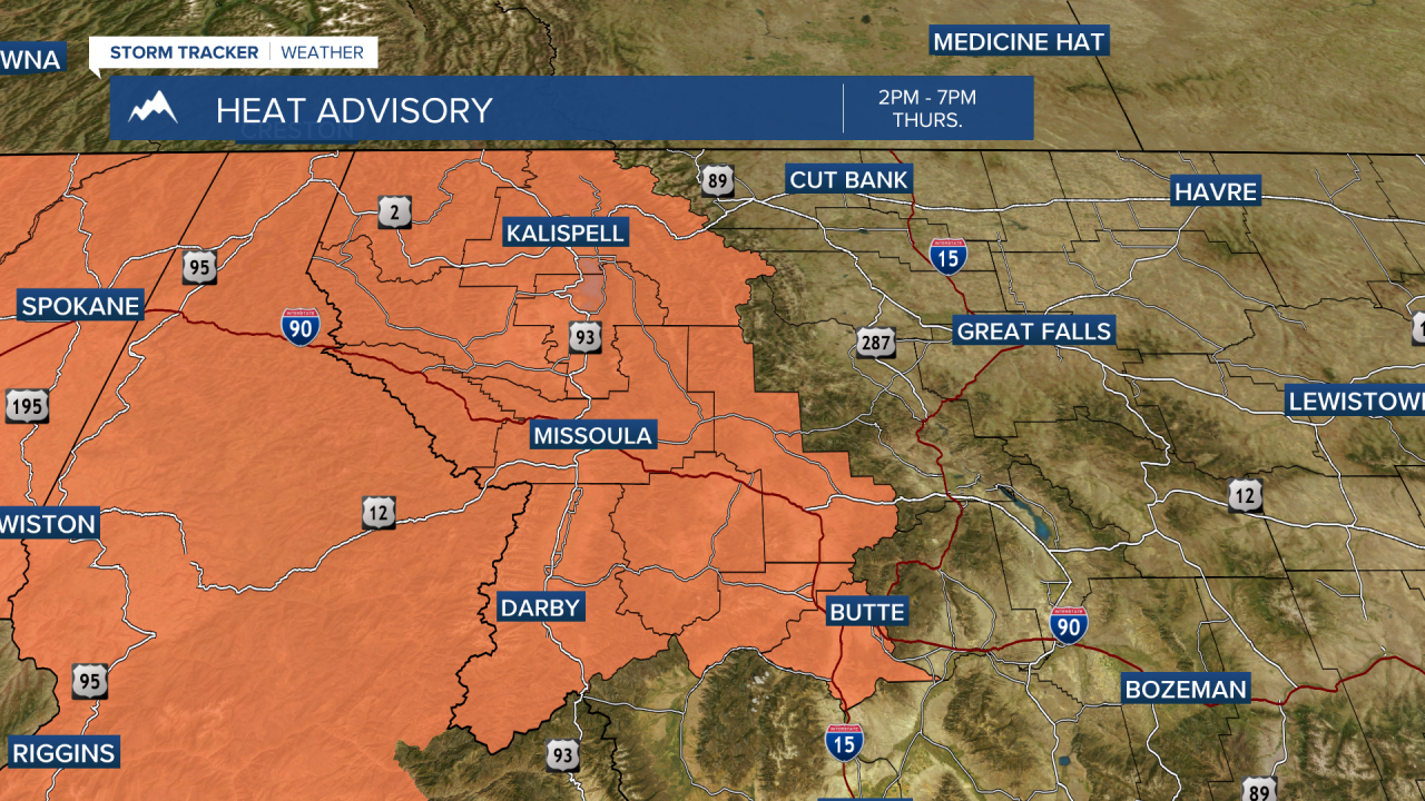
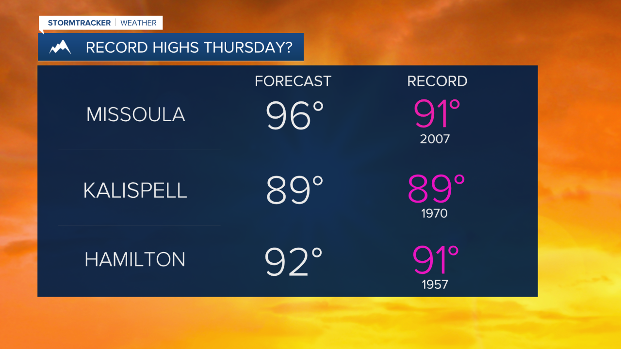
Highs Thursday will be the hottest they’ve been so far this year and very likely in record high territory (90s). A Heat Advisory is in place from 2pm - 7pm. Drink plenty of fluids, stay in an air-conditioned room, stay out of the sun & check up on relatives & neighbors. Young children & pets should never be left unattended in vehicles under any circumstances.
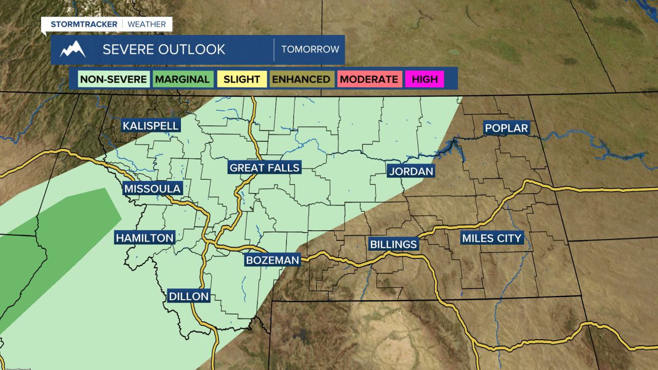
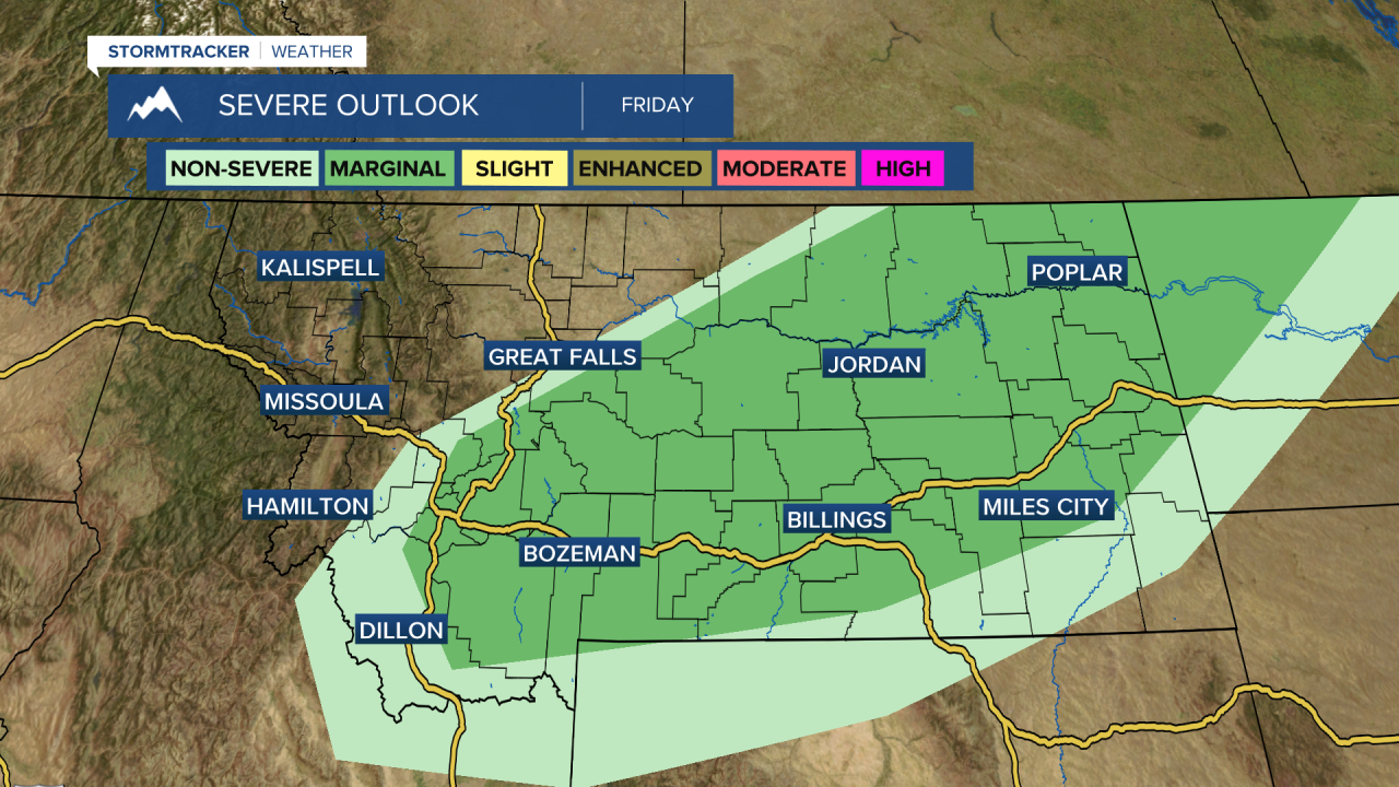
As our ridge begins to shift east, a south to southwesterly flow will develop and usher in a little instability. This will set the stage for isolated thunderstorm development Thursday afternoon and evening. Some of these storms could last into the overnight hours, but most activity will die down after sunset.
More of the same is expected Friday with highs well into the 80s.
The weekend is looking warm and mainly dry with temps around average (upper 60s to mid 70s).
Next best bet for moisture looks to show up early next week, but overall, not an impressive chance.
