


MISSOULA - Little growth has been seen at a wildfire east of Missoula in the Rock Creek area.
The blaze has now burned 434 acres, according to the Tuesday update.
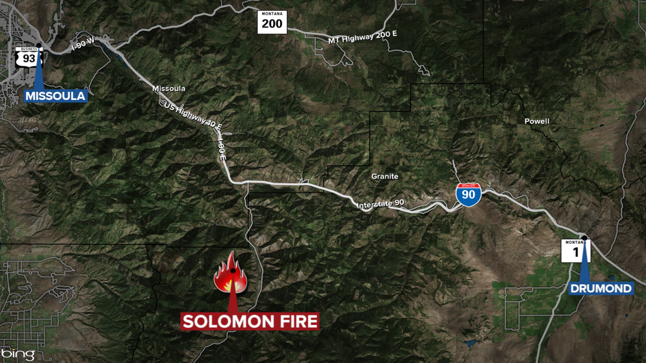
The lightning-caused Solomon Fire is burning in the Welcome Creek Wilderness approximately six miles south of the Rock Creek exit off Interstate 90.
It is near Solomon Mountain in upper Solomon Creek, two miles southwest of the Spring Creek Trailhead.
MTN News
Fire managers report the fire continues to show moderate fire behavior, primarily on the eastern and the northern flanks of the fire.
Cooler weather and higher humidity are expected to moderate fire behavior.
Emergency trail closures are in place for public safety:
- Solomon Ridge Trail #142, from milepost 0.0 at Solomon Ridge Trailhead to milepost 4.2 at its junction with Trail #232.
- Welcome-Sawmill Saddle Trail #232, from milepost 0.0 at its junction with Trail #142 to milepost 5.4.
- Sawmill Ridge Trail #178, from milepost 0.0 at Sawmill Fishing Access to milepost 6.4 at its junction with Trail #232.
- Welcome Mountain Trailhead
No structures or infrastructure are threatened at this time.
