


GREAT FALLS - Broadcast meteorologists work alongside NOAA's Storm Prediction Center (SPC) in Norman, Oklahoma to communicate a consistent message regarding severe weather threats year-round.
The Center releases daily convective outlooks highlighting the areas with the greatest potential for severe thunderstorms.
The outlook includes five categories: marginal, slight, enhanced, moderate and high. The main threats in a marginal and slight risk are hail and strong wind gusts - although it is not unheard of for tornadoes and damage to occur in these categories.
Thus, it is vital to take some level of precaution regardless of the category. Central Montana rarely exceeds these risk thresholds. Every now and then eastern Montana is placed under an enhanced or moderate risk.
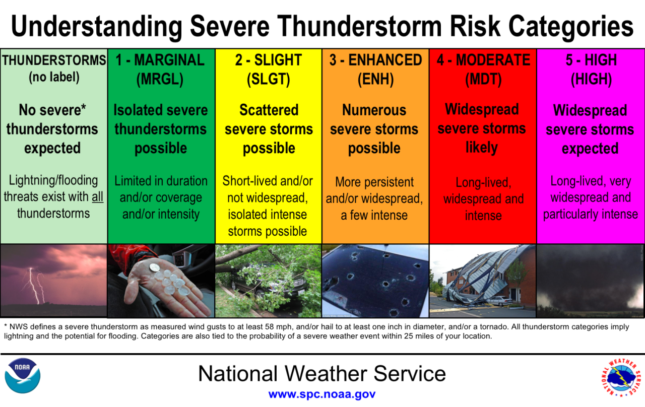
Numerous to widespread thunderstorms are likely in areas with enhanced and moderate risks, along with the potential for damaging tornadoes. The SPC rarely issues a high risk but it would generally indicate the possibility of powerful tornadoes or destructive straight-line winds.
Last year, the National Weather Service introduced damage tags in the warnings pinged to smartphones. These damage tags are an effort to identify the urgency of potentially damaging, non-tornadic thunderstorms. Straight-line winds are capable of producing just as much, if not more, damage than tornadoes.
A base severe thunderstorm warning threatens 58 mph or greater wind gusts or an inch or greater in diameter hailstones. A considerable thunderstorm contains wind gusts over 70 MPH and golf ball sized hail. The most dangerous, destructive thunderstorms have the potential of 80 MPH or greater wind gusts or baseball sized hail.
Keep in mind, lightning is prevalent in all thunderstorms — severe or not.
