


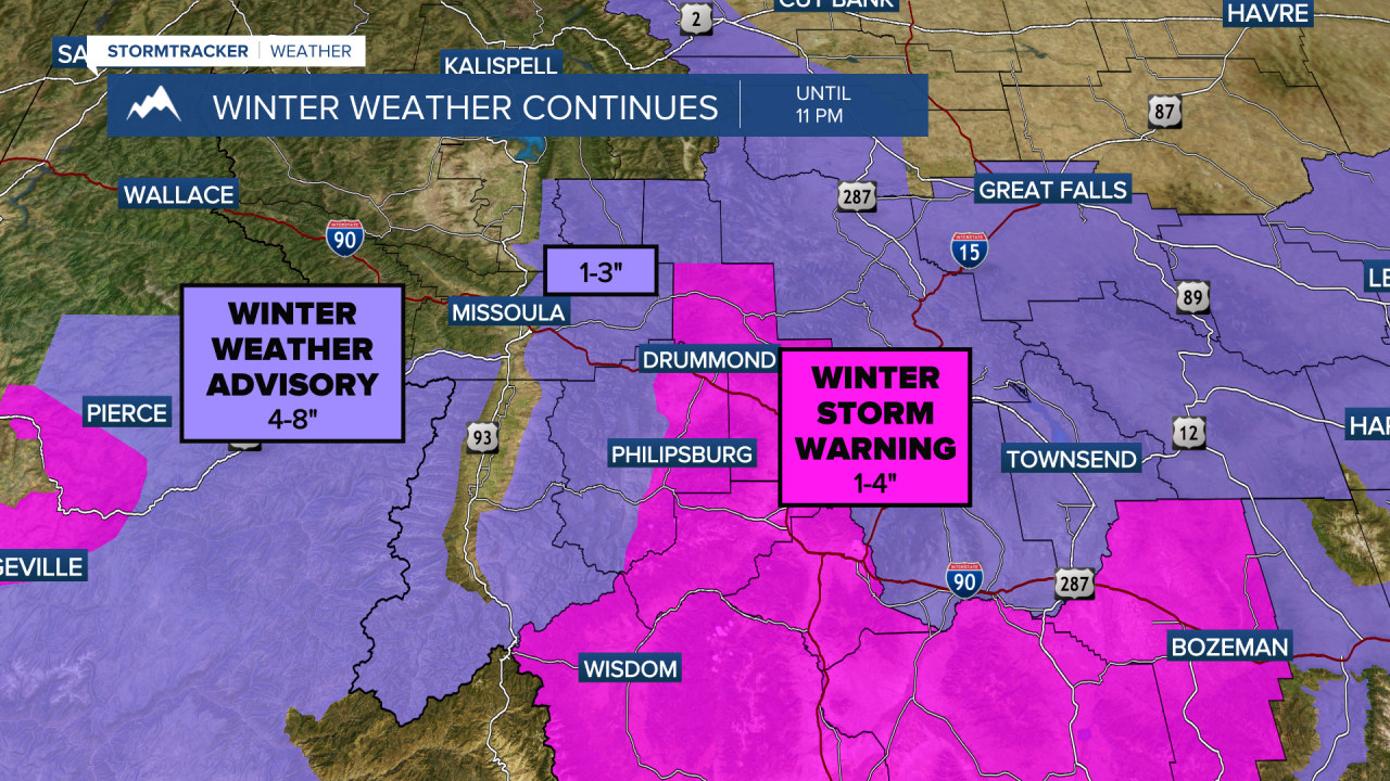
MISSOULA — Winter Storm Warnings and Winter Weather Advisories are in place until 11 PM Tuesday night due to moderate to heavy snow accumulation and slush turning to ice on roadways.
There will be MANY slick spots late Tuesday night into Wednesday morning, even as snow moves out.
Temperatures will drop quickly after sunset, so road conditions will likely change quickly.
A cold front is bringing this MUCH cooler air to our forecast.
Lows will be some of the coldest of the season in Western Montana.
Monday night into Tuesday morning, temperatures in valleys will drop to the teens.
Higher elevation valleys will likely see single digits as lows especially in west-central and southwest Montana.
Partly cloudy skies will fill in over Western Montana Wednesday, but highs will only creep to the 20s.
More snow arrives to our cooler atmosphere early (before we wake up) Thursday morning.
Thursday’s commute will be slick.
Snow continues to fall at all elevations Thursday before drying up Friday.
For the latest look at roads and passes visit our StormTracker 24/7 stream here.
The latest road conditions from the Montana Department of Transportation can be found here.
