


MISSOULA — Changes to our forecast are just around the corner.
Highs this weekend start dropping to the 30s.
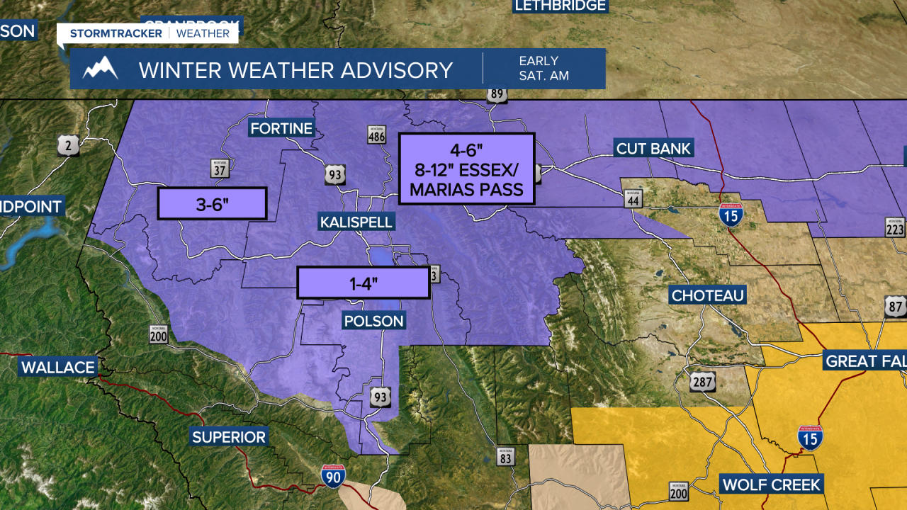
Moisture moves in early Saturday morning (we are talking 2-3 AM) and will mix with colder temperatures allowing snow to fall to valley floors.
Parts of the northwest corner are under a Winter Weather Advisory Saturday morning.
Rain will fall across West-Central and Southwest valleys during Saturday afternoon and evening.
It will also be a very windy Saturday.
The Missoula and Bitterroot valleys are under a Wind Advisory Saturday with gusts up to 45 MPH expected.
Butte, Philipsburg, and Georgetown Lake will see gusts up to 50 MPH, and snow will be blowing and drifting in these higher elevations.

Visibility will be limited especially on passes Saturday from blowing and drifting snow.
Sunday we still cool off into the mid to low 30s, but moisture makes a comeback late Sunday night into Monday.
Monday through Wednesday of next week will be very active with snow falling at all elevations.
We are still watching for significant amounts of snow possible in mountains during this early week period and will keep you updated!
Follow all the updates for winter weather driving here:
