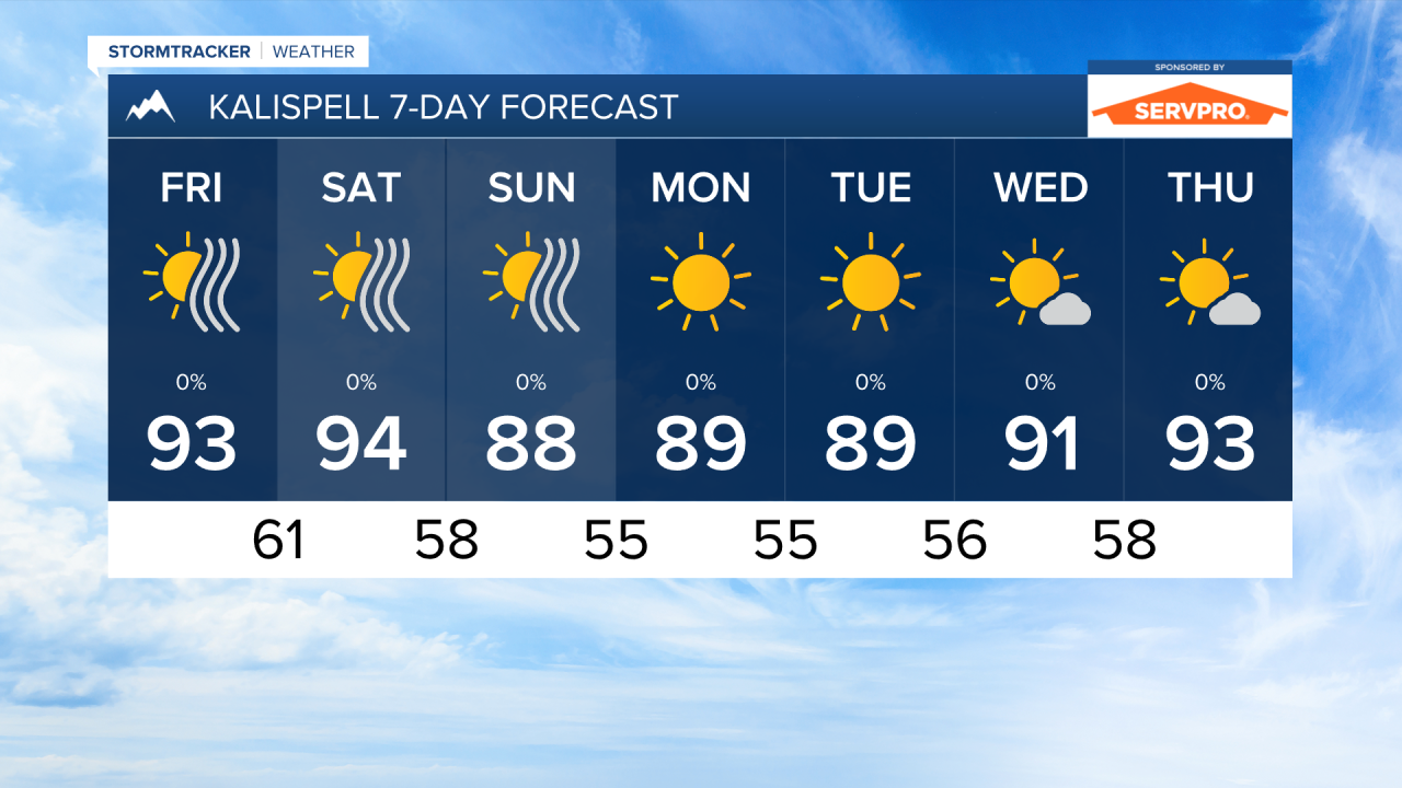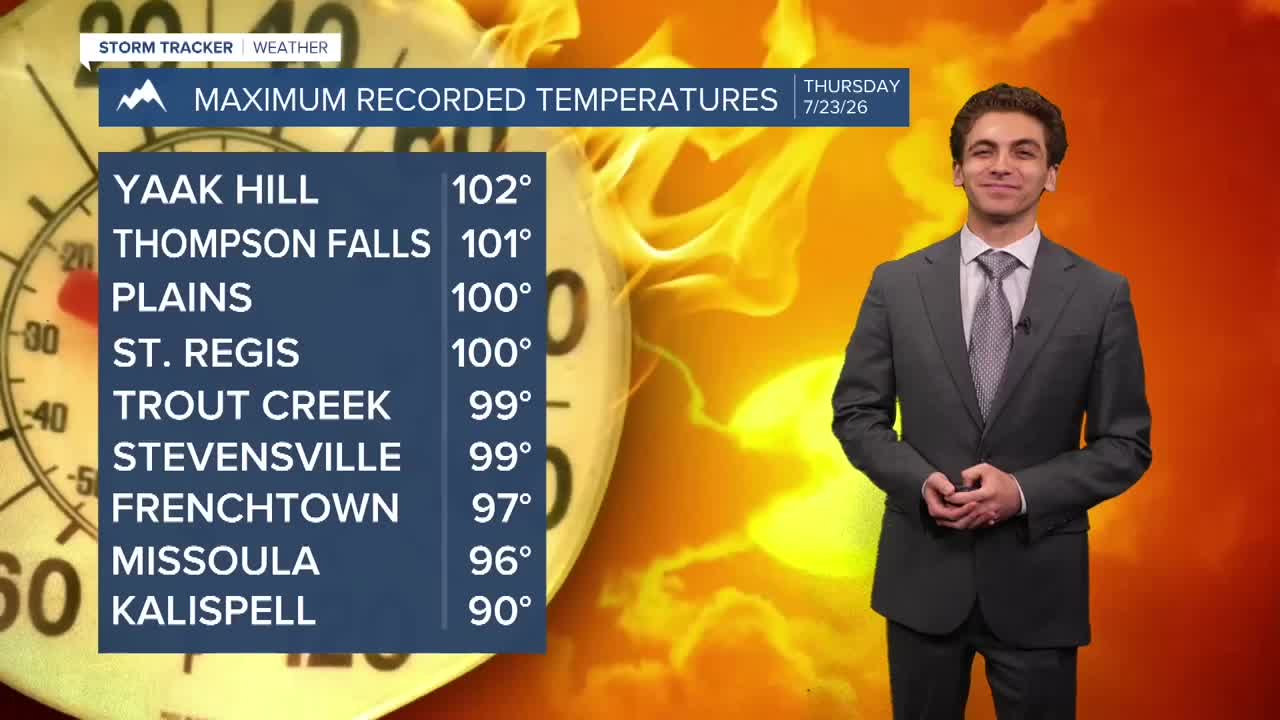


MISSOULA — Temperatures have reached the mid to upper 90s in most locations in western Montana this afternoon. A few places, like Thompson Falls, Plains, and St. Regis have hit 100° already. We are forecasting upper 90s and low 100s highs over the next couple of days. We will continue to see these hot temperatures stick around through Saturday afternoon.
Expect high temperatures to drop about 5 to 10° by Sunday, but we will still remain above the normal highs for this time of year.
Isolated thunderstorms are possible early this evening. But once they come through, that will be our last shot at rain for quite a while. Likely through the rest of the month we will remain dry.
Smoke has impacted air quality today, especially in northwest Montana. We will continue to see hazy conditions sticking around over the next few days with southwest flow aloft transporting smoke from Washington and Oregon.
We will be on fire watch in our own state as well, as the fire danger turns to near critical with drier air having moved in, along with some afternoon wind gusts approaching 20-30 MPH on Friday and Saturday.
——————————————————————————————————————————
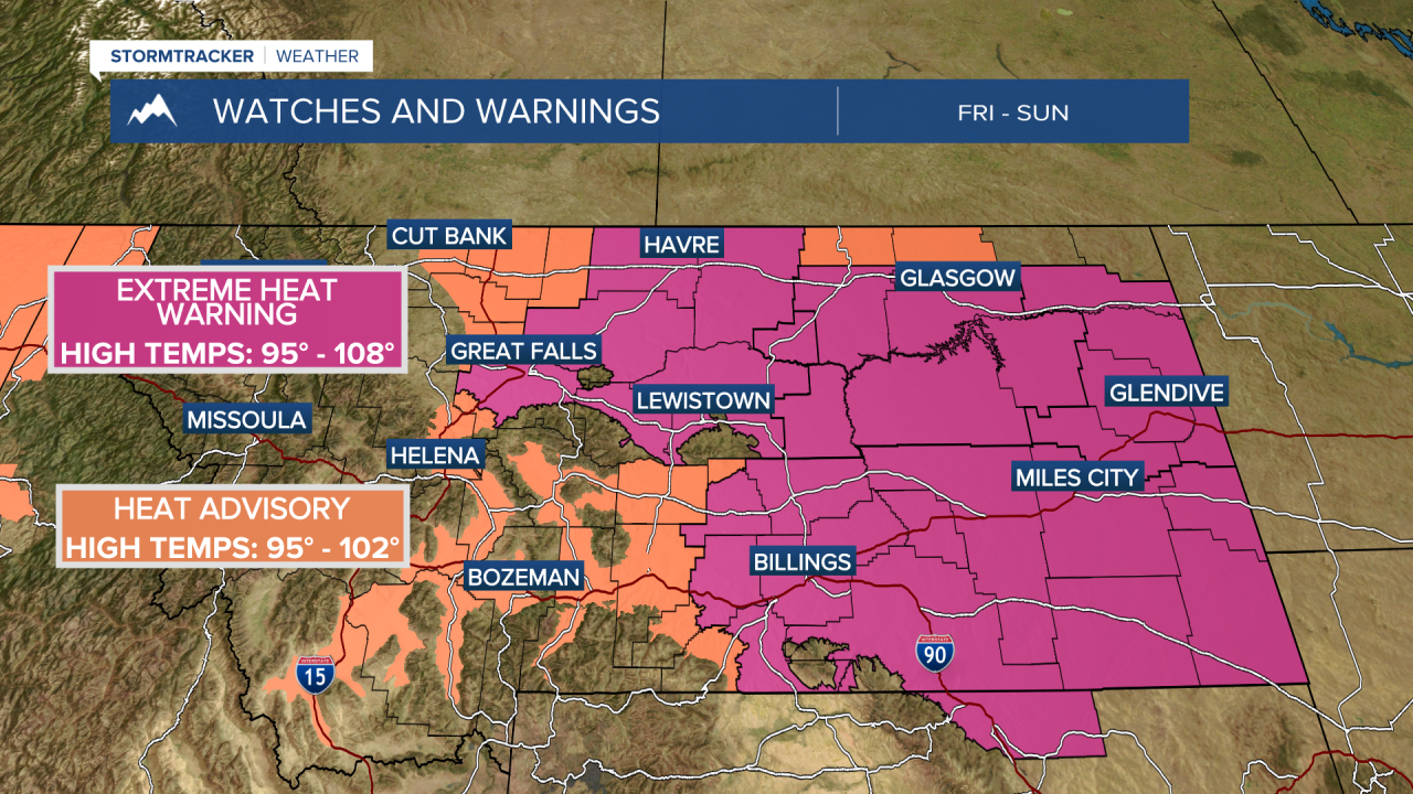
MONTANA WEATHER ALERTS:

——————————————————————————————————————————