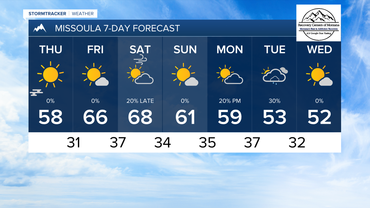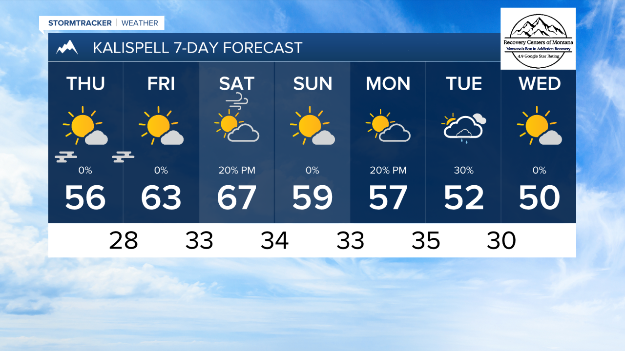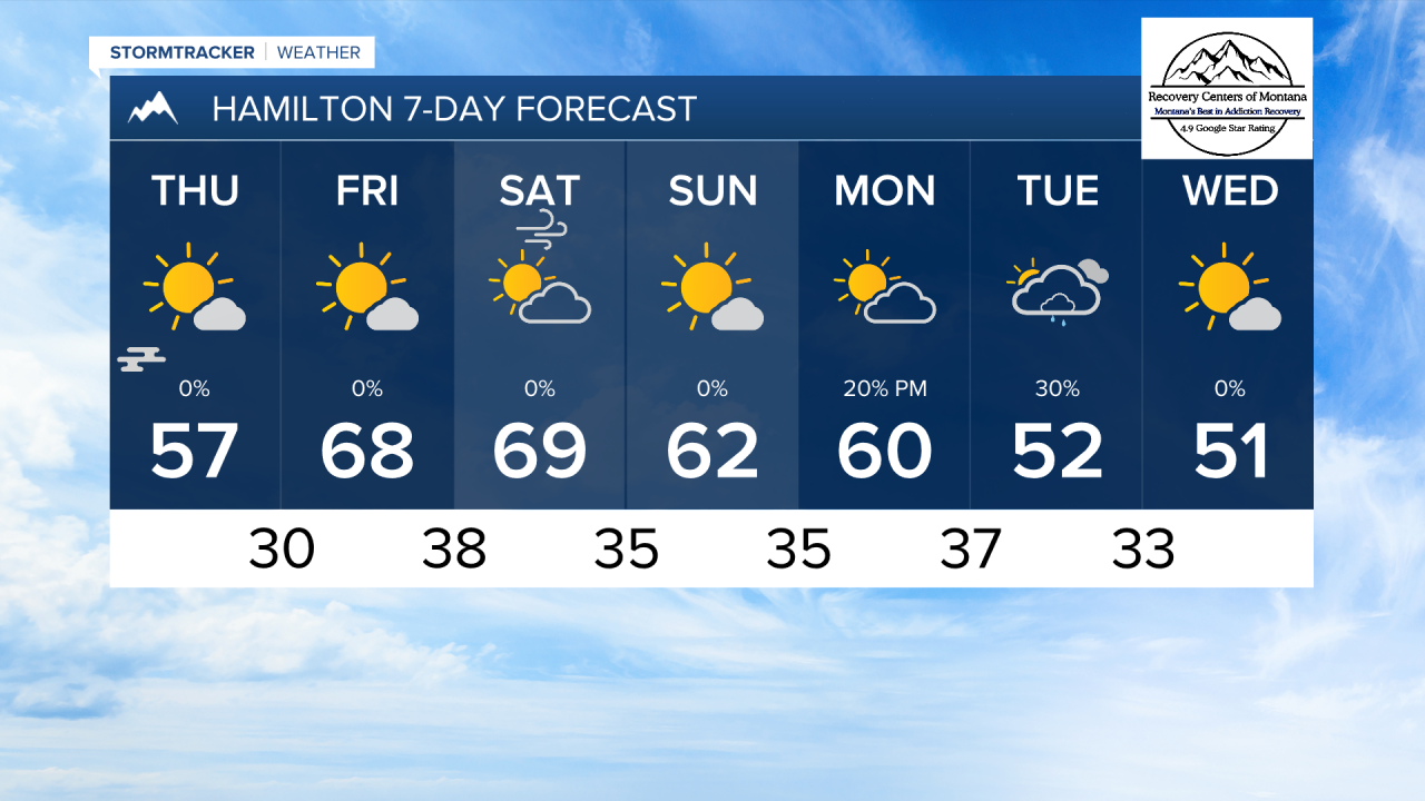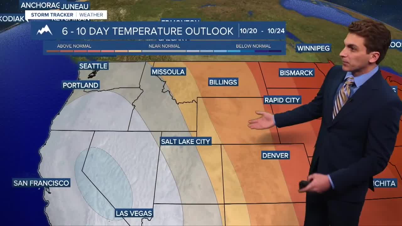


MISSOULA — We expect temperatures to warm a few degrees each day as a ridge of high pressure builds over the western United States as out trough of low pressure departs. Highs should reach the 60s and low 70s on Saturday.
Patchy valley fog is likely to form in the mornings over the next few days as light wind, cold air, and mostly clear skies are expected.
Stronger winds will return to the forecast on Saturday when a dry cold front moves through our area. Gusts are expected to reach around 30 to 40 MPH
Our next shot at rain and mountain snow appears to come in around Tuesday of next week. Recent models runs have trended to bring in overall less precipitation with this system.
Download the KPAX Weather app to view your localized forecast at any time, and also view our 24/7 weather stream!
——————————————————————————————————————————
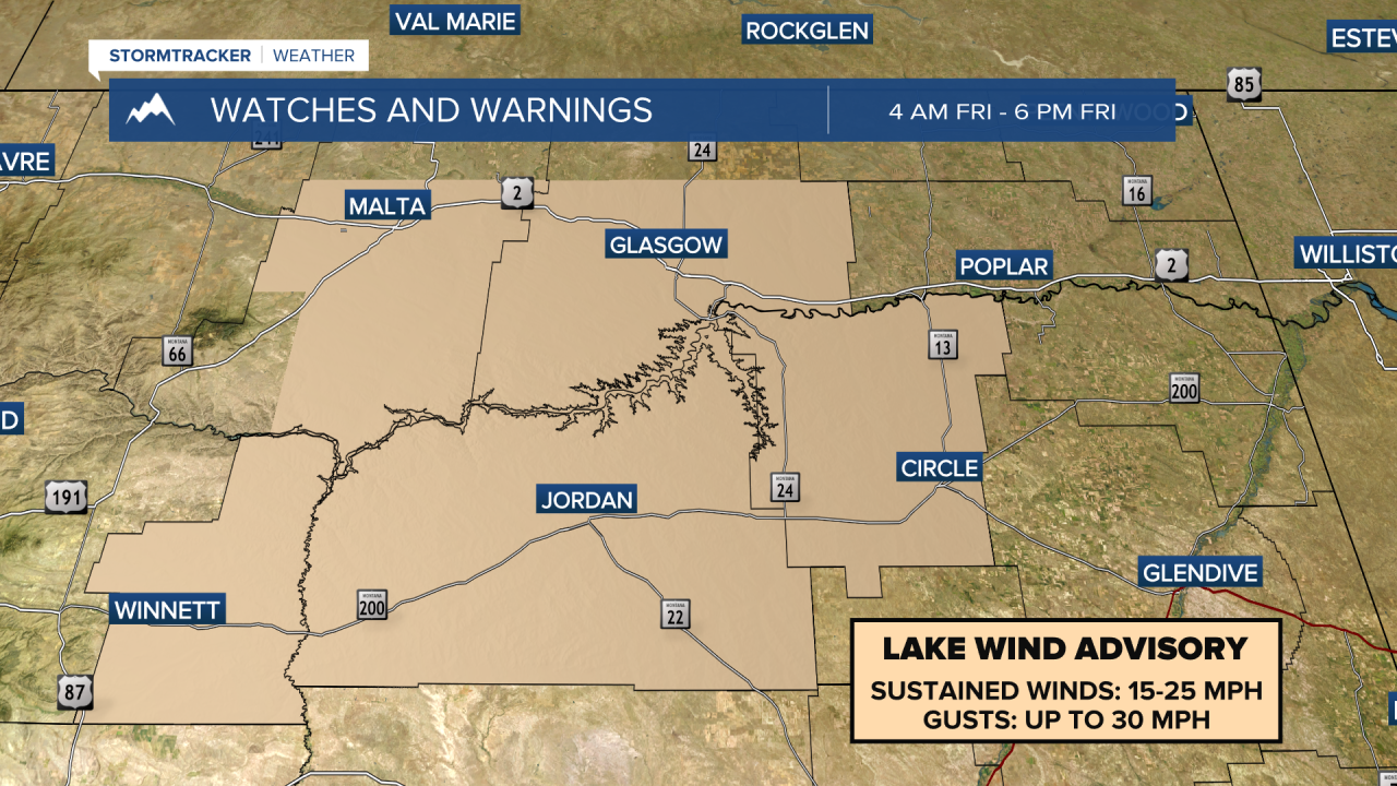
MONTANA WEATHER ALERTS:
——————————————————————————————————————————