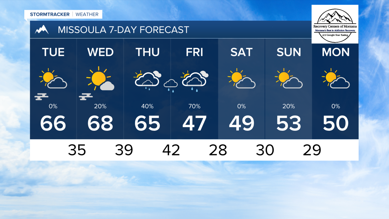
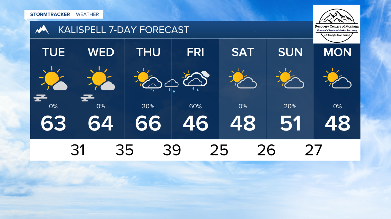
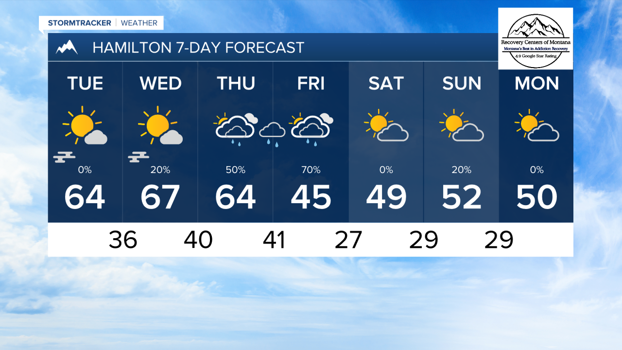
MISSOULA — Mild afternoons and crisp mornings will continue over the next three days. High temperatures will reach the 60s, while lows fall into the 30s. Patchy fog is possible each morning.
Rain shower will move in from the southwest on Thursday, becoming a bit more widespread on Friday. A surface cold front from the northwest will also bring a reinforcing round of precipitation, as well as colder temperatures on Friday. It will also be a bit breezy around the time this front moves in.
Snow levels will drop to about 5,000 feet by Friday night. a couple of inches of snow accumulation is likely in some of the mountains. Snow reaching the valley floors looks very unlikely at this time.
The weekend will be cooler with highs in the 40s and lows in the 20s with just some passing clouds and an isolated shower or two.
——————————————————————————————————————————
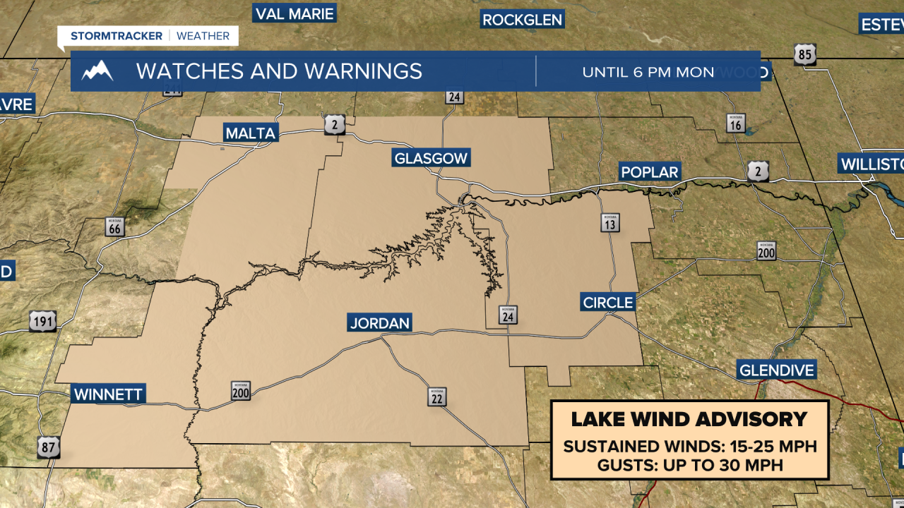
MONTANA WEATHER ALERTS:
——————————————————————————————————————————