


MISSOULA — Snow bands develop through Monday night into Tuesday morning for parts of Western Montana.
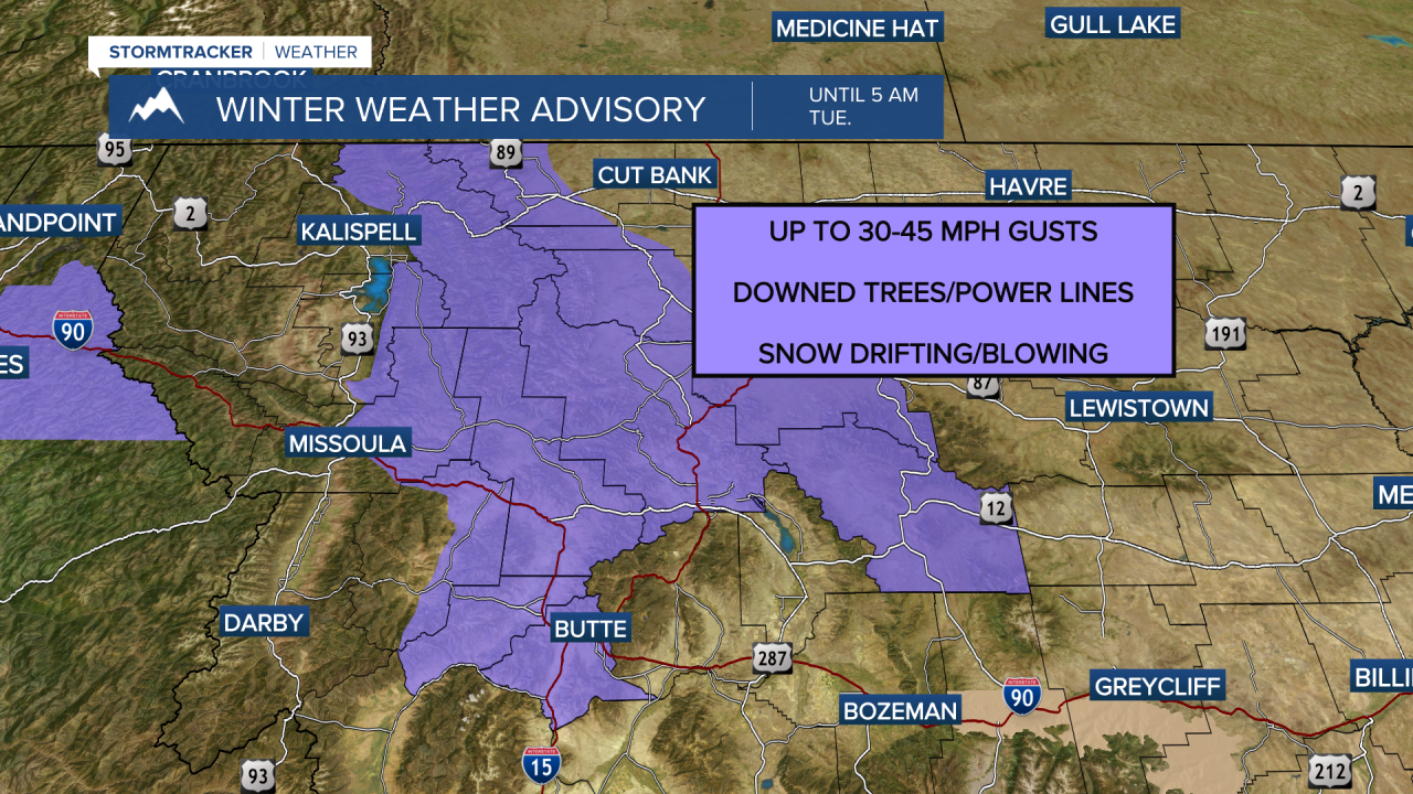
A Winter Weather Advisory has been issued through 5 AM Tuesday morning for these areas.
Expect fast-changing road conditions, reduced visibility, and, of course, slick roadways.
On top of the new snow causing road problems, we also have avalanche concerns on the rise especially in the northwest corner of the state.
Check with your local avalanche center before heading out!
Snow moves out Tuesday morning, but an arctic front is on the way.
Tuesday morning the front enters the West Glacier region after sliding over the Divide.
Wind gusts will pick up to 40 MPH gusts or more.
By Tuesday afternoon the front will reach West-Central Montana eventually reaching the Bitterroot Valley last Tuesday night.
Highs Tuesday top out in the mid 20s, but by Tuesday night we will all be down into the single digits.
Wednesday, highs will struggle to make it into the teens before dropping back to the single digits and subzero temperatures overnight.
We stay dry from midweek through the end of the week as high pressure builds and inversions set up again over valleys.
Highs return to the mid to upper 40s by Friday.
