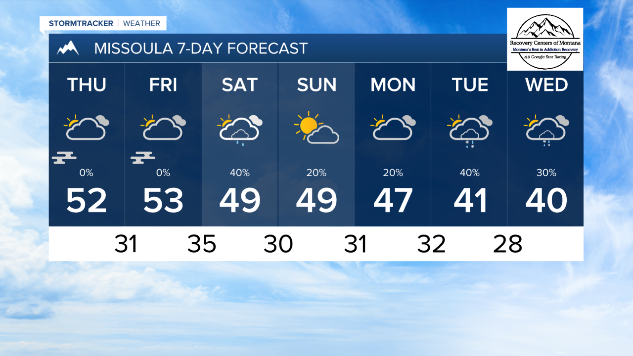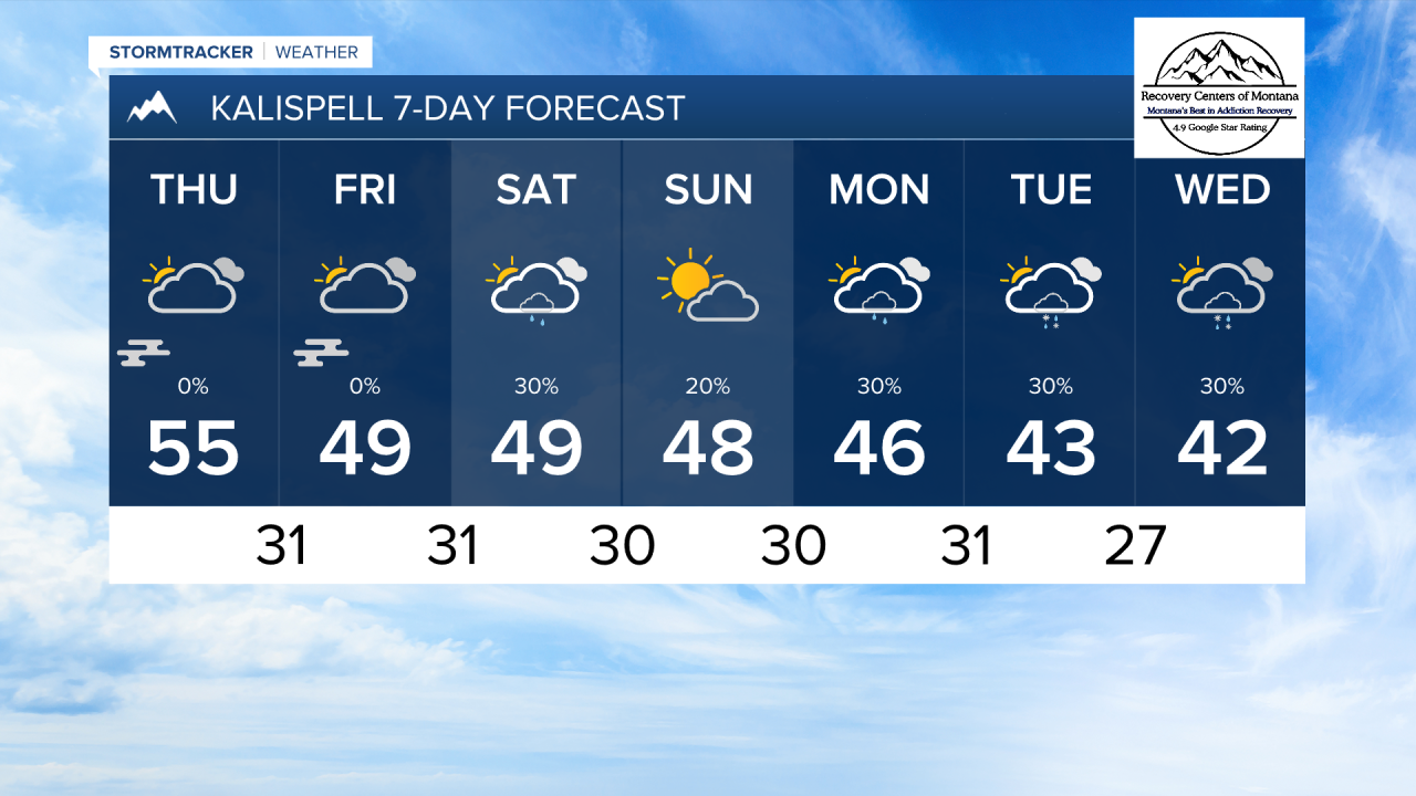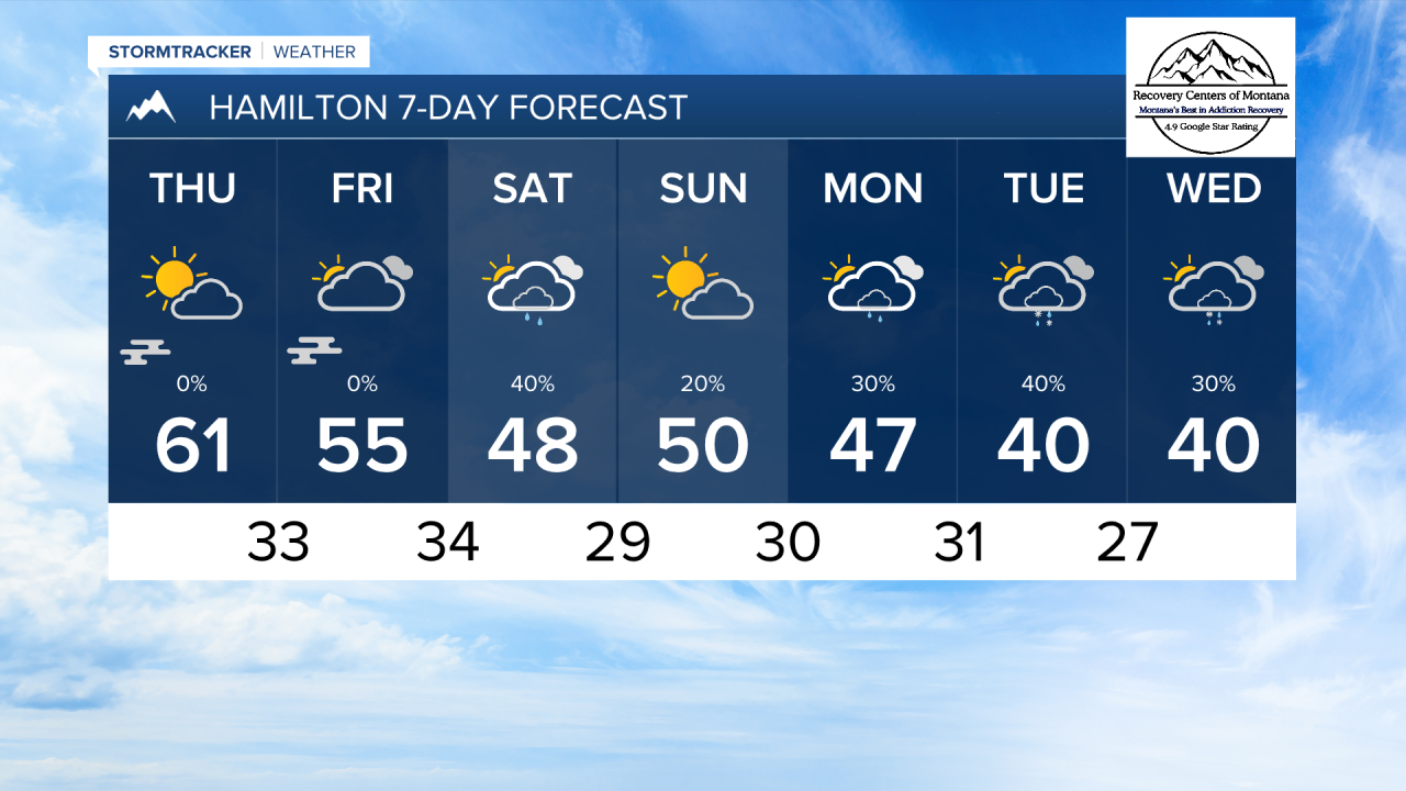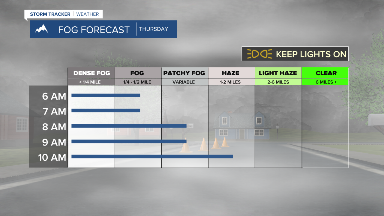


MISSOULA — Valley fog was present throughout western Montana this morning. You can expect that to continue through the rest of this week.
A ridge of high pressure is sitting over the state. While you will notice passing clouds, we will remain dry through Friday night. High temperatures will reach the 50s and low 60s for some areas. There still is the potential for inversions to stick around through most of the day, therefore leading to cooler afternoon temperatures.
A series of weak cold fronts will begin to move in from the Pacific this weekend, lasting into next week. Temperatures will decline next weak to near seasonal norms of the low 40s. Rain and mountain snow showers will also be introduced to the forecast from the weekend onward.
——————————————————————————————————————————
MONTANA WEATHER ALERTS:
NONE
——————————————————————————————————————————