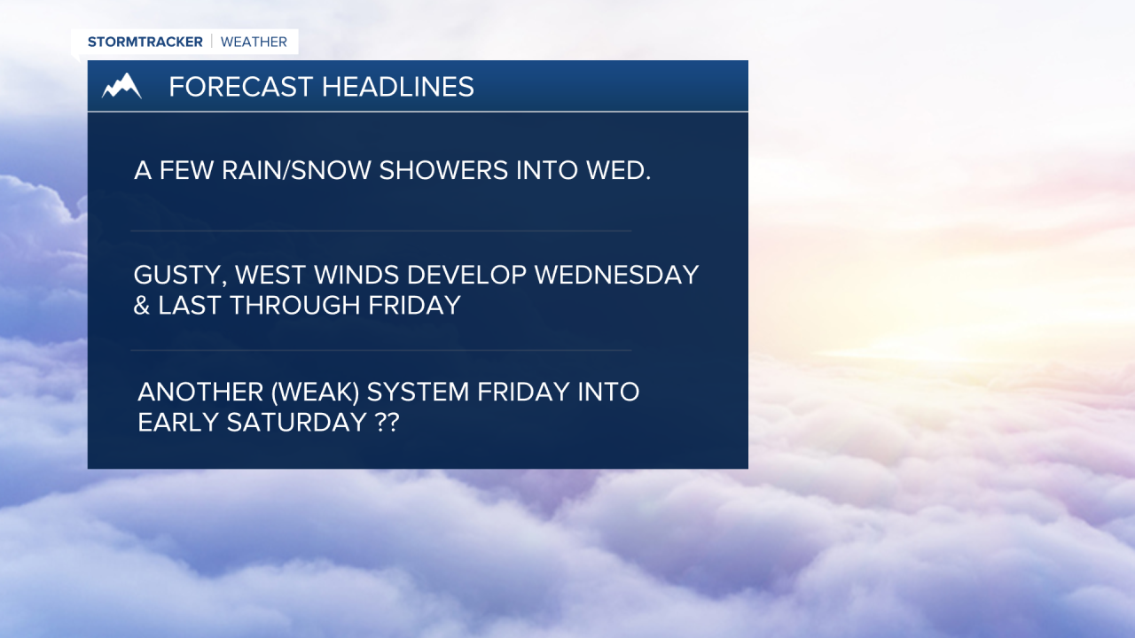


MISSOULA — Our Pacific moisture plume continues to pump in some mountain snow and valley rain/snow, with most being felt across west central and Southwest Montana. That will continue to be the trend overnight into Wednesday morning with minimal impacts expected. A Winter Weather Advisory has been issued for the Butte/Blackfoot Region and the Elkhorn & Boulder Mountains, Upper Blackfoot & MacDonald Pass, and Southern Rocky Mountain Front until 8am Wednesday.
Incredibly dangerous avalanche conditions continue for our mountains with numerous Warnings in place.
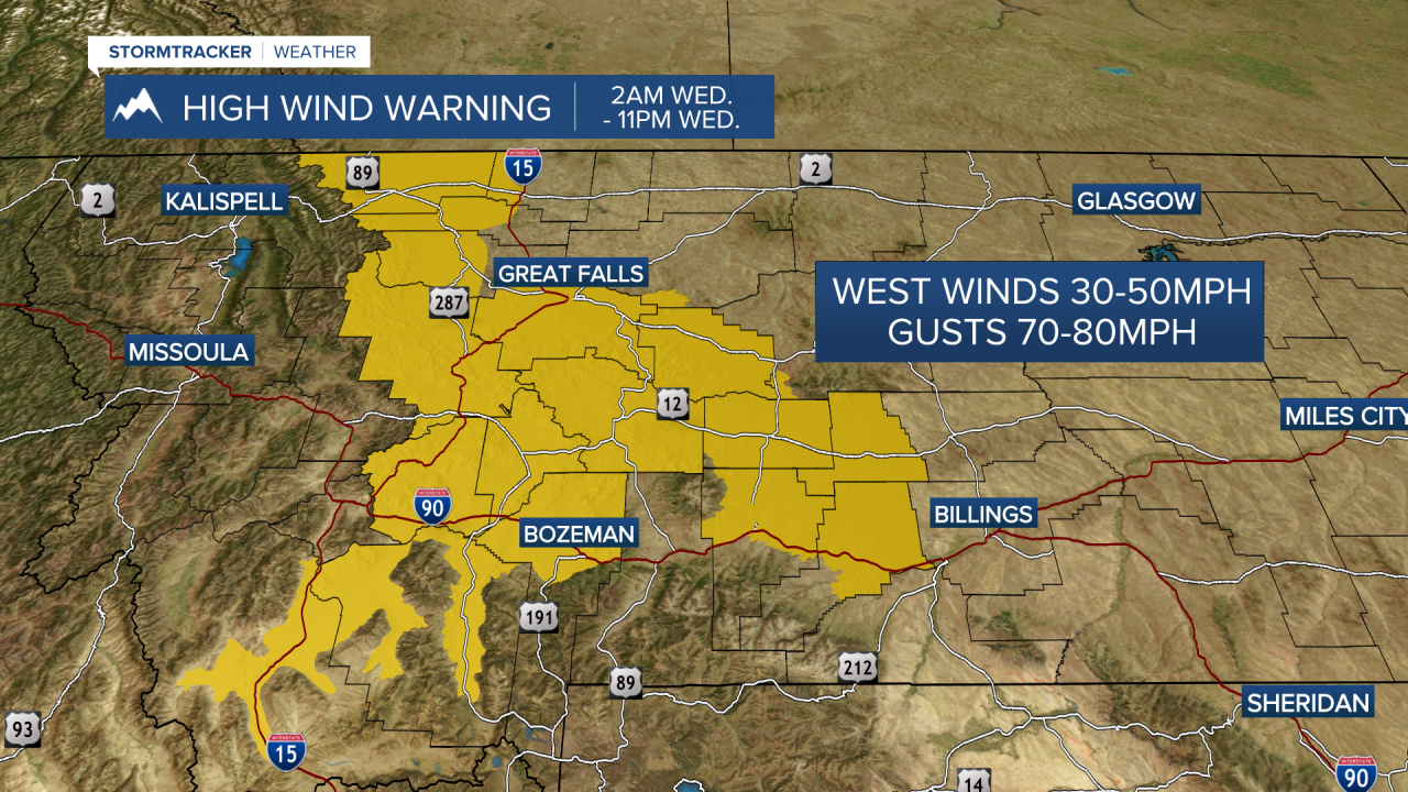
Beginning Wednesday, our focus will shift to developing gusty westerly winds. Valley locations will see widespread gusts from 25 mph to 35 mph, which is enough to blow around unsecured trash cans, recycling bins and lightweight patio furniture. If you're in Southwest Montana, expect stronger gusts up to 45 mph.
For those driving high-profile vehicles or towing trailers, prepare for dangerous crosswinds over the mountain passes and along the Divide, where gusts could peak between 60-80 mph (High Wind Warnings are in place here).
Expect more sun the further south you go on Thursday, with highs in the 40s.
A weak disturbance will brush NW Montana late Thursday into early Saturday with a few rain/snow showers for the valleys and mountain snow. Elsewhere, more sun than clouds are expected with highs in the 40s... mid 40s to around 50° for the weekend.
Watch the 24/7 StormTracker Weather stream below:
