


MISSOULA — We’ve started the work week off with a passing cold front, which has allowed snow levels to drop to valley floors today.
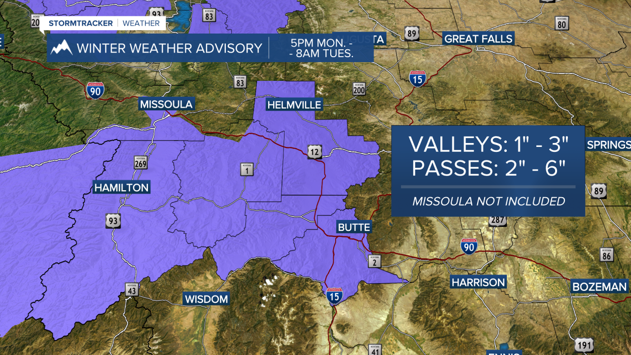
The moisture band will shift further south and east overnight with Winter Weather Advisories in place through 8 a.m. Tuesday for the Bitterroot Valley, Bitterroot/Sapphire Mountains and the Butte/Blackfoot Region where 1”-3” of snow are possible.
Watch the forecast:
Tuesday will offer up scattered rain/snow showers with highs in the mid to upper 30s. A larger surge of moisture is on tap overnight into Wednesday, which will bring significant mountain snow to area passes - particularly Lookout Pass, which seems to have the “bullseye”.
Winter Storm Warnings are out for the Lower Clark Fork Region from 5 p.m. Tuesday to 11 a.m. Wednesday. 6”-12” of snow will be possible for elevations above 3,000’ with a foot to a foot and a half in the highest terrain. Valleys located further away from the border could see 1”-3”. Gusty winds are also expected and will reduce visibility at times.
Winter Weather Advisories are out for the Kootenai/Cabinet Region from noon Tuesday through 11 a.m. on Wednesday, where 1”-3” are likely for Libby & Eureka, but higher amounts are very possible throughout the region - especially closer to the ID border. The highest mountains here will see 1’ to 2’.
There’s also an Advisory for the West Glacier Region from 5 p.m. Tuesday through 11 a.m. on Wednesday, where 3”-6” will be possible in the valleys and 6”-10” for Marias Pass.
A secondary trough is possible on Thursday with a good chance of widespread, valley snow.
Things look to calm by Friday afternoon with quiet, stable conditions on tap for the weekend.
Watch the 24/7 StormTracker Weather stream below:
